File:Antwerp, Belgium - Flickr - NASA Goddard Photo and Video.jpg
Original file (4,800 × 3,600 pixels, file size: 3.89 MB, MIME type: image/jpeg)
Captions
Captions
Summary
[edit]
| Description |
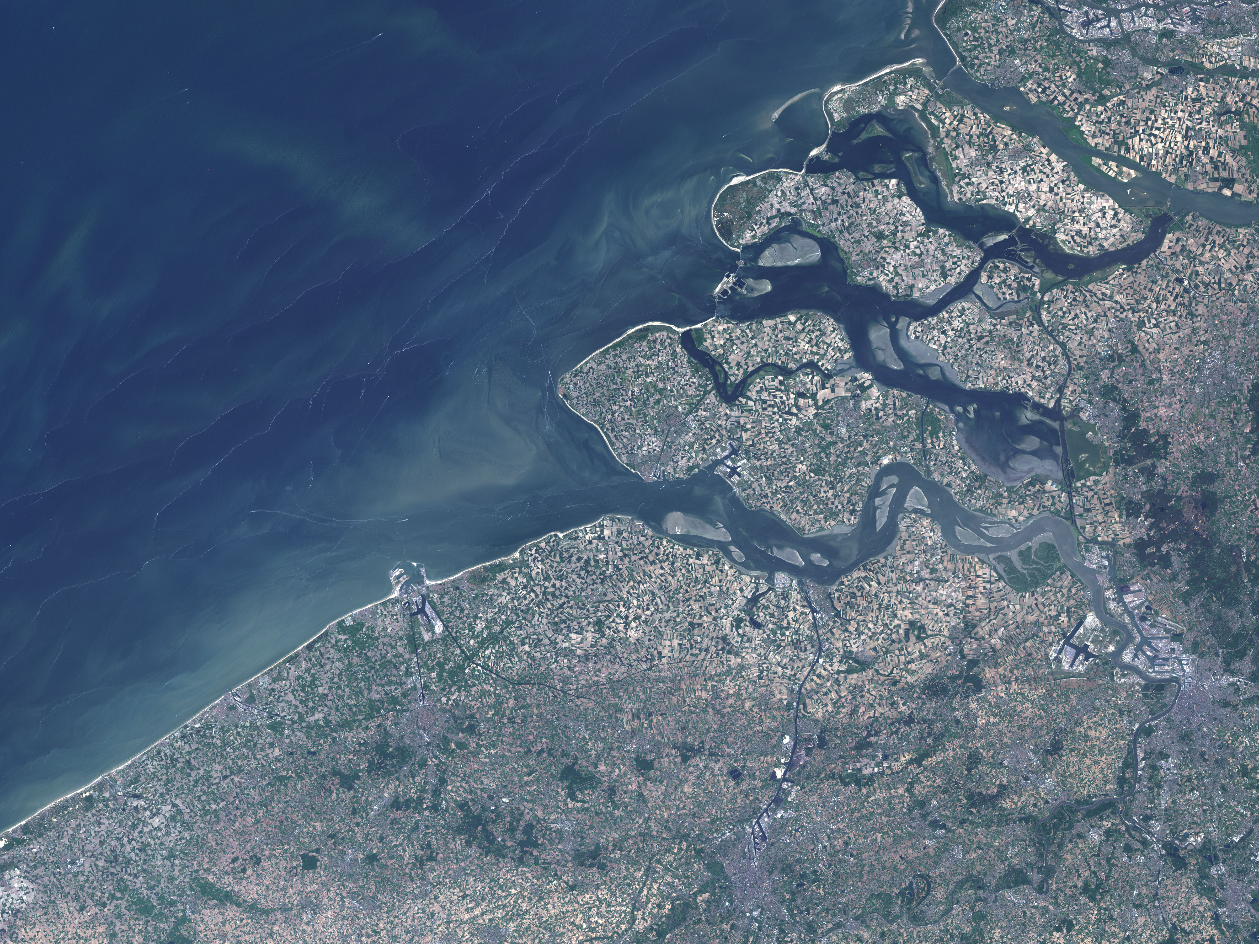
This natural-color Landsat 7 image was collected by the Enhanced Thematic Mapper Plus (ETM+) instrument on May 23, 2001. The modern city of Bruges appears in the image as a grey area with a roughly circular center that is ringed by a canal (the Ringvaart), which was made by the reshaping of the Reie River. This canal encircles the limits of the old city, and it connects to smaller canals threading through the city. The ring canal connects with the Zwin River to the northeast at Damme. Near the coast, the very large, Y-shaped, Boudewijn Canal leads north to the Port of Bruges-Zeebrugge and to the North Sea. Surrounding Bruges is the Flanders countryside, a very flat, fertile plain. The fields make a tan and green checkerboard. Credit: NASA/GSFC/Landsat 7
NASA Goddard Space Flight Center enables NASA’s mission through four scientific endeavors: Earth Science, Heliophysics, Solar System Exploration, and Astrophysics. Goddard plays a leading role in NASA’s accomplishments by contributing compelling scientific knowledge to advance the Agency’s mission. Follow us on Twitter Like us on Facebook Find us on Instagram |
| Date | |
| Source | Antwerp, Belgium |
| Author | NASA Goddard Space Flight Center from Greenbelt, MD, USA |
Licensing
[edit]
- You are free:
- to share – to copy, distribute and transmit the work
- to remix – to adapt the work
- Under the following conditions:
- attribution – You must give appropriate credit, provide a link to the license, and indicate if changes were made. You may do so in any reasonable manner, but not in any way that suggests the licensor endorses you or your use.
| This image was originally posted to Flickr by NASA Goddard Photo and Video at https://www.flickr.com/photos/24662369@N07/7651356260. It was reviewed on 17 August 2012 by FlickreviewR and was confirmed to be licensed under the terms of the cc-by-2.0. |
| This file is in the public domain in the United States because it was solely created by NASA. NASA copyright policy states that "NASA material is not protected by copyright unless noted". (See Template:PD-USGov, NASA copyright policy page or JPL Image Use Policy.) | ||
 |
Warnings:
|
File history
Click on a date/time to view the file as it appeared at that time.
| Date/Time | Thumbnail | Dimensions | User | Comment | |
|---|---|---|---|---|---|
| current | 20:12, 17 August 2012 | | 4,800 × 3,600 (3.89 MB) | Werieth (talk | contribs) | == {{int:filedesc}} == {{Information |Description=This natural-color Landsat 7 image was collected by the Enhanced Thematic Mapper Plus (ETM+) instrument on May 23, 2001. The modern city of Bruge appears in the image as a grey area with a roughly circu... |
You cannot overwrite this file.
File usage on Commons
There are no pages that use this file.
File usage on other wikis
The following other wikis use this file:
- Usage on nl.wikipedia.org