File:Antoine Augustin Calmet, A plan of Nazareth (FL6878993 2372518).jpg
Jump to navigation
Jump to search

Size of this preview: 800 × 579 pixels. Other resolutions: 320 × 232 pixels | 640 × 464 pixels | 1,024 × 742 pixels | 1,280 × 927 pixels | 2,560 × 1,854 pixels | 2,927 × 2,120 pixels.
Original file (2,927 × 2,120 pixels, file size: 3.38 MB, MIME type: image/jpeg)
Captions
Captions
Add a one-line explanation of what this file represents
Summary
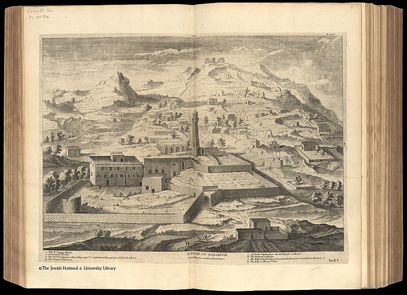
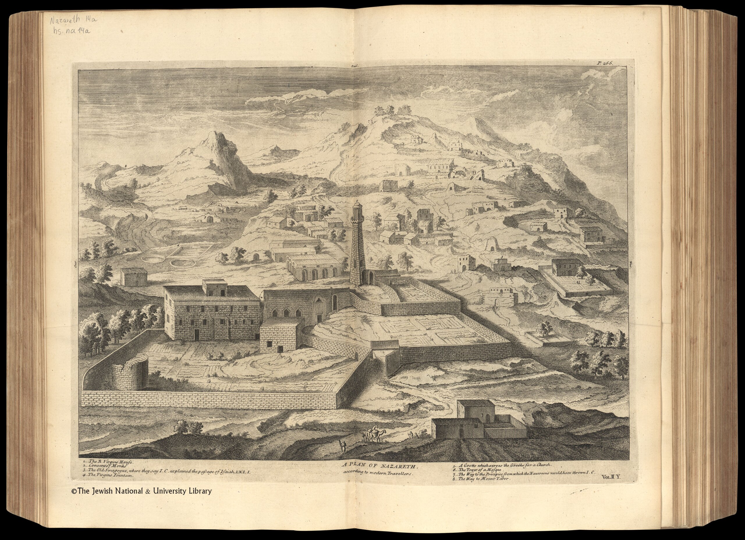
[edit]| Antoine Augustin Calmet: A plan of Nazareth
( |
||||||||||||||||||||||||
|---|---|---|---|---|---|---|---|---|---|---|---|---|---|---|---|---|---|---|---|---|---|---|---|---|
| Artist |
|
|||||||||||||||||||||||
| Title |
A plan of Nazareth |
|||||||||||||||||||||||
| Description |
A plan of Nazareth. according to modern travellers.. |
|||||||||||||||||||||||
| Language | English | |||||||||||||||||||||||
| Publication date | 1732 | |||||||||||||||||||||||
| Dimensions | height: 320 mm (12.59 in); width: 430 mm (16.92 in) | |||||||||||||||||||||||
| Collection |
|
|||||||||||||||||||||||
| Current location |
|
|||||||||||||||||||||||
| Place of publication | London | |||||||||||||||||||||||
| search Merhav catalog | London | |||||||||||||||||||||||
| Notes | Copperplate; From: Calmet Augustin Antoine. A historical, critical, geographical...dictionary of the Holy Bible. London, 1732. Vol. II, between pp. 266-67. | |||||||||||||||||||||||
| IE PID | IE6878991 | |||||||||||||||||||||||
| Rosetta filename | FL6878993 | |||||||||||||||||||||||
| NNL item ID (P3959) | 990023725180205171 | |||||||||||||||||||||||
| search Merhav catalog | English, Antoine Augustin Calmet | |||||||||||||||||||||||
| Source/Photographer |
|
|||||||||||||||||||||||
| Other versions | ||||||||||||||||||||||||
| Jpg / Tif version |
|
|||||||||||||||||||||||
.jpg)

.jpg)

.jpg&action=edit§ion=1)
Licensing
[edit].jpg&action=edit§ion=2)
The copyright situation of this work is theoretically uncertain, because in the country of origin copyright lasts 70 years after the death of the author, and the date of the author's death is unknown. However, the date of creation of the work was over 120 years ago, and it is thus a reasonable assumption that the copyright has expired (see here for the community discussion). Do not use this template if the date of death of the author is known.
| |
| This file has been identified as being free of known restrictions under copyright law, including all related and neighboring rights. | |
File history
Click on a date/time to view the file as it appeared at that time.
| Date/Time | Thumbnail | Dimensions | User | Comment | |
|---|---|---|---|---|---|
| current | 23:29, 30 July 2023 | | 2,927 × 2,120 (3.38 MB) | Geagea (talk | contribs) | pattypan 22.03 |
You cannot overwrite this file.
File usage on Commons
The following page uses this file:
.jpg&oldid=799278264)