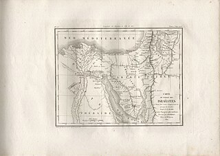
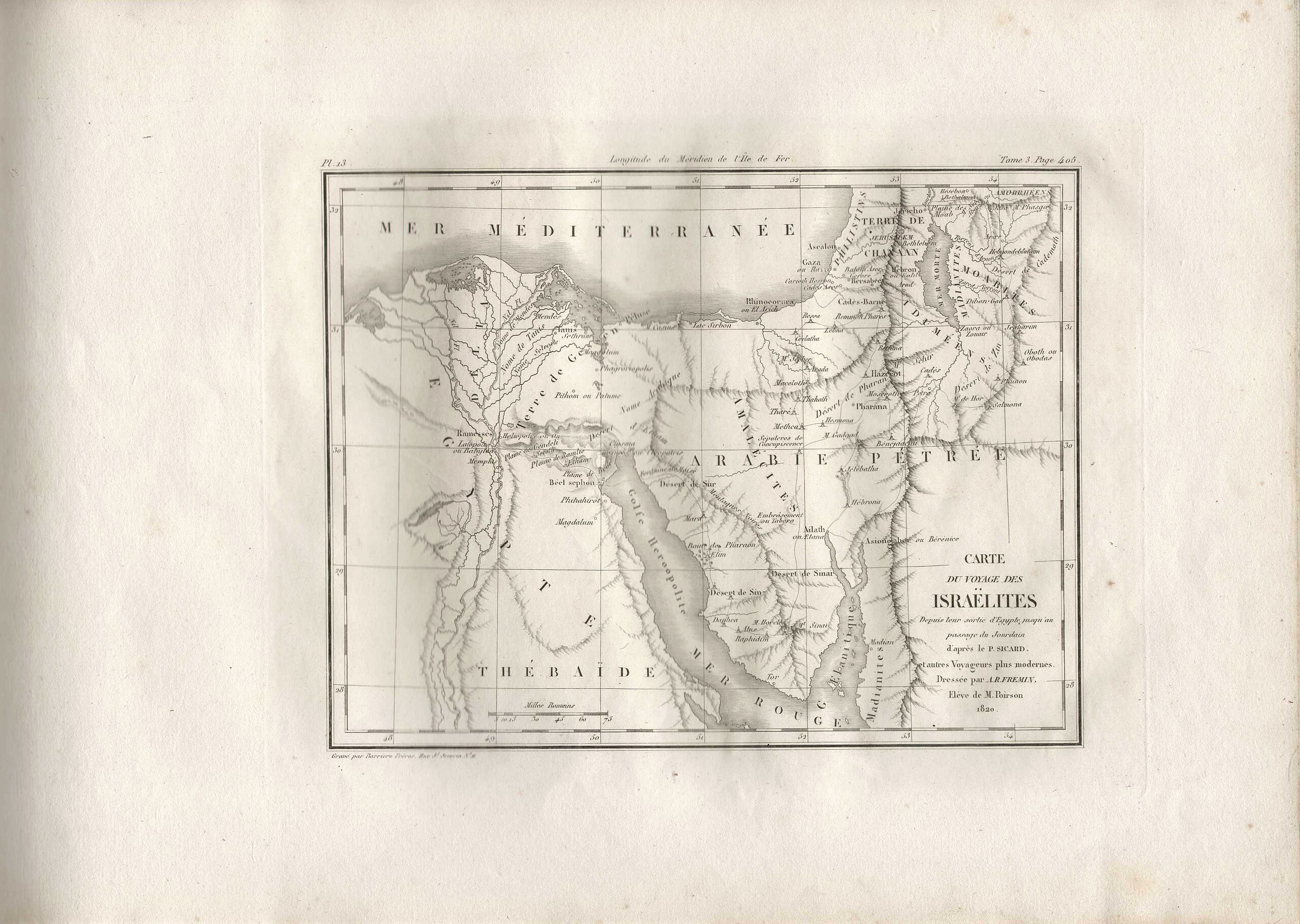
File:Antoine-Remy Frémin, Carte du voyage des Israëlites Depuis leur sortie d'Egypte jusqu au passage du Jourdain d'après le P. Sicard. Et autres Voyageurs plus modernes (FL37128397 3906575).jpg
Jump to navigation
Jump to search

Size of this preview: 800 × 569 pixels. Other resolutions: 320 × 227 pixels | 640 × 455 pixels | 1,024 × 728 pixels | 1,280 × 910 pixels | 2,560 × 1,820 pixels | 4,692 × 3,335 pixels.
Original file (4,692 × 3,335 pixels, file size: 5.65 MB, MIME type: image/jpeg)
Captions
Captions
Add a one-line explanation of what this file represents
Summary
[edit]| Antoine-Remy Frémin: Carte du voyage des Israëlites Depuis leur sortie d'Egypte jusqu au passage du Jourdain d'après le P. Sicard. Et autres Voyageurs plus modernes
( |
||||||||||||||||||||||||
|---|---|---|---|---|---|---|---|---|---|---|---|---|---|---|---|---|---|---|---|---|---|---|---|---|
| Artist |
|
|||||||||||||||||||||||
| Title |
Carte du voyage des Israëlites Depuis leur sortie d'Egypte jusqu au passage du Jourdain d'après le P. Sicard. Et autres Voyageurs plus modernes |
|||||||||||||||||||||||
| Publisher |
M. L. Migne |
|||||||||||||||||||||||
| Description |
Carte du voyage des Israëlites Depuis leur sortie d'Egypte jusqu au passage du Jourdain d'après le P. Sicard. Et autres Voyageurs plus modernes. Dressée par A. R. Fremin, Elève de M. Poirson. 1820. |
|||||||||||||||||||||||
| Language | French | |||||||||||||||||||||||
| Publication date | 1824 | |||||||||||||||||||||||
| Medium | 1 online resource (1 map). | |||||||||||||||||||||||
| Collection |
|
|||||||||||||||||||||||
| Current location |
|
|||||||||||||||||||||||
| Place of publication | Paris | |||||||||||||||||||||||
| search Merhav catalog | Paris | |||||||||||||||||||||||
| Notes | Digital image of the original in Amir Cahanovitc Collection, Israel. ACC 995-2.; Digital image received from donor. | |||||||||||||||||||||||
| IE PID | IE37128394 | |||||||||||||||||||||||
| Rosetta filename | FL37128397 | |||||||||||||||||||||||
| NNL item ID (P3959) | 990039065750205171 | |||||||||||||||||||||||
| search Merhav catalog | French, Antoine-Remy Frémin | |||||||||||||||||||||||
| search Merhav catalog | Exodus, TheMapsM. L. Migne | |||||||||||||||||||||||
| Source/Photographer |
|
|||||||||||||||||||||||
| Other versions | ||||||||||||||||||||||||
| Jpg / Tif version |
|
|||||||||||||||||||||||

.jpg)

.jpg&action=edit§ion=1)
Licensing
[edit].jpg&action=edit§ion=2)
The copyright situation of this work is theoretically uncertain, because in the country of origin copyright lasts 70 years after the death of the author, and the date of the author's death is unknown. However, the date of creation of the work was over 120 years ago, and it is thus a reasonable assumption that the copyright has expired (see here for the community discussion). Do not use this template if the date of death of the author is known.
| |
| This file has been identified as being free of known restrictions under copyright law, including all related and neighboring rights. | |
File history
Click on a date/time to view the file as it appeared at that time.
| Date/Time | Thumbnail | Dimensions | User | Comment | |
|---|---|---|---|---|---|
| current | 19:05, 1 September 2023 | | 4,692 × 3,335 (5.65 MB) | Geagea (talk | contribs) | pattypan 22.03 |
You cannot overwrite this file.
File usage on Commons
The following page uses this file:
.jpg&oldid=799276614)