File:Antique Map of Ireland by John Thomson, 1815.jpg
Original file (2,366 × 2,850 pixels, file size: 1.57 MB, MIME type: image/jpeg)
Captions
Captions
Summary
[edit]
| Description |
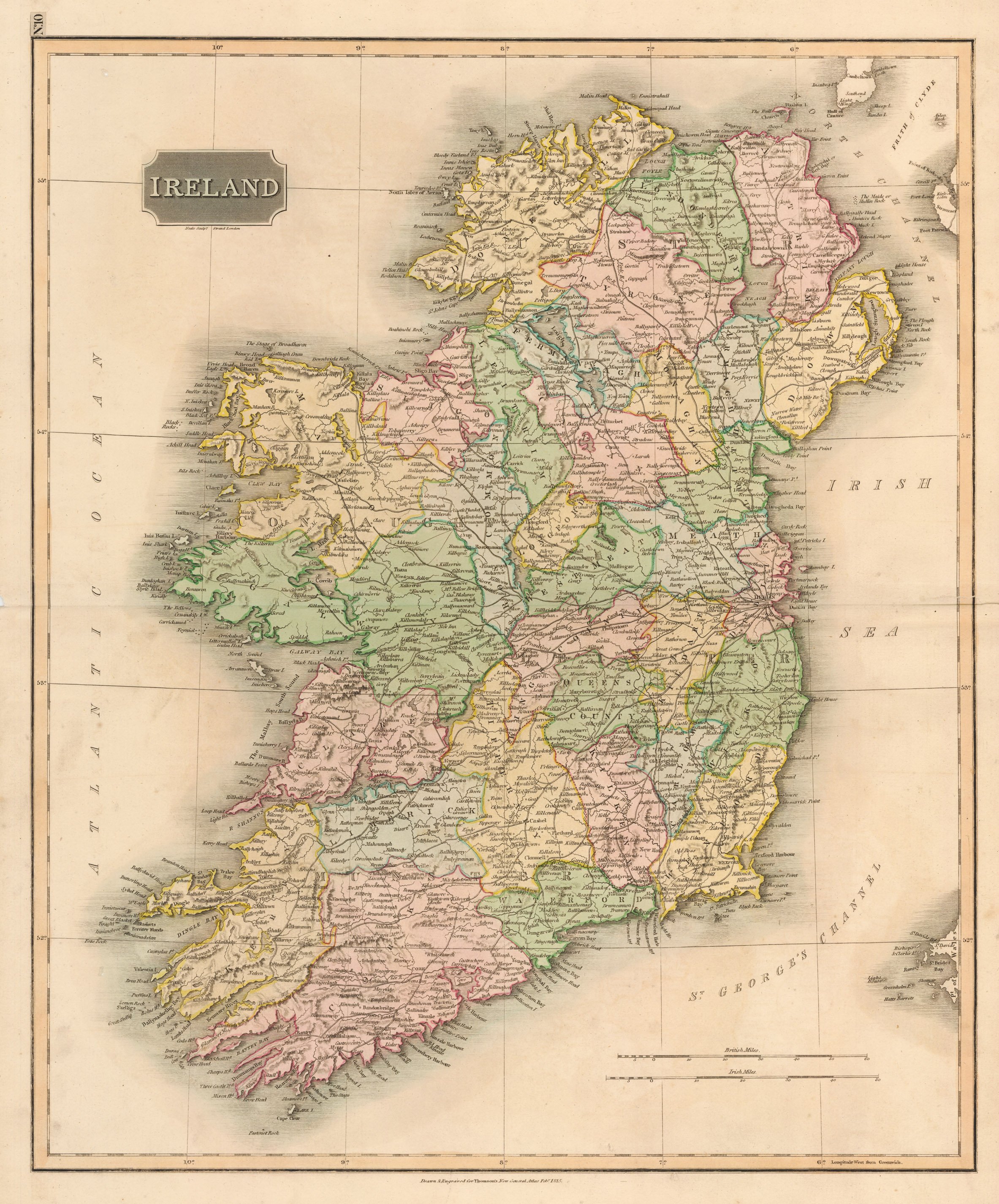
English: By: John Thomson
Date: 1815 (Published) Edinburgh Dimensions: 23.5 x 19.5 inches (59.7 x 49.5 cm) This beautiful Thomson map covers Ireland in its entirety. Thomson uses color coding to break down the island into its many counties. The whole is beautifully engraved in the minimalist English style pioneered in the early part of the 19th century. Relief is shown by hachure with towns, roadways, cities, and major topographical features identified. John Thomson (1777 - 1841) was a Scottish cartographer, publisher, and bookbinder active in Edinburgh during the early part of the 19th century. Thomson apprenticed under Edinburgh bookbinder Robert Alison. Thomson was one of the leading publishers in the Edinburgh school of cartography, which flourished in the early decades of the 19th century. Thomson and his contemporaries (Pinkerton and Cary) redefined European cartography by abandoning typical 18th century decorative elements such as elaborate title cartouches and fantastic beasts in favor of detail and accuracy. |
| Date | |
| Source | Own work |
| Author | New World Cartographic |
https://nwcartographic.com/collections/antique-maps-british-isles/products/ireland-thomson-1815
Licensing
[edit]
- You are free:
- to share – to copy, distribute and transmit the work
- to remix – to adapt the work
- Under the following conditions:
- attribution – You must give appropriate credit, provide a link to the license, and indicate if changes were made. You may do so in any reasonable manner, but not in any way that suggests the licensor endorses you or your use.
- share alike – If you remix, transform, or build upon the material, you must distribute your contributions under the same or compatible license as the original.
File history
Click on a date/time to view the file as it appeared at that time.
| Date/Time | Thumbnail | Dimensions | User | Comment | |
|---|---|---|---|---|---|
| current | 17:37, 1 July 2020 | | 2,366 × 2,850 (1.57 MB) | New World Cartographic (talk | contribs) | Uploaded own work with UploadWizard |
You cannot overwrite this file.
File usage on Commons
There are no pages that use this file.
File usage on other wikis
The following other wikis use this file:
- Usage on simple.wikipedia.org