File:Antarctica ice shelves-en.svg

Original file (SVG file, nominally 410 × 379 pixels, file size: 153 KB)
Captions
Captions
Summary
[edit]| Description |
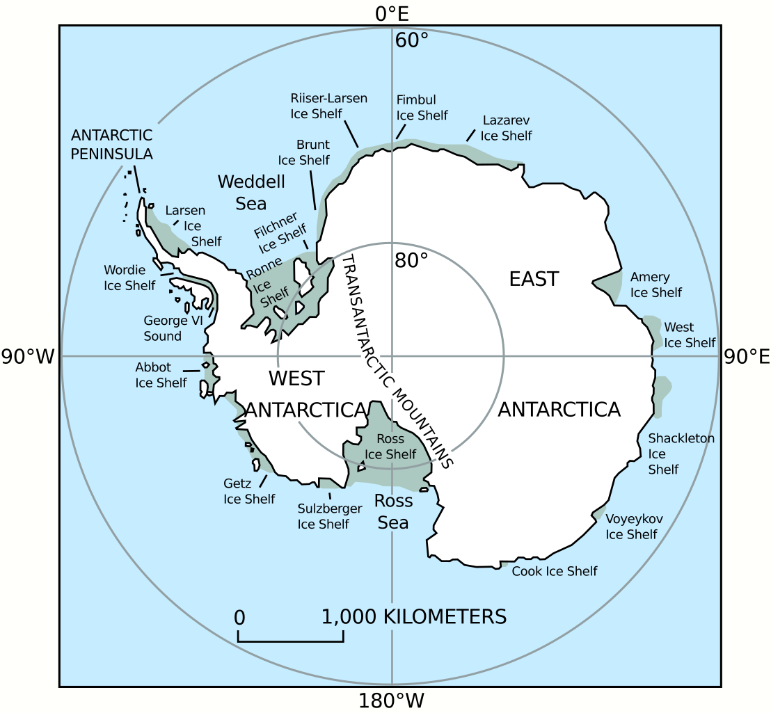
English: Antarctic principal geographic features, with ice shelves labeled.
Source: Coastal-Change and Glaciological Maps of Antarctica. USGS Fact Sheet 050-98. Archived from the original on 2005-02-06. Retrieved on February 28.
Català: Principals característiques geogràfiques de l'Antàrtida, amb les plataformes de gel etiquetades. |
| Date | |
| Source | https://pubs.usgs.gov/fs/2005/3055/ |
| Author | Department of the Interior/U.S. Geological Survey (data), Antimuonium |
| Other versions |
File:Antarctica ice shelves-en.svg has 2 translations.
Other related versions: []
|


|
This SVG file contains embedded text that can be translated into your language, using any capable SVG editor, text editor or the SVG Translate tool. For more information see: About translating SVG files. |
This file is translated using SVG <switch> elements. All translations are stored in the same file! Learn more.
For most Wikipedia projects, you can embed the file normally (without a To translate the text into your language, you can use the SVG Translate tool. Alternatively, you can download the file to your computer, add your translations using whatever software you're familiar with, and re-upload it with the same name. You will find help in Graphics Lab if you're not sure how to do this. |
Licensing
[edit]
This image is in the public domain in the United States because it only contains materials that originally came from the United States Geological Survey, an agency of the United States Department of the Interior. For more information, see the official USGS copyright policy.
|
File history
Click on a date/time to view the file as it appeared at that time.
| Date/Time | Thumbnail | Dimensions | User | Comment | |
|---|---|---|---|---|---|
| current | 15:06, 28 June 2024 | | 410 × 379 (153 KB) | Manlleus (talk | contribs) | File uploaded using svgtranslate tool (https://svgtranslate.toolforge.org/). Added translation for ca. |
| 07:12, 26 October 2022 |  | 384 × 355 (130 KB) | Antimuonium (talk | contribs) | Fixed disappeared text | |
| 06:53, 26 October 2022 |  | 384 × 355 (129 KB) | Antimuonium (talk | contribs) | Uploaded a work by Department of the Interior/U.S. Geological Survey from https://pubs.usgs.gov/fs/2005/3055/ with UploadWizard |
You cannot overwrite this file.
File usage on Commons
The following 6 pages use this file:
File usage on other wikis
The following other wikis use this file:
- Usage on ast.wikipedia.org
- Usage on ca.wikipedia.org
- Usage on cs.wikipedia.org
- Usage on en.wikipedia.org
- Usage on es.wikipedia.org
- Usage on fr.wikipedia.org
- Usage on id.wikipedia.org
- Usage on it.wikipedia.org
- Usage on ko.wikipedia.org
- Usage on mk.wikipedia.org
- Usage on sr.wikinews.org
- Usage on sv.wikipedia.org
- Usage on tr.wikipedia.org
- Usage on uk.wikipedia.org
- Usage on www.wikidata.org