File:Annfield Plain station site geograph-3233212-by-Ben-Brooksbank.jpg
Jump to navigation
Jump to search
Size of this preview: 800 × 399 pixels. Other resolutions: 320 × 160 pixels | 640 × 319 pixels | 1,024 × 510 pixels | 1,280 × 638 pixels | 2,347 × 1,170 pixels.
Original file (2,347 × 1,170 pixels, file size: 2.25 MB, MIME type: image/jpeg)
Captions
Captions
Add a one-line explanation of what this file represents
Summary
[edit]
| Description |
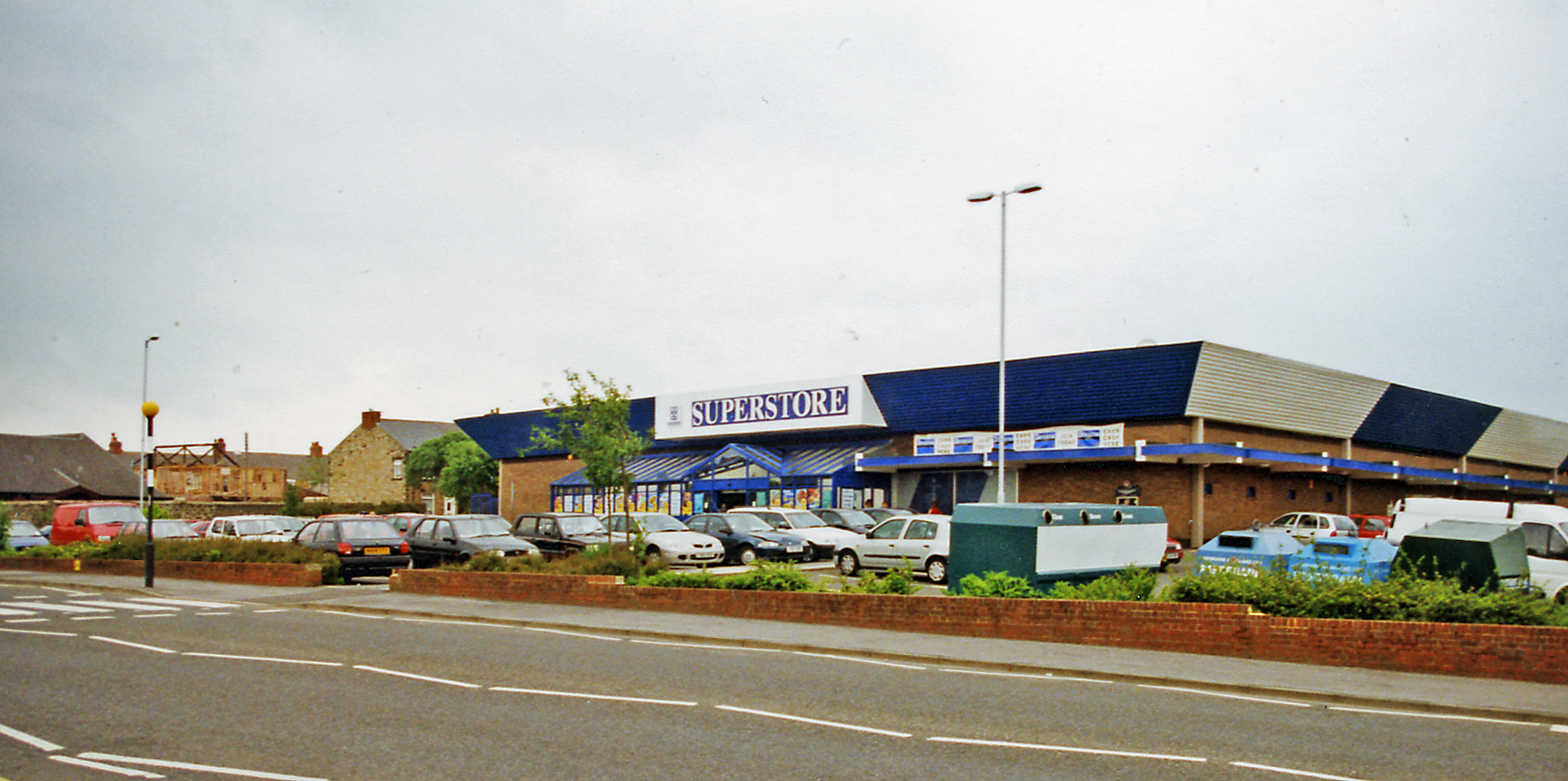
English: Superstore on site of Annfield Plain station. View SW, probably on the B6168 road. The station had been where the superstore is, or just behind it. It had been on the line to Consett from Newcastle via Birtley and Ouston Junction and closed to passengers on 23/5/55 (goods 10/8/64). The line through Annfield Plain had remained active for the iron ore traffic from Tyne Dock via South Pelaw Junction, until Consett Ironworks closed in 9/80. |
| Date | |
| Source | From geograph.org.uk |
| Author | Ben Brooksbank |
| Permission (Reusing this file) |
Creative Commons Attribution Share-alike license 2.0 |
| Attribution (required by the license) | Ben Brooksbank / Superstore on site of Annfield Plain station? / |
| Camera location | | View this and other nearby images on: OpenStreetMap |
|---|
Licensing
[edit]

|
This image was taken from the Geograph project collection. See this photograph's page on the Geograph website for the photographer's contact details. The copyright on this image is owned by Ben Brooksbank and is licensed for reuse under the Creative Commons Attribution-ShareAlike 2.0 license.
|
This file is licensed under the Creative Commons Attribution-Share Alike 2.0 Generic license.
Attribution: Ben Brooksbank
- You are free:
- to share – to copy, distribute and transmit the work
- to remix – to adapt the work
- Under the following conditions:
- attribution – You must give appropriate credit, provide a link to the license, and indicate if changes were made. You may do so in any reasonable manner, but not in any way that suggests the licensor endorses you or your use.
- share alike – If you remix, transform, or build upon the material, you must distribute your contributions under the same or compatible license as the original.
File history
Click on a date/time to view the file as it appeared at that time.
| Date/Time | Thumbnail | Dimensions | User | Comment | |
|---|---|---|---|---|---|
| current | 21:09, 8 December 2012 | | 2,347 × 1,170 (2.25 MB) | Chevin (talk | contribs) | == {{int:filedesc}} == {{Information |Description={{en|1='''Superstore on site of Annfield Plain station.'''<br/> View SW, probably on the B6168 road. The station had been where the superstore is, or just behind it. It had been on the line to Consett f... |
You cannot overwrite this file.
File usage on Commons
The following page uses this file: