File:Annay - Cités de la fosse n° 24 - 25 des mines de Courrières (01).JPG

Original file (3,648 × 2,736 pixels, file size: 4.1 MB, MIME type: image/jpeg)
Captions
Captions
Summary
[edit]| Description |
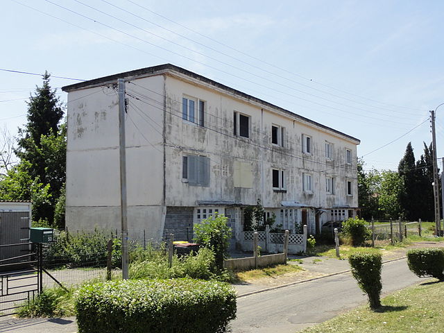
Français : Cité du Maréchal Leclerc, détruite, de la fosse n° 24 - 25 de la Compagnie des mines de Courrières dans le bassin minier du Nord-Pas-de-Calais, Annay, Pas-de-Calais, Nord-Pas-de-Calais, France. Le seul camus subsistant est inscrit sur la liste du patrimoine mondial par l'Unesco le 30 juin 2012 et y constitue le site no 52. |
|||||||||||||||||||||||
| Date | ||||||||||||||||||||||||
| Source | Own work | |||||||||||||||||||||||
| Author |
|
|||||||||||||||||||||||
| Permission (Reusing this file) |
This file is licensed under the Creative Commons Attribution-Share Alike 3.0 Unported license.
| |||||||||||||||||||||||
| Attribution (required by the license) | Jérémy-Günther-Heinz Jähnick / Annay - Cités de la fosse n° 24 - 25 des mines de Courrières (01) / Wikimedia Commons / | |||||||||||||||||||||||
.JPG)


.JPG&action=edit§ion=1)
.JPG)
| Camera location | | View this and other nearby images on: OpenStreetMap |
|---|
.JPG¶ms=050.460198_N_0002.892058_E_globe:Earth_type:camera_heading:187.50&language=en)
File history
Click on a date/time to view the file as it appeared at that time.
| Date/Time | Thumbnail | Dimensions | User | Comment | |
|---|---|---|---|---|---|
| current | 13:21, 18 November 2011 | | 3,648 × 2,736 (4.1 MB) | Jérémy-Günther-Heinz Jähnick (talk | contribs) |
You cannot overwrite this file.
File usage on Commons
The following 2 pages use this file:
File usage on other wikis
The following other wikis use this file:
- Usage on fr.wikipedia.org
- Portail:Bassin minier du Nord-Pas-de-Calais/Le saviez-vous ?
- Portail:Bassin minier du Nord-Pas-de-Calais
- Fosse no 24 - 25 des mines de Courrières
- Portail:Bassin minier du Nord-Pas-de-Calais/Le saviez-vous ?/17
- Portail:Bassin minier du Nord-Pas-de-Calais/Unesco
- Liste des biens du bassin minier du Nord-Pas-de-Calais inscrits sur la liste du patrimoine mondial
- Portail:Bassin minier du Nord-Pas-de-Calais/Unesco/52
- Liste des monuments historiques du Pas-de-Calais (A-H)
- Usage on it.wikipedia.org
- Usage on pcd.wikipedia.org
- Usage on www.wikidata.org
.JPG&oldid=796003562)