File:Angers (Arrondissement) Plan.svg
Jump to navigation
Jump to search

Size of this PNG preview of this SVG file: 601 × 471 pixels. Other resolutions: 306 × 240 pixels | 613 × 480 pixels | 980 × 768 pixels | 1,280 × 1,003 pixels | 2,560 × 2,006 pixels.
Original file (SVG file, nominally 601 × 471 pixels, file size: 116 KB)
Captions
Captions
Add a one-line explanation of what this file represents
Summary
[edit]_Plan.svg&action=edit§ion=1)
| Description |
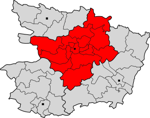
Deutsch: Lageplan des Arrondissements von Angers im Département Maine-et-Loire.
Français : Arrondissement d'Angers, division territoriale du département de Maine-et-Loire (France), en 2007. |
| Date | |
| Source | Own work (Original caption: "") |
| Author | Pierre Audité at de.wikipedia |
Licensing
[edit]_Plan.svg&action=edit§ion=2)
This file is licensed under the Creative Commons Attribution-Share Alike 2.0 Germany license.
- You are free:
- to share – to copy, distribute and transmit the work
- to remix – to adapt the work
- Under the following conditions:
- attribution – You must give appropriate credit, provide a link to the license, and indicate if changes were made. You may do so in any reasonable manner, but not in any way that suggests the licensor endorses you or your use.
- share alike – If you remix, transform, or build upon the material, you must distribute your contributions under the same or compatible license as the original.

Original upload log
[edit]_Plan.svg&action=edit§ion=3)
The original description page was here. All following user names refer to de.wikipedia.
- 2007-08-20 13:50 Pierre Audité 601×471× (119212 bytes) {{Information |Beschreibung = Lageplan des Arrondissements von Angers im Département Maine-et-Loire. |Quelle = Eigene Arbeit unter Verwendung von Informationen der folgenden Internetseiten: [http://www.insee.fr] und [http://splaf.free.fr/] |Urheber = [[B
File history
Click on a date/time to view the file as it appeared at that time.
| Date/Time | Thumbnail | Dimensions | User | Comment | |
|---|---|---|---|---|---|
| current | 01:14, 6 September 2011 | | 601 × 471 (116 KB) | File Upload Bot (Magnus Manske) (talk | contribs) | {{BotMoveToCommons|de.wikipedia|year={{subst:CURRENTYEAR}}|month={{subst:CURRENTMONTHNAME}}|day={{subst:CURRENTDAY}}}} {{Information |Description={{de|Lageplan des Arrondissements von Angers im Département Maine-et-Loire.}} |Source=Transferred from [htt |
You cannot overwrite this file.
File usage on Commons
There are no pages that use this file.
_Plan.svg&oldid=795522392)