File:Anger in Röhrda im nordhessischen Werra-Meißner-Kreis.jpg
Jump to navigation
Jump to search
Size of this preview: 799 × 599 pixels. Other resolutions: 320 × 240 pixels | 640 × 480 pixels | 1,024 × 768 pixels | 1,280 × 960 pixels | 2,560 × 1,920 pixels | 6,566 × 4,925 pixels.
Original file (6,566 × 4,925 pixels, file size: 10.84 MB, MIME type: image/jpeg)
Captions
Captions
Add a one-line explanation of what this file represents
Summary
[edit]
| Description |
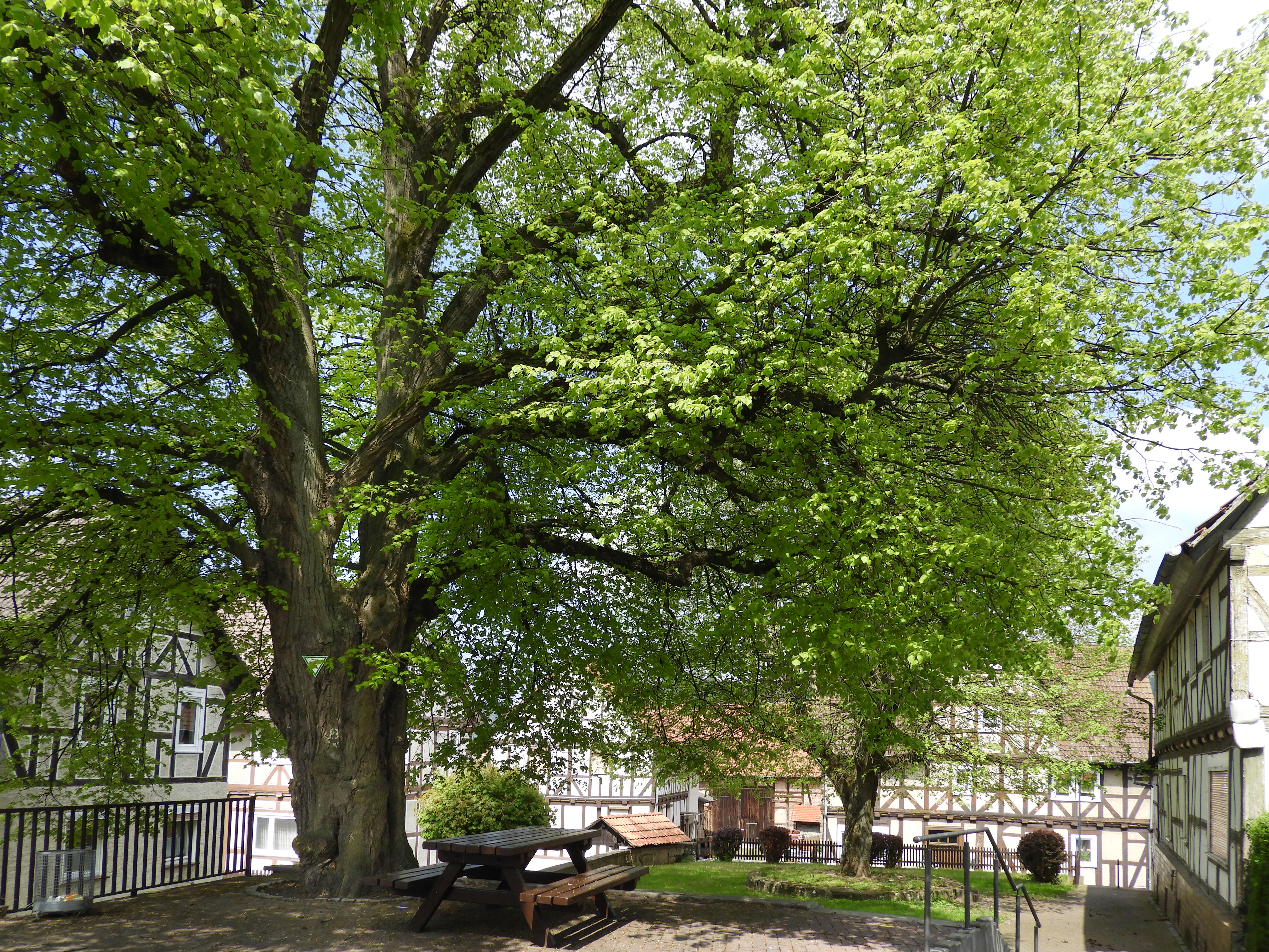
Deutsch: Die Linden auf dem Anger in Röhrda im nordhessischen Werra-Meißner-Kreis wurden bereits 1936, anlässlich der Neuregelung des Naturschutzes, in das Naturdenkmalbuch des Landkreises Eschwege eingetragen und erhielten mit der „Verordnung zur Sicherung von Naturdenkmalen in den Stadt- und Landkreisen des Regierungsbezirks Kassel“ den Schutz des Reichsnaturschutzgesetzes. In der Liste der Naturdenkmale des Werra-Meißner-Kreises haben die Linden die Nummer ND 636.582.
|
||||
| Date | |||||
| Source | Own work | ||||
| Author | Heinz K. S. |
Licensing
[edit]
I, the copyright holder of this work, hereby publish it under the following license:
This file is licensed under the Creative Commons Attribution 4.0 International license.
- You are free:
- to share – to copy, distribute and transmit the work
- to remix – to adapt the work
- Under the following conditions:
- attribution – You must give appropriate credit, provide a link to the license, and indicate if changes were made. You may do so in any reasonable manner, but not in any way that suggests the licensor endorses you or your use.
This image was uploaded as part of Wiki Loves Earth 2024.
|
 |
File history
Click on a date/time to view the file as it appeared at that time.
| Date/Time | Thumbnail | Dimensions | User | Comment | |
|---|---|---|---|---|---|
| current | 20:08, 20 June 2024 | | 6,566 × 4,925 (10.84 MB) | Heinz K. S. (talk | contribs) | Uploaded own work with UploadWizard |
You cannot overwrite this file.
File usage on Commons
The following page uses this file:
File usage on other wikis
The following other wikis use this file:
- Usage on de.wikipedia.org
- Usage on www.wikidata.org