File:Anenské údolí, CZ130518-072.jpg
Jump to navigation
Jump to search

Size of this preview: 800 × 529 pixels. Other resolutions: 320 × 212 pixels | 640 × 424 pixels | 1,024 × 678 pixels | 1,280 × 847 pixels | 2,560 × 1,694 pixels | 4,066 × 2,691 pixels.
Original file (4,066 × 2,691 pixels, file size: 7.06 MB, MIME type: image/jpeg)
Captions
Captions
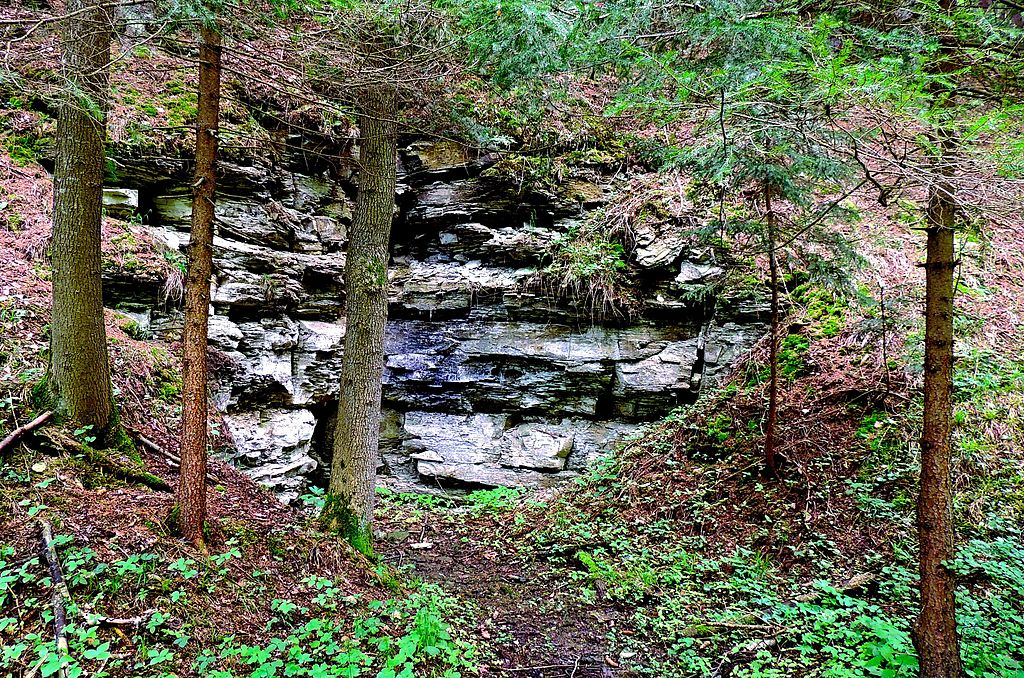
Exposed layers of rocks in the valley slope with a spring of water.
Summary
[edit]
| Description |
English: The nature reserve and locality of European importance with named Valley of Anny. An important part of the nature reserve lies in the valley with the local name "near st. Anna" (after St. Anne's Chapel in the valley). Exposed layers of rocks in the valley slope with a spring of water. Photo location - Czechia, Pardubice Region, Skuteč town.
Čeština: Přírodní rezervace a evropsky významná lokalita Anenské údolí. Významná část přírodní rezervace leží v údolí s místním jménem "u svaté Anny" (podle kaple svaté Anny v údolí). Odkryté vrstvy hornin ve svahu údolí s pramenem vody. Foto lokace - Česko, Pardubický kraj, město Skuteč, obec Hroubovice, Anenské údolí (přírodní rezervace). |
| Date | |
| Source | Own work |
| Author | Josef Kreuz (PEPan) |
| Camera location | | View this and other nearby images on: OpenStreetMap |
|---|
Faktografie
[edit]
Prameniště vodoteče v puklinách horninových vrstev opuky v Anenském údolí, v něm několik vodních pramenů s malou vydatností.
Externí odkazy
[edit]
- 2016-12-16 Přírodní rezervace Anenské údolí
- 2016-12-16 Evropsky významná lokalita Anenské údolí
- 2016-12-16 Agentura ochrany přírody a krajiny ČR
- 2016-12-16 Anenské údolí, přírodní rezervace a evropsky významná lokalita - turistická mapa
Licensing
[edit]
I, the copyright holder of this work, hereby publish it under the following license:
This file is licensed under the Creative Commons Attribution-Share Alike 4.0 International license.
- You are free:
- to share – to copy, distribute and transmit the work
- to remix – to adapt the work
- Under the following conditions:
- attribution – You must give appropriate credit, provide a link to the license, and indicate if changes were made. You may do so in any reasonable manner, but not in any way that suggests the licensor endorses you or your use.
- share alike – If you remix, transform, or build upon the material, you must distribute your contributions under the same or compatible license as the original.
File history
Click on a date/time to view the file as it appeared at that time.
| Date/Time | Thumbnail | Dimensions | User | Comment | |
|---|---|---|---|---|---|
| current | 11:52, 28 December 2016 | | 4,066 × 2,691 (7.06 MB) | PEPan (talk | contribs) | User created page with UploadWizard |
You cannot overwrite this file.
File usage on Commons
There are no pages that use this file.
File usage on other wikis
The following other wikis use this file:
- Usage on cs.wikipedia.org