File:Andes mountains from 35,000 feet (24495877342).jpg
Jump to navigation
Jump to search

Size of this preview: 800 × 534 pixels. Other resolutions: 320 × 214 pixels | 640 × 427 pixels | 1,024 × 683 pixels | 1,280 × 854 pixels | 2,560 × 1,708 pixels | 7,049 × 4,704 pixels.
Original file (7,049 × 4,704 pixels, file size: 12.4 MB, MIME type: image/jpeg)
Captions
Captions
Add a one-line explanation of what this file represents
Summary
[edit]| Description |
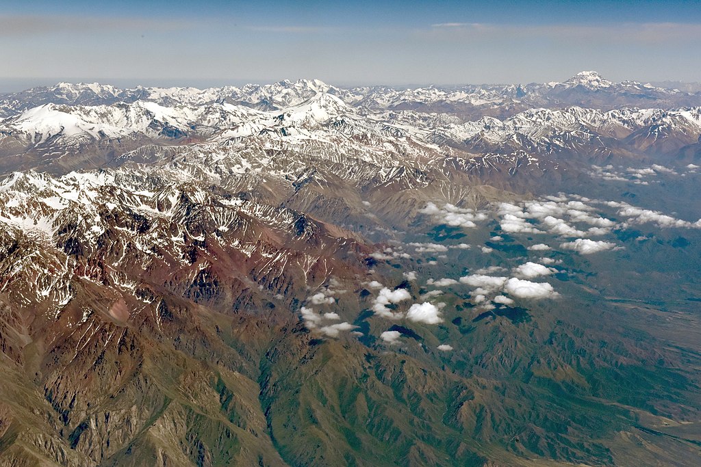
English: Andes mountains from 35,000 feet. The image shows the Andes range in almost its entire width between the province of Mendoza, Argentina to the east and the metropolitan area of Santago de Chile to the west. With the Aconcagua in the north (upper right), the El Plomo in the west (upper left), the Tupungato in the center, and the plains of Argentina in the east (lower right). |
||
| Date | |||
| Source | Andes mountains from 35,000 feet | ||
| Author | sgbirch from Peterborough, United Kingdom | ||
| Permission (Reusing this file) |
This file is licensed under the Creative Commons Attribution-Share Alike 2.0 Generic license.
|
| Camera location | | View this and other nearby images on: OpenStreetMap |
|---|
| Object location | | View this and other nearby images on: OpenStreetMap |
|---|
| Object location | | View this and other nearby images on: OpenStreetMap |
|---|
| Object location | | View this and other nearby images on: OpenStreetMap |
|---|
| Annotations | This image is annotated: View the annotations at Commons |


.jpg&action=edit§ion=1)
.jpg¶ms=-34.166667_N_-069.000000_E_globe:Earth_type:camera_heading:315.00_region:AR-M&language=en)
.jpg¶ms=-32.653056_N_-070.011667_E_globe:Earth_class:object_type:object__&language=en)
.jpg¶ms=-33.358556_N_-069.770417_E_globe:Earth_class:object_type:object__&language=en)
.jpg¶ms=-33.232778_N_-070.212222_E_globe:Earth_class:object_type:object__&language=en)
.jpg)
File history
Click on a date/time to view the file as it appeared at that time.
| Date/Time | Thumbnail | Dimensions | User | Comment | |
|---|---|---|---|---|---|
| current | 17:16, 9 January 2020 | | 7,049 × 4,704 (12.4 MB) | WeHaKa (talk | contribs) | Levels adjustment |
| 11:38, 28 March 2017 |  | 7,049 × 4,704 (7.4 MB) | Спасимир (talk | contribs) | Transferred from Flickr via Flickr2Commons |
You cannot overwrite this file.
File usage on Commons
The following page uses this file:
.jpg&oldid=850468243)