File:Andalucía-loc-Spain inset.png
Jump to navigation
Jump to search

Size of this preview: 800 × 539 pixels. Other resolutions: 320 × 216 pixels | 640 × 431 pixels | 1,024 × 690 pixels | 1,280 × 863 pixels | 1,972 × 1,329 pixels.
Original file (1,972 × 1,329 pixels, file size: 512 KB, MIME type: image/png)
Captions
Captions
Add a one-line explanation of what this file represents
| Description |
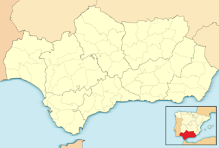
English: Location map of Andalusia
Equirectangular projection, N/S stretching 130 %. Geographic limits of the map:
Español: Mapa de localización de Andalucía
Proyección equirrectangular, N/S estirada 130 %. Límites geográficos del mapa:
|
||
| Date | |||
| Source |
|
||
| Author | Source files: User:HansenBCN, User:Mutxamel, User:Miguillen. Combined by User:Calliopejen1. | ||
| Permission (Reusing this file) |
I, the copyright holder of this work, hereby publish it under the following licenses:
This file is licensed under the Creative Commons Attribution-Share Alike Attribution-Share Alike 4.0 International, 3.0 Unported, 2.5 Generic, 2.0 Generic and 1.0 Generic license.
You may select the license of your choice. |

File history
Click on a date/time to view the file as it appeared at that time.
| Date/Time | Thumbnail | Dimensions | User | Comment | |
|---|---|---|---|---|---|
| current | 14:19, 4 November 2023 | | 1,972 × 1,329 (512 KB) | Lojwe (talk | contribs) | Cropped 1 % horizontally, 1 % vertically using CropTool with precise mode. |
| 02:16, 18 April 2012 |  | 2,000 × 1,348 (510 KB) | Calliopejen1 (talk | contribs) | {{Information |Description= {{en|Location map of Andalusia}} Equirectangular projection, N/S stretching 130 %. Geographic limits of the map: * N: 38.869010° N * S: 35.716589° N * W: 7.640606° O * E: 1.551795° O {{es|Mapa de l... |
You cannot overwrite this file.
File usage on Commons
There are no pages that use this file.
File usage on other wikis
The following other wikis use this file:
- Usage on ar.wikipedia.org
- Usage on de.wikivoyage.org
- Marbella
- Baeza
- Casares
- Priego de Córdoba
- Estepona
- Nerja
- Baelo Claudia
- Conil de la Frontera
- Vélez-Málaga
- Algarrobo (Málaga)
- Laguna Grande
- Loja (Spanien)
- Sierra Mágina
- Parque Natural Sierras de Cazorla, Segura y Las Villas
- Torre del Mar
- Rincón de la Victoria
- Alhaurín de la Torre
- Almodóvar del Río
- Novo Sancti Petri
- El Palmar (Vejer)
- Parque natural de La Breña y Marismas del Barbate
- Modul:Location map data es-an
- Modul:Location map data es-an/Doku
- Rota
- Sanlúcar de Barrameda
- Moclinejo
- Usage on en.wikipedia.org
- Usage on id.wikipedia.org
- Usage on mk.wikipedia.org
- Usage on pa.wikipedia.org
- Usage on sh.wikipedia.org