File:Ancient2.map.jpeg
Jump to navigation
Jump to search

Size of this preview: 800 × 400 pixels. Other resolutions: 320 × 160 pixels | 640 × 320 pixels | 1,024 × 512 pixels | 1,280 × 640 pixels | 2,560 × 1,280 pixels | 8,192 × 4,096 pixels.
Original file (8,192 × 4,096 pixels, file size: 8.67 MB, MIME type: image/jpeg)
Captions
Captions
Add a one-line explanation of what this file represents
| Description |
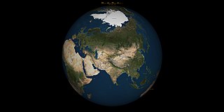
Türkçe: Divân-ı Lügati't-Türk'te ismi geçen yerleşim birimleri
English: Black area with a modern satellite-map (globe/hemisphere, apparently a NASA Blue Marble product?) superimposed with placenames known by medieval scholar Mahmud al-Kashgari, used in Dīwān Lughāt al-Turk |
| Date | 1 Ekim 2008 |
| Source | Transferred from tr.wikipedia to Commons. original: |
| Author | Tevfik Günyüzlü |
| Other versions | versions |
Lisanslama
[edit]
| This file is in the public domain in the United States because it was solely created by NASA. NASA copyright policy states that "NASA material is not protected by copyright unless noted". (See Template:PD-USGov, NASA copyright policy page or JPL Image Use Policy.) | ||
 |
Warnings:
|
File history
Click on a date/time to view the file as it appeared at that time.
| Date/Time | Thumbnail | Dimensions | User | Comment | |
|---|---|---|---|---|---|
| current | 14:22, 1 October 2008 | | 8,192 × 4,096 (8.67 MB) | Tevfik1958 (talk | contribs) | {{Bilgi |açıklama=Divân-ı Lügati't-Türk'te ismi geçen yerleşim birimleri |kaynak=Divân-ı Lügati't-Türk |tarih=1 Ekim 2008 |yazar=Tevfik Günyüzlü |izinler= |diğer_sürümler= }} |
You cannot overwrite this file.
File usage on Commons
There are no pages that use this file.