File:Ancienne carte postale Besançon Rivotte.JPG
Jump to navigation
Jump to search

Size of this preview: 800 × 523 pixels. Other resolutions: 320 × 209 pixels | 640 × 418 pixels | 1,024 × 669 pixels | 1,280 × 836 pixels | 2,560 × 1,673 pixels | 3,249 × 2,123 pixels.
Original file (3,249 × 2,123 pixels, file size: 1.72 MB, MIME type: image/jpeg)
Captions
Captions
Add a one-line explanation of what this file represents
Summary
[edit]
| Description |
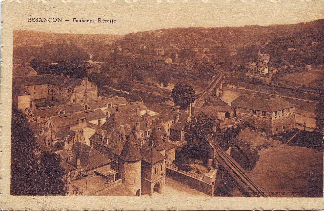
English: Carte postale montrant la porte Rivotte et la place des Jacobins (dite alors place aux Veaux). Aucune date ne figure sur la carte, mais on peut la dater entre 1893 (où la Porte Rivotte est percée de deux passages piétons) et vers 1935 (construction de l'immeuble place des Jacobins). On remarquera les trois lucarnes de l'hôtel Mareschal, les anciens bâtiments conventuels du couvent des dominicains, ainsi que l'existence de la voie de chemin de fer alors que l'avenue Gaulard n'existe pas encore. |
| Source | Own work |
| Author | Booris |
| Object location | | View this and other nearby images on: OpenStreetMap |
|---|
| Camera location | | View this and other nearby images on: OpenStreetMap |
|---|
Licensing
[edit]
| I, the copyright holder of this work, release this work into the public domain. This applies worldwide. In some countries this may not be legally possible; if so: I grant anyone the right to use this work for any purpose, without any conditions, unless such conditions are required by law. |
File history
Click on a date/time to view the file as it appeared at that time.
| Date/Time | Thumbnail | Dimensions | User | Comment | |
|---|---|---|---|---|---|
| current | 08:52, 13 July 2008 | | 3,249 × 2,123 (1.72 MB) | Booris (talk | contribs) | {{Information |Description={{en|1=Carte postale montrant la porte Rivotte et la place des Jacobins (dite alors place aux Veaux). Aucune date ne figure sur la carte, mais on peut la dater entre 1893 (où la Porte Rivotte est percée de deux passages piéto |
You cannot overwrite this file.
File usage on Commons
The following page uses this file:
File usage on other wikis
The following other wikis use this file:
- Usage on fr.wikipedia.org
- Usage on www.wikidata.org