File:Amtliche Entfernungskarte des Kreises Wohlau, 1899.png
Jump to navigation
Jump to search

Size of this preview: 800 × 288 pixels. Other resolutions: 320 × 115 pixels | 640 × 231 pixels | 1,024 × 369 pixels | 1,280 × 461 pixels | 3,440 × 1,239 pixels.
Original file (3,440 × 1,239 pixels, file size: 4.03 MB, MIME type: image/png)
Captions
Captions
Add a one-line explanation of what this file represents
Summary
[edit]
| Description |
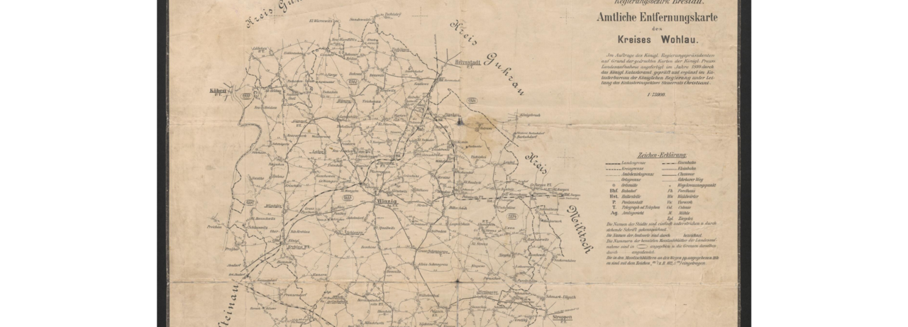
Deutsch: amtliche Entfernungen zwischen den einzelnen Gemeinden und Ortschaften im Kreise Wohlau aus dem Jahre 1899 |
| Date | |
| Source | https://www.bibliotekacyfrowa.pl/dlibra/doccontent?id=46594&format_id=10 |
| Author | Königliches Katasteramt Preußen |
| Camera location | | View this and other nearby images on: OpenStreetMap |
|---|
Licensing
[edit]
This work is in the public domain in the United States because it was published (or registered with the U.S. Copyright Office) before January 1, 1929.
Public domain works must be out of copyright in both the United States and in the source country of the work in order to be hosted on the Commons. If the work is not a U.S. work, the file must have an additional copyright tag indicating the copyright status in the source country.
Note: This tag should not be used for sound recordings. |
File history
Click on a date/time to view the file as it appeared at that time.
| Date/Time | Thumbnail | Dimensions | User | Comment | |
|---|---|---|---|---|---|
| current | 10:25, 19 January 2024 | 3,440 × 1,239 (4.03 MB) | KaiTrippmacher (talk | contribs) | Uploaded a work by Königliches Katasteramt Preußen from https://www.bibliotekacyfrowa.pl/dlibra/doccontent?id=46594&format_id=10 with UploadWizard |
You cannot overwrite this file.
File usage on Commons
There are no pages that use this file.
File usage on other wikis
The following other wikis use this file:
- Usage on de.wikipedia.org