File:Amrit Stadio Ellenistico - GAR - 2-01.jpg
Jump to navigation
Jump to search

Size of this preview: 800 × 600 pixels. Other resolutions: 320 × 240 pixels | 640 × 480 pixels | 1,024 × 768 pixels | 1,280 × 960 pixels | 2,048 × 1,536 pixels.
Original file (2,048 × 1,536 pixels, file size: 641 KB, MIME type: image/jpeg)
Captions
Captions
Add a one-line explanation of what this file represents
Summary
[edit]| Italiano: Amrit Stadio Ellenistico
( |
||||||||||||||||||||
|---|---|---|---|---|---|---|---|---|---|---|---|---|---|---|---|---|---|---|---|---|
| Photographer |
Gianfranco Gazzetti |
|||||||||||||||||||
| Title |
Italiano: Amrit Stadio Ellenistico |
|||||||||||||||||||
| Description |
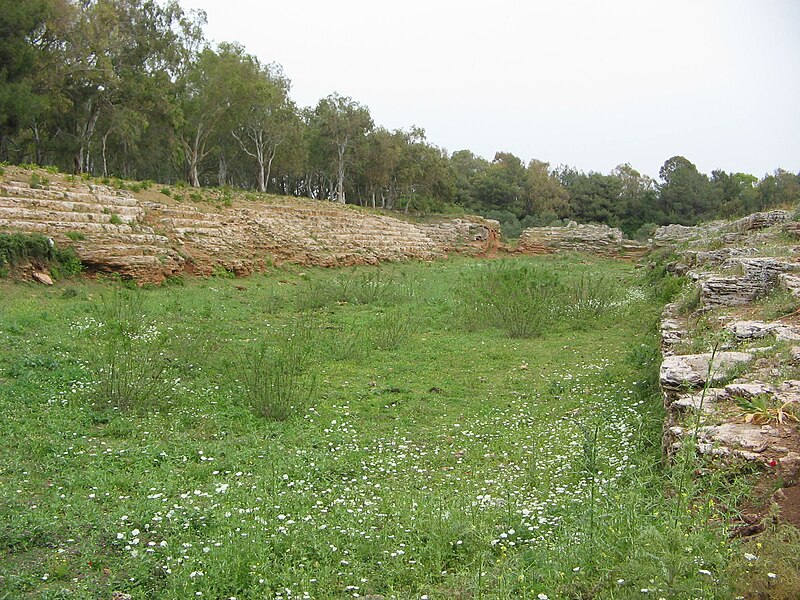
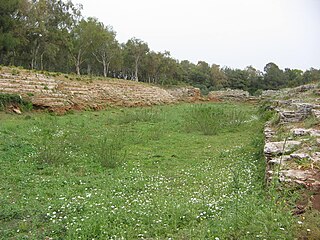
Italiano: Amrit è un piccolo villaggio della Siria posto a sud di Tartus, in passato già fiorente città di origine fenicia con il nome di Marathus. Lo stadio è di origine ellenistica (250 m x 50 m).
English: Hellenistic Stadium, Amrit in 2006 |
|||||||||||||||||||
| Depicted place | Amrit | |||||||||||||||||||
| Date | 2006 | |||||||||||||||||||
| Collection |
|
|||||||||||||||||||
| Source |
2/Amrit_Stadio_Ellenistico_01
|
|||||||||||||||||||
| Permission (Reusing this file) |
This file is licensed under the Creative Commons Attribution-Share Alike 4.0 International license. Attribution: Gianfranco Gazzetti / GAR
|
|||||||||||||||||||

| Camera location | | View this and other nearby images on: OpenStreetMap |
|---|
File history
Click on a date/time to view the file as it appeared at that time.
| Date/Time | Thumbnail | Dimensions | User | Comment | |
|---|---|---|---|---|---|
| current | 16:39, 25 April 2016 | | 2,048 × 1,536 (641 KB) | Ignis animae (talk | contribs) | User created page with UploadWizard |
You cannot overwrite this file.
File usage on Commons
The following 4 pages use this file:
File usage on other wikis
The following other wikis use this file:
- Usage on en.wikipedia.org
- Usage on es.wikipedia.org
- Usage on vi.wikipedia.org