File:Amorfortia Dioecesus Ultraiectensis Oppidum 1595.jpg
Jump to navigation
Jump to search

Size of this preview: 800 × 524 pixels. Other resolutions: 320 × 210 pixels | 640 × 419 pixels | 1,024 × 671 pixels | 1,280 × 838 pixels | 2,898 × 1,898 pixels.
Original file (2,898 × 1,898 pixels, file size: 1.38 MB, MIME type: image/jpeg)
Captions
Captions
Add a one-line explanation of what this file represents
Summary
[edit]| Artist |
Georg Braun |
| Description |
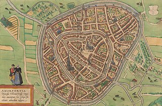
Polski: 1 atlas ([6] s., 59 k. widoków i planów miast, [15] s.), mdz. kolor. Zawiera widoki, widoki z lotu ptaka i plany perspektywiczne 74 wybranych miast oraz dodatkowo mapę Danii (k. 25) i wyspy Hven (k. 27), obok której zamieszczono widok i rzut obserwatorium astronomicznego Tychona Brahe (Uranienborg). Każda karta opatrzona tekstem objaśniającym na verso. Na końcu dołączony indeks miejscowości. Łacińskie wydanie czwartego tomu "Civitates orbis terrarum" datowane na 1594 r. (po raz pierwszy wydanego w 1588). |
| Date | 1594 |
| Medium | drawing |
| Collection | Digital Library of University of Wroclaw |
| Accession number |
[oai:bibliotekacyfrowa.pl:96065] |
| Source/Photographer |
.jpg)
Licensing
[edit]
|
This work is in the public domain in its country of origin and other countries and areas where the copyright term is the author's life plus 70 years or fewer. | |
| This file has been identified as being free of known restrictions under copyright law, including all related and neighboring rights. | |

|
This file was uploaded to Wikimedia Commons as part of a GLAM-Wiki partnership between the Digital Library of University of Wroclaw and Wikimedia Polska.
|
File history
Click on a date/time to view the file as it appeared at that time.
| Date/Time | Thumbnail | Dimensions | User | Comment | |
|---|---|---|---|---|---|
| current | 12:00, 3 February 2024 | | 2,898 × 1,898 (1.38 MB) | Enyavar (talk | contribs) | File:Civitates orbis terrarum. Urbium praecipuarum totius mundi. Liber quartus (page 34).jpg cropped 42 % horizontally, 45 % vertically using CropTool with precise mode. |
You cannot overwrite this file.
File usage on Commons
The following 2 pages use this file:
File usage on other wikis
The following other wikis use this file:
- Usage on fy.wikipedia.org
- Usage on is.wikipedia.org
- Usage on nl.wikipedia.org
- Usage on zea.wikipedia.org