File:Amersfoort.png
Jump to navigation
Jump to search

Size of this preview: 691 × 600 pixels. Other resolutions: 277 × 240 pixels | 553 × 480 pixels | 885 × 768 pixels | 1,180 × 1,024 pixels | 1,607 × 1,395 pixels.
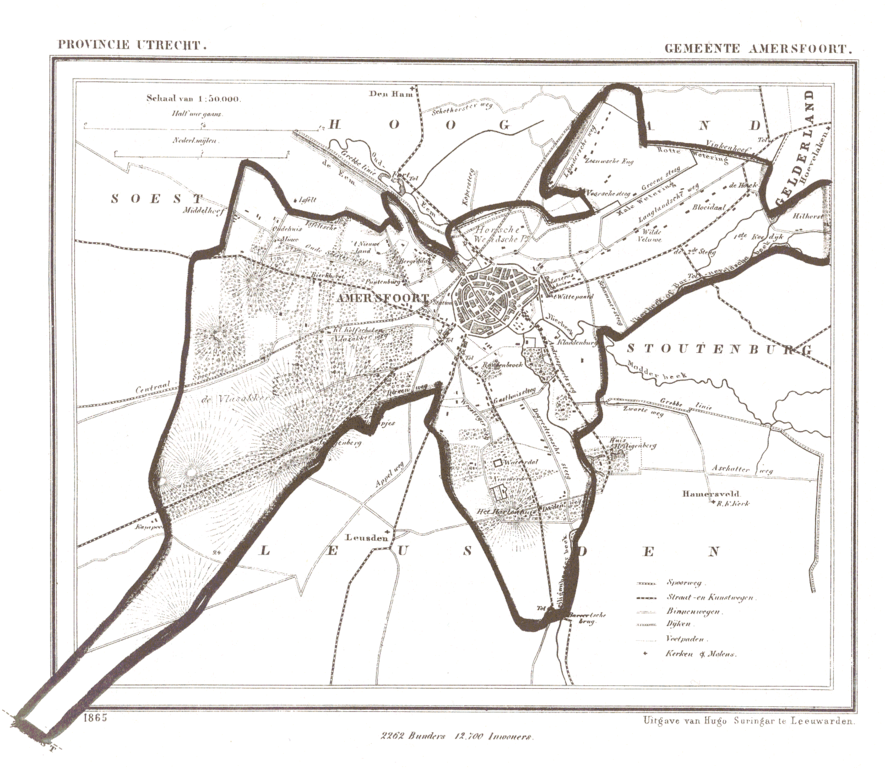
Original file (1,607 × 1,395 pixels, file size: 248 KB, MIME type: image/png)
Captions
Captions
Add a one-line explanation of what this file represents
Summary
[edit]
| Description |
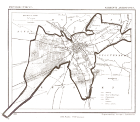
Nederlands: De naam van de website waar het vandaan kwam moet worden vermeld. De afbeelding komt van http://www.rat.de/kuijsten/atlas/ut/ . Het is de kaart van de gemeente nl:Amersfoort uit 1865.
The name of the website it came from must be used. This image came from: http://www.rat.de/kuijsten/atlas/ut/ . It is the map of gemeente nl:Amersfoort. |
| Date | 4 April 2005 (original upload date) |
| Source | Transferred from nl.wikipedia to Commons. Original source is http://www.rat.de/kuijsten/atlas/ut/. |
| Author | The original uploader was Jeroen at Dutch Wikipedia. |
Licensing
[edit]
This file is in the public domain because The name of the website it came from must be used. This image came from: http://www.rat.de/kuijsten/atlas/ut/ . It is the map of gemeente nl:Amersfoort.
|
Original upload log
[edit]
The original description page was here. All following user names refer to nl.wikipedia.
- 2005-04-04 00:39 Jeroen 1607×1395×4 (254150 bytes) {{beperkt}} Deze afbeelding kan alleen worden gebruikt op Wikipedia. De naam van de website waar het vandaan kwam moet worden vermeld. De afbeelding komt van http://www.rat.de/kuijsten/atlas/ut/ . Het is de kaart van de gemeente [[Amersfoort]]. This ima
File history
Click on a date/time to view the file as it appeared at that time.
| Date/Time | Thumbnail | Dimensions | User | Comment | |
|---|---|---|---|---|---|
| current | 16:54, 14 March 2008 | | 1,607 × 1,395 (248 KB) | File Upload Bot (Magnus Manske) (talk | contribs) | {{BotMoveToCommons|nl.wikipedia}} {{Information |Description={{nl|De naam van de website waar het vandaan kwam moet worden vermeld. De afbeelding komt van http://www.rat.de/kuijsten/atlas/ut/ . Het is de kaart van de gemeente nl:Amersfoort. The nam |
You cannot overwrite this file.
File usage on Commons
The following page uses this file:
File usage on other wikis
The following other wikis use this file:
- Usage on eo.wikipedia.org
- Usage on fy.wikipedia.org
- Usage on nds-nl.wikipedia.org