File:Amazon River 95 km upstream of Tabatinga, Leticia.jpg
Jump to navigation
Jump to search
Size of this preview: 800 × 530 pixels. Other resolutions: 320 × 212 pixels | 640 × 424 pixels | 1,024 × 678 pixels | 1,280 × 848 pixels | 3,032 × 2,008 pixels.
Original file (3,032 × 2,008 pixels, file size: 1.65 MB, MIME type: image/jpeg)
Captions
Captions
Add a one-line explanation of what this file represents
Summary
[edit]
| Description |
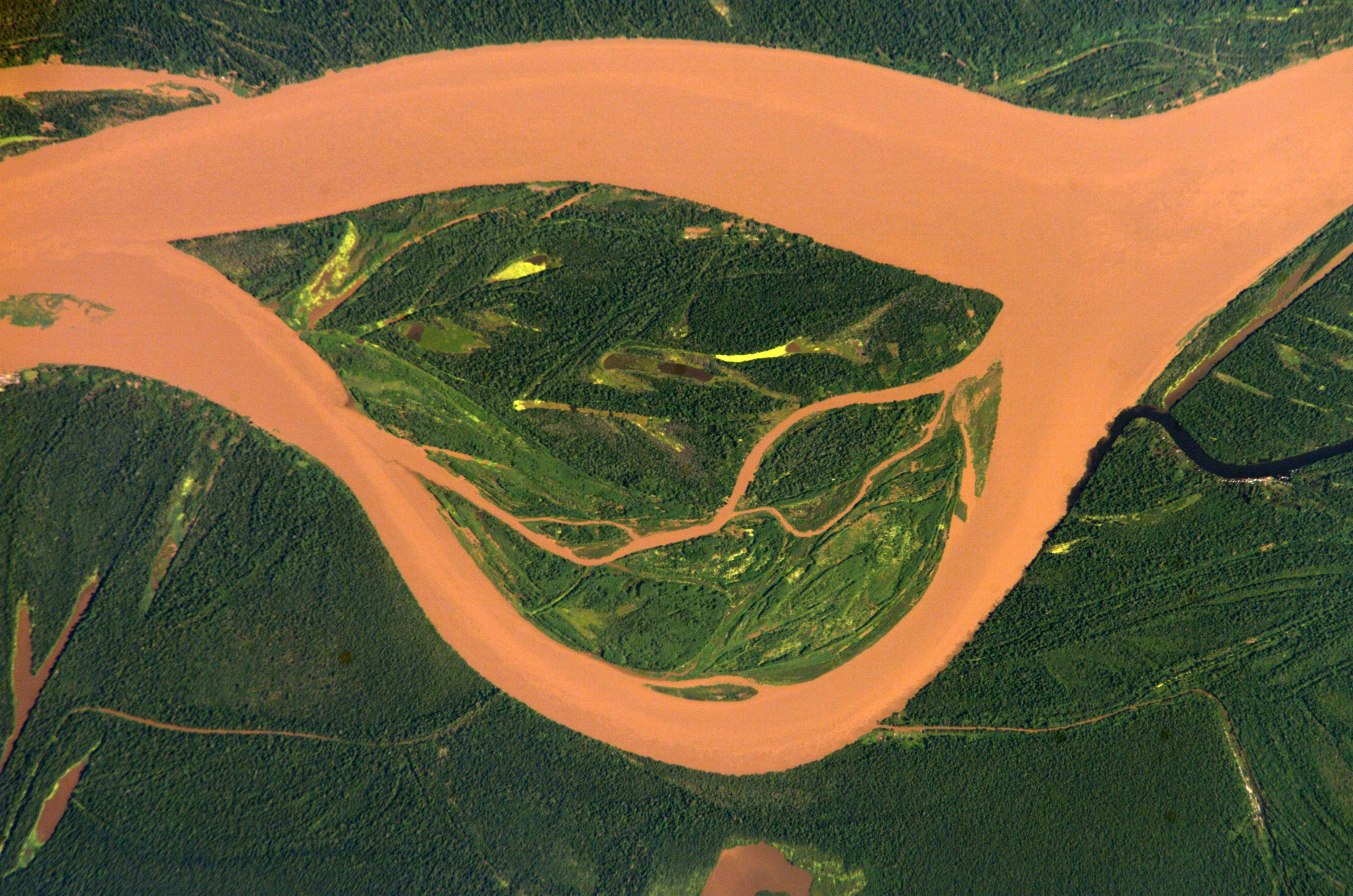
English: Amazon 95 km upstream of Tabatinga/Leticia (Frontier Colombia-Peru)
Deutsch: Amazonas 95 km oberhalb von Tabatinga/Leticia (Grenze Kolumbien-Peru)
Español: Río Amazonas 95 km aguas arriba de Tabatinga/Leticia (Frontera Colombia-Perú) |
| Date | |
| Source | http://eol.jsc.nasa.gov/scripts/sseop/photo.pl?mission=ISS004&roll=E&frame=12730 |
| Author | ISS Expedition 4 crew member |
| Camera location | | View this and other nearby images on: OpenStreetMap |
|---|
This image or video was catalogued by Johnson Space Center of the United States National Aeronautics and Space Administration (NASA) under Photo ID: ISS004-E-12730. This tag does not indicate the copyright status of the attached work. A normal copyright tag is still required. See Commons:Licensing. Other languages:
|
Licensing
[edit]
This file is in the public domain in the United States because it was created by the Image Science & Analysis Laboratory, of the NASA Johnson Space Center. NASA copyright policy states that "NASA material is not protected by copyright unless noted". (NASA media use guidelines or Conditions of Use of Astronaut Photographs).
Photo source: ISS004-E-12730.
|
Original upload log
[edit]
The original description page was here. All following user names refer to de.wikipedia.
- 2005-03-04 12:14 Managementboy 639×435× (331304 bytes) Guaviare Fluss in Kolumbien
| Annotations | This image is annotated: View the annotations at Commons |
File history
Click on a date/time to view the file as it appeared at that time.
| Date/Time | Thumbnail | Dimensions | User | Comment | |
|---|---|---|---|---|---|
| current | 14:54, 13 July 2014 | | 3,032 × 2,008 (1.65 MB) | Ras67 (talk | contribs) | cropped, colors adjusted |
| 14:52, 13 July 2014 |  | 3,032 × 2,064 (1.43 MB) | Ras67 (talk | contribs) | high resolution original | |
| 19:06, 14 April 2006 |  | 639 × 422 (104 KB) | Darwinek (talk | contribs) | ||
| 18:52, 14 April 2006 |  | 639 × 435 (324 KB) | Inge-Lyubov~commonswiki (talk | contribs) | *{{en|Guaviare River in Colombia}} *{{de|Guaviare Fluss in Kolumbien}} *Earth Sciences and Image Analysis, NASA-Johnson Space Center. 30 Apr. 2003. "Astronaut Photography of Earth - Display Record." http://eol.jsc.nasa.gov/scripts/sseop/photo.pl?mission= |
You cannot overwrite this file.
File usage on Commons
The following page uses this file:
- File:Guaviare Fluss.jpg (file redirect)
File usage on other wikis
The following other wikis use this file:
- Usage on azb.wikipedia.org
- Usage on fa.wikipedia.org
- Usage on fr.wikipedia.org
- Usage on it.wikipedia.org
- Usage on lt.wikipedia.org
- Usage on nl.wikipedia.org
- Usage on pl.wikipedia.org
- Usage on pt.wikipedia.org
- Usage on sr.wikipedia.org
- Usage on vi.wikipedia.org
- Usage on zh.wikipedia.org