File:Am-map he.svg
Jump to navigation
Jump to search

Size of this PNG preview of this SVG file: 585 × 600 pixels. Other resolutions: 234 × 240 pixels | 468 × 480 pixels | 749 × 768 pixels | 999 × 1,024 pixels | 1,998 × 2,048 pixels | 1,169 × 1,198 pixels.
Original file (SVG file, nominally 1,169 × 1,198 pixels, file size: 314 KB)
Captions
Captions
Add a one-line explanation of what this file represents
Summary
[edit]| Description |
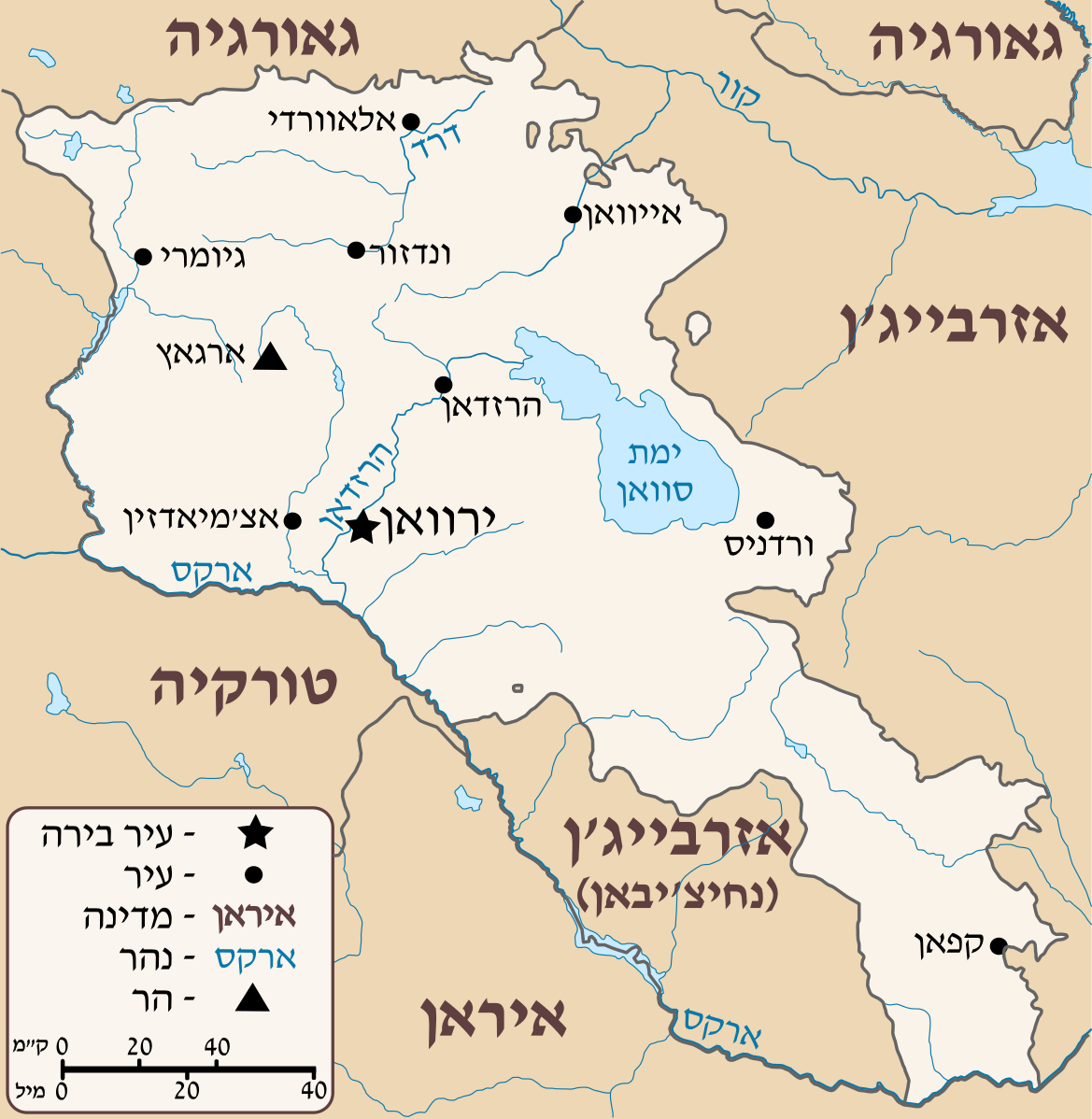
Deutsch: Positionskarte von Armenien. Quadratische Plattkarte, N-S-Streckung 130 %. Geographische Begrenzung der Karte: * N: 41.4° N * S: 38.8° N * W: 43.4° O * O: 46.7° O English: Location map of Armenia. Equirectangular projection, N/S stretching 130 %. Geographic limits of the map: * N: 41.4° N * S: 38.8° N * W: 43.4° E * E: 46.7° E Français : Carte administrative muette de l'Arménie. Projection cylindrique équidistante, avec étirement nord-sud de 130%. Limites de la carte : * N: 41,4° * O: 43,4° * S: 38,8° * E: 46,7° |
| Date | (UTC) |
| Source |
This file was derived from: Armenia location map.svg:  |
| Author |
|
| Other versions |
[]
|


| This is a retouched picture, which means that it has been digitally altered from its original version. Modifications: HEBREW. The original can be viewed here: Armenia location map.svg:
|
Licensing
[edit]
I, the copyright holder of this work, hereby publish it under the following license:
This file is licensed under the Creative Commons Attribution-Share Alike 3.0 Unported license.
- You are free:
- to share – to copy, distribute and transmit the work
- to remix – to adapt the work
- Under the following conditions:
- attribution – You must give appropriate credit, provide a link to the license, and indicate if changes were made. You may do so in any reasonable manner, but not in any way that suggests the licensor endorses you or your use.
- share alike – If you remix, transform, or build upon the material, you must distribute your contributions under the same or compatible license as the original.
Original upload log
[edit]
This image is a derivative work of the following images:
- File:Armenia_location_map.svg licensed with Cc-by-sa-3.0
- 2012-04-05T19:55:11Z Sémhur 1169x1198 (213892 Bytes) ...with the former size
- 2012-04-05T19:47:53Z Sémhur 1000x1024 (213274 Bytes) Adding few rivers : Dzoraget, Aghstafa, Azat, Vedi and Megri
- 2011-01-15T11:52:05Z NordNordWest 1169x1198 (277162 Bytes) according to http://commons.wikimedia.org/w/index.php?title=User_talk%3AVarmin&action=historysubmit&diff=48288330&oldid=40674250
- 2011-01-14T17:54:35Z Varmin 1160x1190 (292375 Bytes) concordance avec les autres cartes vectorisée.
- 2010-08-28T16:58:09Z NordNordWest 1169x1198 (277162 Bytes) Barxudarlı, Yuxarı Əskipara and Karki stay officially non-Armenian (see [[:en:List of enclaves and exclaves]]), no changes without discussion
- 2010-08-28T16:34:29Z 6AND5 1160x1190 (292375 Bytes) (Exclaves deleted according to official map at http://www.gov.am/en/regions/)
- 2009-10-21T09:11:52Z NordNordWest 1169x1198 (277162 Bytes) '
- 2009-10-19T13:24:33Z NordNordWest 1169x1198 (275878 Bytes) '
- 2009-08-11T14:36:27Z NordNordWest 1169x1198 (275144 Bytes) {{int:filedesc}} {{Information |Description= {{de|Positionskarte von [[:de:Armenien|Armenien]]}} Quadratische Plattkarte, N-S-Streckung 130 %. Geographische Begrenzung der Karte: * N: 41.4° N * S: 38.8° N * W: 43.4° O * O:
Uploaded with derivativeFX
File history
Click on a date/time to view the file as it appeared at that time.
| Date/Time | Thumbnail | Dimensions | User | Comment | |
|---|---|---|---|---|---|
| current | 13:44, 29 July 2012 | | 1,169 × 1,198 (314 KB) | Amirki (talk | contribs) | הוספת מקרא |
| 13:13, 29 July 2012 |  | 1,169 × 1,198 (281 KB) | Amirki (talk | contribs) | object to path | |
| 13:11, 29 July 2012 |  | 1,169 × 1,198 (203 KB) | Amirki (talk | contribs) | == {{int:filedesc}} == {{Information |Description={{Multilingual description |de= Positionskarte von Armenien.<br> Quadratische Plattkarte, N-S-Streckung 130 %. Geographische Begrenzung der Karte: * N: 41.4° N * S: 38.8° N * W: 43.4... |
You cannot overwrite this file.
File usage on Commons
The following 9 pages use this file:
File usage on other wikis
The following other wikis use this file:
- Usage on he.wikipedia.org