File:Alt Karin Hollaenderhaus 04.jpg
Jump to navigation
Jump to search

Size of this preview: 800 × 376 pixels. Other resolutions: 320 × 150 pixels | 640 × 301 pixels | 1,024 × 482 pixels | 1,280 × 602 pixels | 2,560 × 1,204 pixels | 5,278 × 2,482 pixels.
Original file (5,278 × 2,482 pixels, file size: 11.63 MB, MIME type: image/jpeg)
Captions
Captions
Add a one-line explanation of what this file represents
Summary
[edit]| Description |
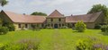
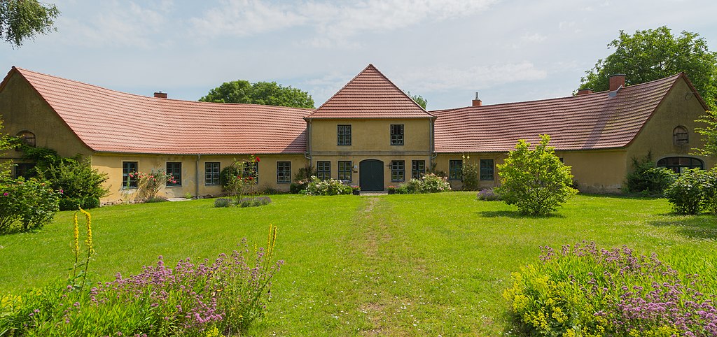
English: The so-called Dutch House (Holländerhaus), 5 Chestnut-lined Avenue (Kastanienallee 5) in Alt Karin, district of Carinerland, Landkreis Rostock, Mecklenburg-Vorpommern, Germany. This former estate house dates from 1699 and is a listed cultural heritage monument. Image taken with permission on private property.
Deutsch: Das Holländerhaus, Kastanienallee 5 in Alt Karin, Ortsteil der Gemeinde Carinerland, Landkreis Rostock, Mecklenburg-Vorpommern, Deutschland. Es entstand 1699 im Auftrag von Karl Leonhard Müller von der Lühne als Gutshaus. Das halbrunde Gebäude mit seinen parallelen Giebeln stellt eine architektonische Besonderheit in der Region dar. Aufgrund seiner Bauweise wird es auch das „Krumme Haus“ genannt und steht unter Denkmalschutz. Fotografiererlaubnis vom Eigentümer erteilt. |
||||||||||||||||||||||||||
| Date | Taken on 14 July 2020 | ||||||||||||||||||||||||||
| Source | Own work | ||||||||||||||||||||||||||
| Author |
|
||||||||||||||||||||||||||
| Other versions |
|
||||||||||||||||||||||||||


| Camera location | | View this and other nearby images on: OpenStreetMap |
|---|
Notes
[edit]
This image is not public domain. Please respect the copyright protection. It may only be used according to the rules mentioned here. This specifically excludes use in social media, if applicable terms of the licenses listed here not appropriate. (See for example CC BY-SA on Facebook.) Of course, a free license is no carte blanche for use. Especially there restrictions not based on the License, for example to the personality rights of the author. This is especially true for the required attribution and the use of the image. It is expressly not allowed to give the impression through the use of the image, that the author supports the work, in which the image is used, or whose rights holders in any way. |

| Please do not upload a modified image here without consultation with the author. The author would like to make possible minor modifications only at his own source. (The source is usually a RAW file. Processing of the JPEG file means a loss of quality.) This ensures that the changes and the quality are preserved. Please if you think that any changes should be required, please contact the author. Otherwise you can upload a new image with a new name. Please use one of the templates derivative or extract. Please enter your name too, if you upload a derivative or a detail, because you're in charge of the changes. Please do not rename this file. The name is part of the attribution. In the case of misstatements, the author is pleased to provide information. |
Licensing
[edit]
I, the copyright holder of this work, hereby publish it under the following license:
This file is licensed under the Creative Commons Attribution-Share Alike 4.0 International license.
- You are free:
- to share – to copy, distribute and transmit the work
- to remix – to adapt the work
- Under the following conditions:
- attribution – You must give appropriate credit, provide a link to the license, and indicate if changes were made. You may do so in any reasonable manner, but not in any way that suggests the licensor endorses you or your use.
- share alike – If you remix, transform, or build upon the material, you must distribute your contributions under the same or compatible license as the original.

|
This image was uploaded as part of Wiki Loves Monuments 2020.
|
File history
Click on a date/time to view the file as it appeared at that time.
| Date/Time | Thumbnail | Dimensions | User | Comment | |
|---|---|---|---|---|---|
| current | 20:44, 22 September 2020 | | 5,278 × 2,482 (11.63 MB) | J.-H. Janßen (talk | contribs) | {{Information |Description ={{en|1=The so-called Dutch House (''Holländerhaus''), 5 Chestnut-lined Avenue (''Kastanienallee 5'') in Alt Karin, district of Carinerland, Landkreis Rostock, Mecklenburg-Vorpommern, Germany. This former estate house dates from 1699 and is a listed cultural heritage monument. Image taken with permission on private property.}} {{de|1=Das Holländerhaus, Kastanienallee 5 in [[:Ca... |
You cannot overwrite this file.
File usage on Commons
The following 2 pages use this file:
File usage on other wikis
The following other wikis use this file:
- Usage on de.wikipedia.org