File:Alptransit Gotthardachse.png
Jump to navigation
Jump to search
Size of this preview: 666 × 599 pixels. Other resolutions: 267 × 240 pixels | 534 × 480 pixels | 807 × 726 pixels.
Original file (807 × 726 pixels, file size: 441 KB, MIME type: image/png)
Captions
Captions
Add a one-line explanation of what this file represents
Summary
[edit]
| Description |
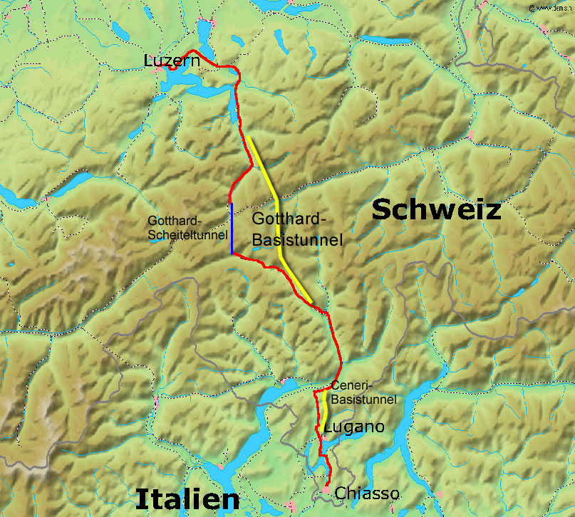
Deutsch: Karte der Gotthardachse der Neuen Eisenbahn-Alpentransversale NEAT
|
| Date | |
| Source | WikiCommons, Bild:Karte Gotthardbahn.png; ursprüngl. Quelle: http://www2.demis.nl/mapserver/mapper.asp |
| Author | Markus Schweiß; edited by Cooper at de.wikipedia |
Licensing
[edit]

|
Permission is granted to copy, distribute and/or modify this document under the terms of the GNU Free Documentation License, Version 1.2 or any later version published by the Free Software Foundation; with no Invariant Sections, no Front-Cover Texts, and no Back-Cover Texts. A copy of the license is included in the section entitled GNU Free Documentation License. |
| This file is licensed under the Creative Commons Attribution-Share Alike 3.0 Unported license. | ||
| ||
| This licensing tag was added to this file as part of the GFDL licensing update. |
Original upload log
[edit]
The original description page was here. All following user names refer to de.wikipedia.
- 2006-07-25 13:23 Cooper 807×726×8 (451542 bytes) * Bildbeschreibung: Karte der Gotthardachse der Neuen Eisenbahn-Alpentransversale NEAT * Quelle: WikiCommons, Bild:Karte Gotthardbahn.png; ursprüngl. Quelle: http://www2.demis.nl/mapserver/mapper.asp * Fotograf/Zeichner: [[Benutzer:Markus Schweiß|Mark
File history
Click on a date/time to view the file as it appeared at that time.
| Date/Time | Thumbnail | Dimensions | User | Comment | |
|---|---|---|---|---|---|
| current | 19:41, 19 April 2008 | | 807 × 726 (441 KB) | Akiry (talk | contribs) | {{Information |Description={{de|Karte der Gotthardachse der Neuen Eisenbahn-Alpentransversale NEAT * Sonstiges: Die auf dem Quellbild eingezeichnete Lage des Gotthard-Scheiteltunnels entspricht nicht der Realität, der Tunnel scheint in Wassen UR zu begin |
You cannot overwrite this file.
File usage on Commons
There are no pages that use this file.
File usage on other wikis
The following other wikis use this file:
- Usage on als.wikipedia.org
- Usage on cs.wikipedia.org
- Usage on de.wikinews.org
- Usage on fr.wikipedia.org
- Usage on hu.wikipedia.org
- Usage on nl.wikipedia.org
- Usage on pl.wikipedia.org
- Usage on ro.wikipedia.org
- Usage on www.wikidata.org