File:Almoravid Map.png
Jump to navigation
Jump to search
No higher resolution available.
Almoravid_Map.png (238 × 211 pixels, file size: 5 KB, MIME type: image/png)
Captions
Captions
Add a one-line explanation of what this file represents
Summary
[edit]
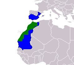
| Description | Almovarid Morocco Map (1073-1147) |
| Date | |
| Source | Own work |
| Author | Vispec |
Licensing
[edit]
| I, the copyright holder of this work, release this work into the public domain. This applies worldwide. In some countries this may not be legally possible; if so: I grant anyone the right to use this work for any purpose, without any conditions, unless such conditions are required by law. |
File history
Click on a date/time to view the file as it appeared at that time.
| Date/Time | Thumbnail | Dimensions | User | Comment | |
|---|---|---|---|---|---|
| current | 20:17, 1 February 2018 | | 238 × 211 (5 KB) | Maphobbyist (talk | contribs) | Montenegro |
| 06:42, 14 March 2017 |  | 238 × 211 (5 KB) | Koavf (talk | contribs) | South Sudan, Western Sahara | |
| 13:26, 24 November 2007 |  | 238 × 211 (5 KB) | Vispec (talk | contribs) | {{Information |Description=Almovarid Morocco Map (1073-1147) |Source=my own work |Date=24 November 2007 |Author=Vispec |Permission=self |other_versions= }} |
You cannot overwrite this file.
File usage on Commons
The following 2 pages use this file:
File usage on other wikis
The following other wikis use this file:
- Usage on ar.wikipedia.org