File:AllerkanalNebengewässerWinkel.svg
Jump to navigation
Jump to search

Size of this PNG preview of this SVG file: 665 × 599 pixels. Other resolutions: 266 × 240 pixels | 533 × 480 pixels | 852 × 768 pixels | 1,136 × 1,024 pixels | 2,272 × 2,048 pixels.
Original file (SVG file, nominally 800 × 721 pixels, file size: 770 KB)
Captions
Captions
Add a one-line explanation of what this file represents
Summary
[edit]
| Description |
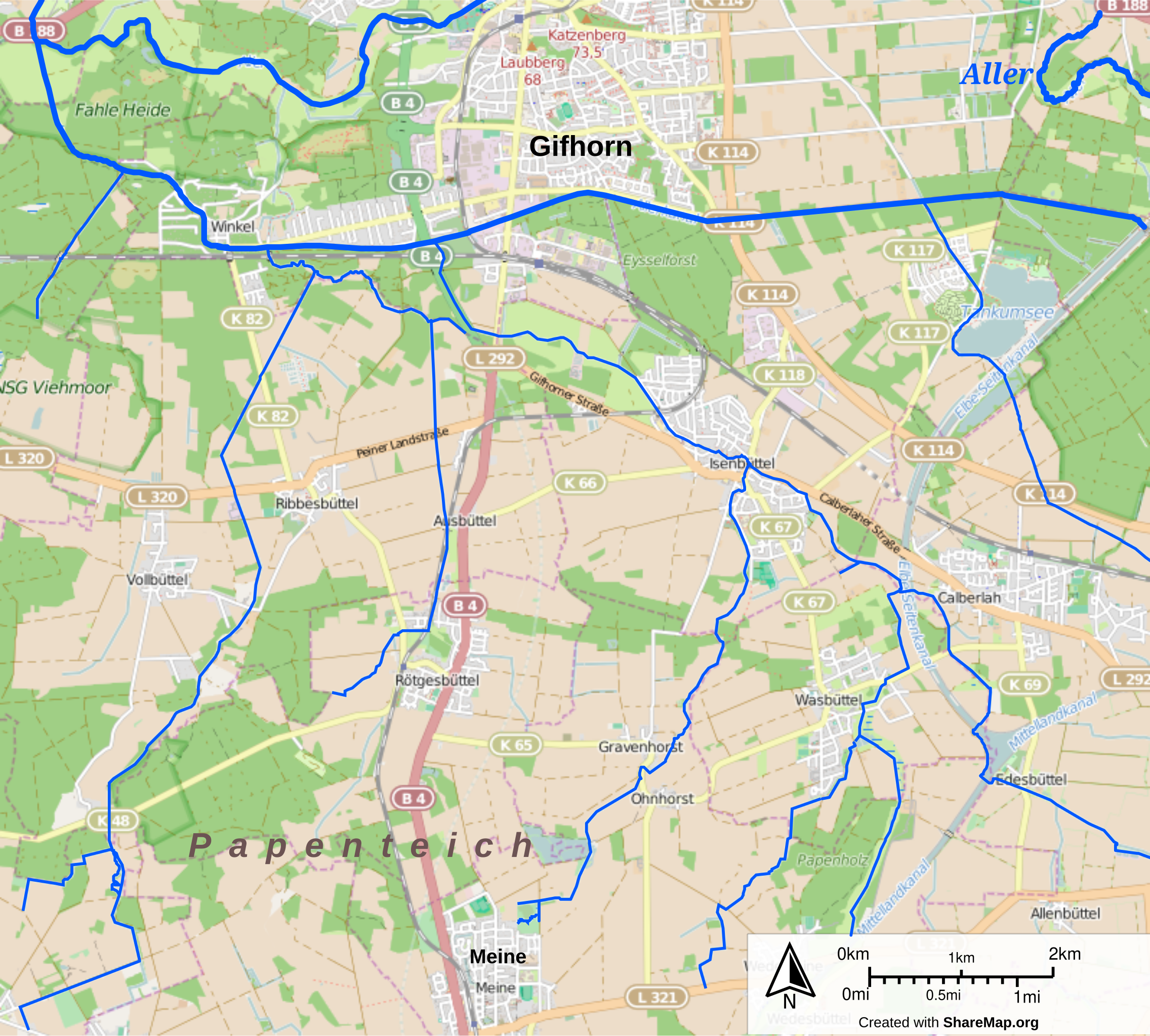
Deutsch: Allerkanal bei Winkel mit den südlichen Nebengewässern Vollbütteler Riede, Rötgesbütteler Riede und Hehlenriede, Stand 2015. In der Wikipedia werden nicht alle Daten korrekt dargestellt, daher sind abgeleitete Bilder als Bitmaps hochgeladen. |
| Date | |
| Source | openstreetmap.org über sharemap.org |
| Author | Okernick |
Licensing
[edit]
I, the copyright holder of this work, hereby publish it under the following license:
This file is licensed under the Creative Commons Attribution-Share Alike 3.0 Unported license.
- You are free:
- to share – to copy, distribute and transmit the work
- to remix – to adapt the work
- Under the following conditions:
- attribution – You must give appropriate credit, provide a link to the license, and indicate if changes were made. You may do so in any reasonable manner, but not in any way that suggests the licensor endorses you or your use.
- share alike – If you remix, transform, or build upon the material, you must distribute your contributions under the same or compatible license as the original.
File history
Click on a date/time to view the file as it appeared at that time.
| Date/Time | Thumbnail | Dimensions | User | Comment | |
|---|---|---|---|---|---|
| current | 17:22, 21 March 2015 | | 800 × 721 (770 KB) | Okernick (talk | contribs) | Name Viehmoorriede auf Viehmoorgraben geändert. |
| 20:51, 20 March 2015 |  | 800 × 721 (766 KB) | Okernick (talk | contribs) | {{Information |Description ={{de|1=Allerkanal bei Winkel mit den südlichen Nebengewässern Vollbütteler Riede, Rötgesbütteler Riede und Hehlenriede, Stand 2015.}} |Source =openstreetmap.org über sharemap.org |Author =[[User:Oker... |
You cannot overwrite this file.
File usage on Commons
There are no pages that use this file.