File:Alex 2022 track full.png
(Redirected from File:All the Track of Alex 2022.png)

Size of this preview: 800 × 495 pixels. Other resolutions: 320 × 198 pixels | 640 × 396 pixels | 1,024 × 633 pixels | 1,280 × 791 pixels | 2,700 × 1,669 pixels.
Original file (2,700 × 1,669 pixels, file size: 2.98 MB, MIME type: image/png)
Captions
Captions
Add a one-line explanation of what this file represents
Summary
[edit]
| Description |
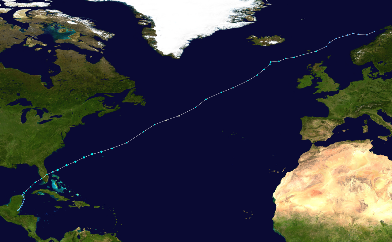
English: Track of Storm Alex extended with the path of the the mid-latitude storm that absorbed the post-tropical low after June 7th, 2022. Technically after the 7th, it is a different system (see NHC Report) |
| Date | |
| Source | WTPC Track Map Generator |
| Author | FleurDeOdile |
| Other versions |
This file was derived from: Alex 2022 track.png |
Licensing
[edit]
This file is licensed under the Creative Commons Attribution-Share Alike 4.0 International license.
- You are free:
- to share – to copy, distribute and transmit the work
- to remix – to adapt the work
- Under the following conditions:
- attribution – You must give appropriate credit, provide a link to the license, and indicate if changes were made. You may do so in any reasonable manner, but not in any way that suggests the licensor endorses you or your use.
- share alike – If you remix, transform, or build upon the material, you must distribute your contributions under the same or compatible license as the original.
File history
Click on a date/time to view the file as it appeared at that time.
| Date/Time | Thumbnail | Dimensions | User | Comment | |
|---|---|---|---|---|---|
| current | 16:16, 1 November 2022 | | 2,700 × 1,669 (2.98 MB) | El Cubano 153 (talk | contribs) | Uploaded a work by FleurDeOdile from WTPC Track Map Generator with UploadWizard |
You cannot overwrite this file.
File usage on Commons
The following page uses this file:
- File:All the Track of Alex 2022.png (file redirect)
File usage on other wikis
The following other wikis use this file:
- Usage on fr.wikipedia.org
- Usage on pt.wikipedia.org