File:Alhambra Granada (2).jpg
Jump to navigation
Jump to search
Size of this preview: 800 × 374 pixels. Other resolutions: 320 × 150 pixels | 1,024 × 479 pixels.
Original file (1,024 × 479 pixels, file size: 374 KB, MIME type: image/jpeg)
Captions
Captions
Add a one-line explanation of what this file represents
Summary
[edit].jpg&action=edit§ion=1)
| Description |
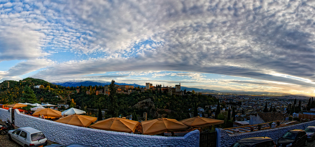
Español: La Alhambra es una ciudad amurallada (medina) que ocupa la mayor parte del cerro de La Sabika. La Granada musulmana tenía su propio sistema de amurallamiento, por tanto la Alhambra podía funcionar con autonomía respecto a la ciudad. En la Alhambra se encontraban todos los servicios propios y necesarios para la población que vivía allí: palacio real, mezquitas, escuelas, talleres, etc.
|
||
| Date | |||
| Source | Alhambra Granada | ||
| Author | CROMEO from Almería, Spain |
| Camera location | | View this and other nearby images on: OpenStreetMap |
|---|
.jpg¶ms=037.170391_N_-003.605420_E_globe:Earth_type:camera_source:Flickr_&language=en)
Licensing
[edit].jpg&action=edit§ion=2)
This file is licensed under the Creative Commons Attribution-Share Alike 2.0 Generic license.
- You are free:
- to share – to copy, distribute and transmit the work
- to remix – to adapt the work
- Under the following conditions:
- attribution – You must give appropriate credit, provide a link to the license, and indicate if changes were made. You may do so in any reasonable manner, but not in any way that suggests the licensor endorses you or your use.
- share alike – If you remix, transform, or build upon the material, you must distribute your contributions under the same or compatible license as the original.
| This image was originally posted to Flickr by CROMEO at https://www.flickr.com/photos/41574962@N03/6377036697. It was reviewed on 27 September 2012 by FlickreviewR and was confirmed to be licensed under the terms of the cc-by-sa-2.0. |

|
This image was uploaded as part of Wiki Loves Monuments 2012.
|
File history
Click on a date/time to view the file as it appeared at that time.
| Date/Time | Thumbnail | Dimensions | User | Comment | |
|---|---|---|---|---|---|
| current | 20:27, 27 September 2012 | | 1,024 × 479 (374 KB) | Wiki-Bot (talk | contribs) | {{Information |Description={{es|1=La Alhambra es una ciudad amurallada (medina) que ocupa la mayor parte del cerro de La Sabika. La Granada musulmana tenía su propio sistema de amurallamiento, por tanto la Alhambra podía funcionar con autonomía resp... |
You cannot overwrite this file.
File usage on Commons
There are no pages that use this file.
.jpg&oldid=788914739)