File:Alexishafenmap1883.png
Jump to navigation
Jump to search

Size of this preview: 564 × 600 pixels. Other resolutions: 226 × 240 pixels | 567 × 603 pixels.
Original file (567 × 603 pixels, file size: 227 KB, MIME type: image/png)
Captions
Captions
Add a one-line explanation of what this file represents
Summary
[edit]
| Description |
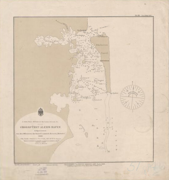
English: Map from 1883 of Alexishafen in New Guinea. |
| Date | |
| Source |
Original publication: Germany. Reichsmarineamt |
| Author |
Germany. Reichsmarineamt |
Licensing
[edit]
The copyright situation of this work is theoretically uncertain, because in the country of origin copyright lasts 70 years after the death of the author, and the date of the author's death is unknown. However, the date of creation of the work was over 120 years ago, and it is thus a reasonable assumption that the copyright has expired (see here for the community discussion). Do not use this template if the date of death of the author is known.
| |
| This file has been identified as being free of known restrictions under copyright law, including all related and neighboring rights. | |
File history
Click on a date/time to view the file as it appeared at that time.
| Date/Time | Thumbnail | Dimensions | User | Comment | |
|---|---|---|---|---|---|
| current | 17:06, 26 February 2023 | | 567 × 603 (227 KB) | Auguel (talk | contribs) | crop |
| 21:19, 17 September 2022 |  | 1,114 × 677 (376 KB) | Telecineguy (talk | contribs) | Uploading an old public-domain work using File Upload Wizard |
You cannot overwrite this file.
File usage on Commons
There are no pages that use this file.
File usage on other wikis
The following other wikis use this file:
- Usage on en.wikipedia.org