File:Ales Stenar from pole camera.jpg
Jump to navigation
Jump to search
Size of this preview: 800 × 406 pixels. Other resolutions: 320 × 162 pixels | 640 × 325 pixels | 1,024 × 520 pixels | 1,280 × 649 pixels | 2,560 × 1,299 pixels | 4,730 × 2,400 pixels.
Original file (4,730 × 2,400 pixels, file size: 10.64 MB, MIME type: image/jpeg)
Captions
Captions
Add a one-line explanation of what this file represents
Summary
[edit]
| Description |
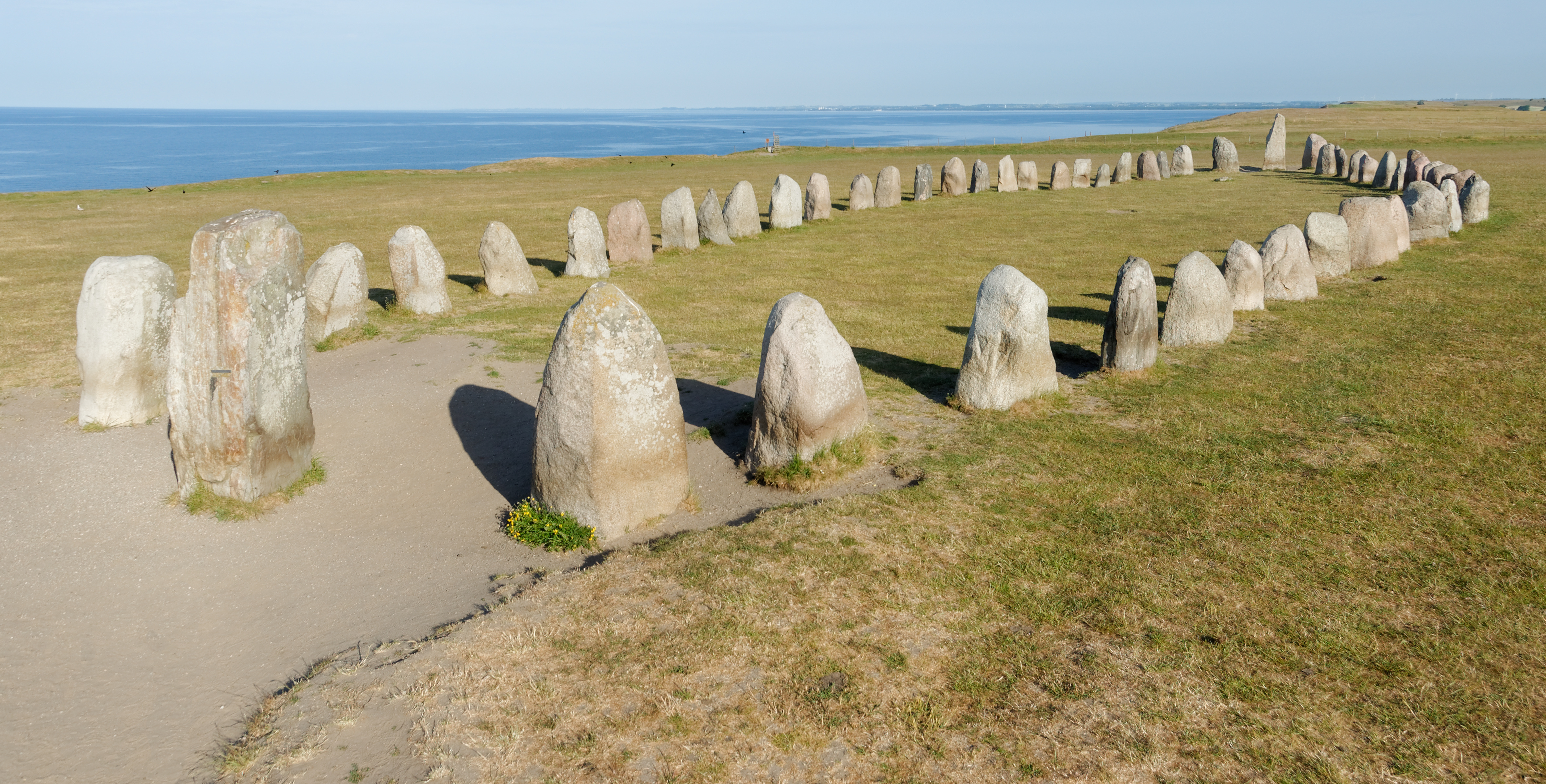
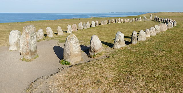
English: Ales Stenar seen from about 4 m above ground
Image taken using a monopod-mounted camera.
Deutsch: Ales Stenar aus 4 m Höhe über Boden
Aufnahme mit Hilfe eines Stativs
Svenska: Ales Stenar.
Bilden är tagen ca 4 m över marknivå med hjälp av ett stativ. |
| Date | |
| Source | Own work |
| Author | Wikimalte |
| Camera location | | View this and other nearby images on: OpenStreetMap |
|---|
Modification of image: Shadow of camera has been removed (affecting only the unstructured sand part of the image)
Licensing
[edit]
I, the copyright holder of this work, hereby publish it under the following license:
This file is licensed under the Creative Commons Attribution-Share Alike 4.0 International license.
- You are free:
- to share – to copy, distribute and transmit the work
- to remix – to adapt the work
- Under the following conditions:
- attribution – You must give appropriate credit, provide a link to the license, and indicate if changes were made. You may do so in any reasonable manner, but not in any way that suggests the licensor endorses you or your use.
- share alike – If you remix, transform, or build upon the material, you must distribute your contributions under the same or compatible license as the original.
File history
Click on a date/time to view the file as it appeared at that time.
| Date/Time | Thumbnail | Dimensions | User | Comment | |
|---|---|---|---|---|---|
| current | 14:50, 11 November 2018 | | 4,730 × 2,400 (10.64 MB) | Wikimalte (talk | contribs) | User created page with UploadWizard |
You cannot overwrite this file.
File usage on Commons
The following page uses this file:
File usage on other wikis
The following other wikis use this file:
- Usage on de.wikipedia.org
- Usage on en.wikipedia.org