File:Aldermaston Wharf - geograph.org.uk - 1189190.jpg
Jump to navigation
Jump to search
No higher resolution available.
Aldermaston_Wharf_-_geograph.org.uk_-_1189190.jpg (640 × 427 pixels, file size: 162 KB, MIME type: image/jpeg)
Captions
Captions
Add a one-line explanation of what this file represents
Summary
[edit]
| Description |
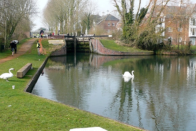
English: Aldermaston Wharf This is the original wharf (off to the right) on the Kennet navigation, now the Kennet and Avon canal, that served the village of Aldermaston, two miles to the south. Thus a small community grew up here in its own right. The lock was originally a turf-sided lock, like all of them on the Kennet navigation between Reading and Newbury. It was rebuilt in 1984 during the restoration of the canal. The flats have been built during the last few years on the site of the former Sterling Cables works. Various canoeists are seen practising for the Devizes to Westminster canoe race, that takes place over the Easter weekend. The swans ignore all the activity and go about their business. |
| Date | |
| Source | From geograph.org.uk |
| Author | Graham Horn |
| Attribution (required by the license) | Graham Horn / Aldermaston Wharf / |
| Camera location | | View this and other nearby images on: OpenStreetMap |
|---|
_heading:270.00&language=en)
| Object location | | View this and other nearby images on: OpenStreetMap |
|---|
_heading:270.00&language=en)
Licensing
[edit]

|
This image was taken from the Geograph project collection. See this photograph's page on the Geograph website for the photographer's contact details. The copyright on this image is owned by Graham Horn and is licensed for reuse under the Creative Commons Attribution-ShareAlike 2.0 license.
|
This file is licensed under the Creative Commons Attribution-Share Alike 2.0 Generic license.
Attribution: Graham Horn
- You are free:
- to share – to copy, distribute and transmit the work
- to remix – to adapt the work
- Under the following conditions:
- attribution – You must give appropriate credit, provide a link to the license, and indicate if changes were made. You may do so in any reasonable manner, but not in any way that suggests the licensor endorses you or your use.
- share alike – If you remix, transform, or build upon the material, you must distribute your contributions under the same or compatible license as the original.
File history
Click on a date/time to view the file as it appeared at that time.
| Date/Time | Thumbnail | Dimensions | User | Comment | |
|---|---|---|---|---|---|
| current | 20:00, 25 February 2011 | | 640 × 427 (162 KB) | GeographBot (talk | contribs) | == {{int:filedesc}} == {{Information |description={{en|1=Aldermaston Wharf This is the original wharf (off to the right) on the Kennet navigation, now the Kennet and Avon canal, that served the village of Aldermaston, two miles to the south. Thus a small |
You cannot overwrite this file.
File usage on Commons
There are no pages that use this file.