File:Albertstadt Map 1917 (cropped) Exerzierplatz Heller.jpg
Jump to navigation
Jump to search

Size of this preview: 681 × 600 pixels. Other resolutions: 273 × 240 pixels | 545 × 480 pixels | 872 × 768 pixels | 1,117 × 984 pixels.
Original file (1,117 × 984 pixels, file size: 361 KB, MIME type: image/jpeg)
Captions
Captions
Add a one-line explanation of what this file represents
Summary
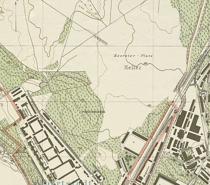
[edit]| Description | Albertstadt North of Dresden in 1917, section of a outreach map of Dresden |
| Date | |
| Source | Deutsche Fotothek — Kartenforum |
| Author | Vermessungsamt der Stadt Dresden |
| Permission (Reusing this file) |
public domain |

_Exerzierplatz_Heller.jpg&action=edit§ion=1)
Licensing
[edit]_Exerzierplatz_Heller.jpg&action=edit§ion=2)
|
This work is in the public domain in its country of origin and other countries and areas where the copyright term is the author's life plus 70 years or fewer. | |
| This file has been identified as being free of known restrictions under copyright law, including all related and neighboring rights. | |
File history
Click on a date/time to view the file as it appeared at that time.
| Date/Time | Thumbnail | Dimensions | User | Comment | |
|---|---|---|---|---|---|
| current | 11:06, 28 April 2017 | | 1,117 × 984 (361 KB) | Frze (talk | contribs) | File:Albertstadt Map 1917.jpg cropped 25 % horizontally and 48 % vertically using CropTool with precise mode. |
You cannot overwrite this file.
File usage on Commons
The following 3 pages use this file:
File usage on other wikis
The following other wikis use this file:
- Usage on de.wikipedia.org
- Usage on www.wikidata.org
_Exerzierplatz_Heller.jpg&oldid=836944832)