File:Alberto 2018-05-29 1200Z.jpg
Jump to navigation
Jump to search
Size of this preview: 600 × 600 pixels. Other resolutions: 240 × 240 pixels | 480 × 480 pixels | 768 × 768 pixels | 1,024 × 1,024 pixels.
Original file (1,024 × 1,024 pixels, file size: 913 KB, MIME type: image/jpeg)
Captions
Captions
Add a one-line explanation of what this file represents
Summary
[edit]
| Description |
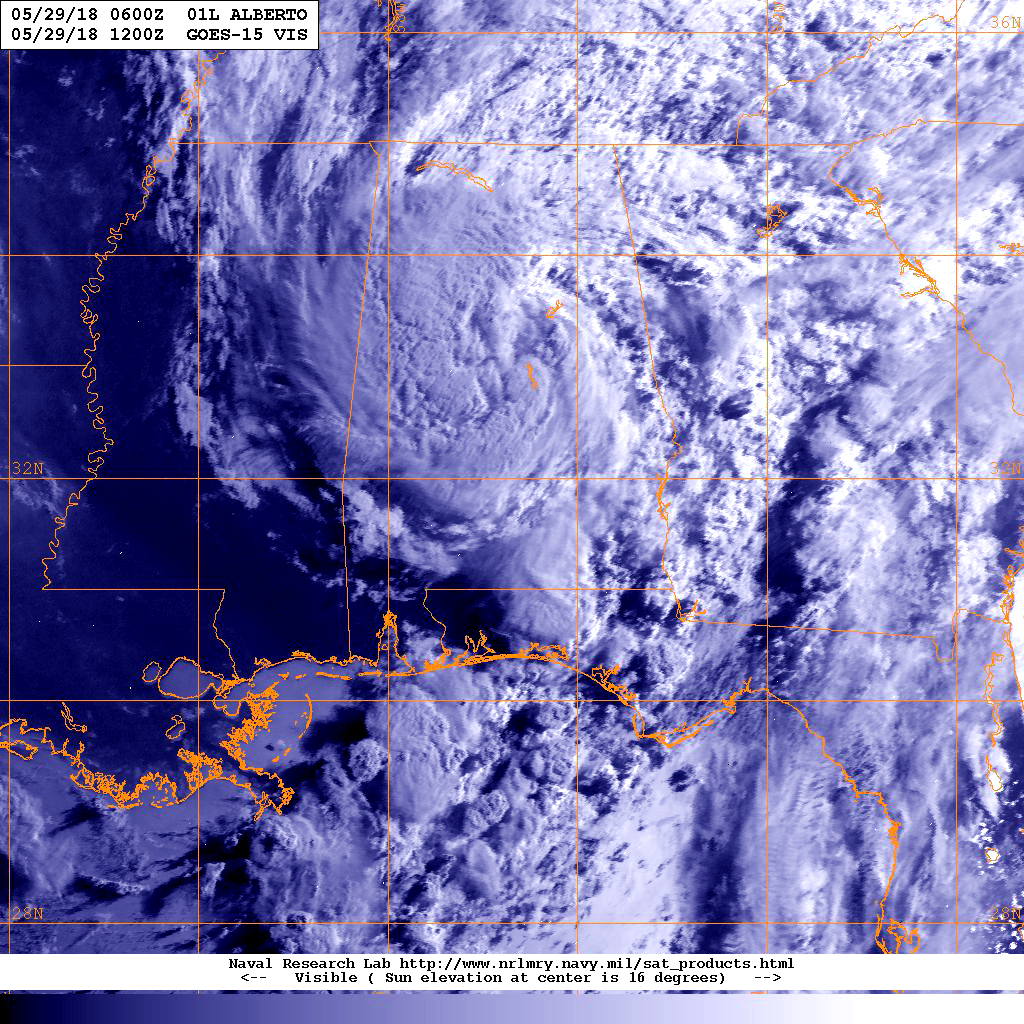
English: NOAA's GOES-East satellite showed Alberto centered over Alabama. Western Mississippi was clear of clouds in an image taken on May 29 at 8 a.m. EDT. The bulk of Alberto's clouds and storms stretched from the northern to eastern and southern quadrants, blanketing Alabama, Georgia, the Carolinas, Tennessee and Kentucky. |
| Date | |
| Source | https://www.nasa.gov/feature/goddard/2018/alberto-caribbean-sea |
| Author | NRL |
Licensing
[edit]
This file is a work of a sailor or employee of the U.S. Navy, taken or made as part of that person's official duties. As a work of the U.S. federal government, it is in the public domain in the United States.
|
 | |
| This file has been identified as being free of known restrictions under copyright law, including all related and neighboring rights. | ||
File history
Click on a date/time to view the file as it appeared at that time.
| Date/Time | Thumbnail | Dimensions | User | Comment | |
|---|---|---|---|---|---|
| current | 08:14, 4 June 2018 | | 1,024 × 1,024 (913 KB) | A1Cafel (talk | contribs) | User created page with UploadWizard |
You cannot overwrite this file.
File usage on Commons
There are no pages that use this file.