File:Alberta Topo Labeled 90 dpi.png
Jump to navigation
Jump to search
Size of this preview: 381 × 599 pixels. Other resolutions: 153 × 240 pixels | 305 × 480 pixels | 489 × 768 pixels | 651 × 1,024 pixels | 2,100 × 3,300 pixels.
Original file (2,100 × 3,300 pixels, file size: 12.08 MB, MIME type: image/png)
Captions
Captions
Add a one-line explanation of what this file represents
Summary
[edit]
| Description |
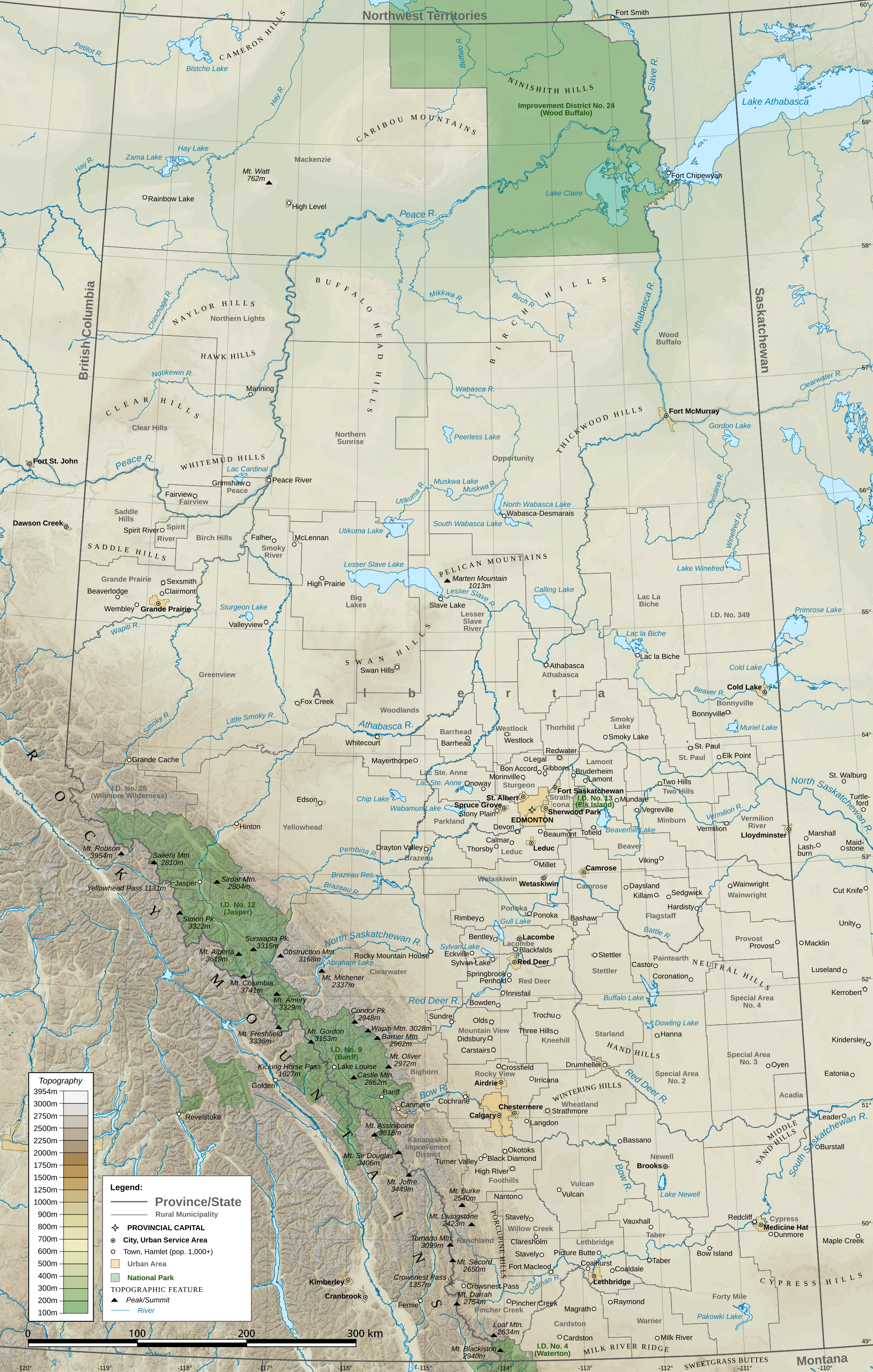
English: A topographic map of the province of Alberta, Canada, with cities, towns, rural municipalities, and natural features. |
| Date | |
| Source |
Own work (Hamlet of Granum, north of Fort Macleod, incorrectly labeled as Stavely), generated in QGIS
|
| Author | Awmcphee |
Licensing
[edit]
I, the copyright holder of this work, hereby publish it under the following license:
This file is licensed under the Creative Commons Attribution-Share Alike 4.0 International license.
- You are free:
- to share – to copy, distribute and transmit the work
- to remix – to adapt the work
- Under the following conditions:
- attribution – You must give appropriate credit, provide a link to the license, and indicate if changes were made. You may do so in any reasonable manner, but not in any way that suggests the licensor endorses you or your use.
- share alike – If you remix, transform, or build upon the material, you must distribute your contributions under the same or compatible license as the original.
File history
Click on a date/time to view the file as it appeared at that time.
| Date/Time | Thumbnail | Dimensions | User | Comment | |
|---|---|---|---|---|---|
| current | 07:36, 30 January 2017 | | 2,100 × 3,300 (12.08 MB) | Awmcphee (talk | contribs) | Finally located the Milk River Ridge |
| 05:48, 30 January 2017 |  | 2,100 × 3,300 (12.08 MB) | Awmcphee (talk | contribs) | Added more named hill ranges where appropriate | |
| 05:03, 30 January 2017 |  | 2,100 × 3,300 (12.05 MB) | Awmcphee (talk | contribs) | Added hamlets with over 1,000 population, changed "Rural municipality" name ambiguity, adjusted labeling, added Wintering and Saddle Hills | |
| 07:20, 15 January 2017 |  | 2,100 × 3,300 (12.04 MB) | Awmcphee (talk | contribs) | User created page with UploadWizard |
You cannot overwrite this file.
File usage on Commons
The following page uses this file:
File usage on other wikis
The following other wikis use this file:
- Usage on as.wikipedia.org
- Usage on en.wikipedia.org