File:Alabama National Forest Map.png

From Wikimedia Commons, the free media repository
Jump to navigation Jump to search

Original file (500 × 604 pixels, file size: 29 KB, MIME type: image/png)

Captions

Captions

Add a one-line explanation of what this file represents

Summary

[edit]
Description
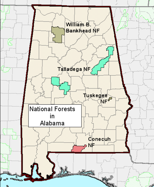
English: Map of National Forests in Alabama.
Date
Source http://www.fs.fed.us/sopa/
Author U.S. Forest Service

Licensing

[edit]
Public domain
This image is a work of the Forest Service of the United States Department of Agriculture. As a work of the U.S. federal government, the image is in the public domain.

Original upload log

[edit]
Date/Time Dimensions User Comment
12 October 2012, 05:15:32 500 × 604 (29242 bytes) Fredlyfish4 (talk · contribs) User created page with UploadWizard

File history

Click on a date/time to view the file as it appeared at that time.

Date/TimeThumbnailDimensionsUserComment
current17:26, 11 August 2014Thumbnail for version as of 17:26, 11 August 2014500 × 604 (29 KB)GifTagger (talk | contribs)Bot: Converting file to superior PNG file. (Source: Alabama_National_Forest_Map.gif). This GIF was problematic due to non-greyscale color table.

The following page uses this file: