File:Alabama Hills at Sunset.jpg
Jump to navigation
Jump to search

Size of this preview: 800 × 533 pixels. Other resolutions: 320 × 213 pixels | 640 × 427 pixels | 1,024 × 683 pixels | 1,280 × 853 pixels | 2,560 × 1,707 pixels | 4,368 × 2,912 pixels.
Original file (4,368 × 2,912 pixels, file size: 8.7 MB, MIME type: image/jpeg)
Captions
Captions
Add a one-line explanation of what this file represents
Summary
[edit]
| Description |
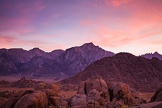
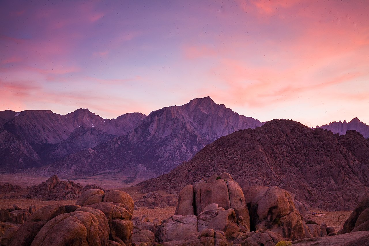
English: This 30,000-acre area received its name from a Confederate warship responsible for wreaking havoc on northern shipping during the Civil War. Prospectors sympathetic to the Confederate cause named their mining claims after the C.S.S. Alabama, and eventually the name stuck to these unique hills. The rounded, weathered contours of the Alabamas form a sharp contrast with the crisply-sculpted ridges of the nearby Sierra Nevada Mountains. Unlike the Sierra peaks, the Alabama Hills’ granite rock has been etched by wind and water, creating rounded and soft-looking boulders and leaving desert varnish—a mottled black coating of iron and manganese compounds—on many of the rocks. The scenic rock formations have been the setting for many commercials and movies, including “The Shadow” and “How the West Was Won.” These geologic features also lure rock climbers, hikers, and mountain bikers, and several streams in the area attract anglers.
Photo by Jesse Pluim, BLM. |
| Date | |
| Source | https://www.flickr.com/photos/blmcalifornia/48952622593/ |
| Author | Bureau of Land Management California |
Licensing
[edit]
| This image is a work of a Bureau of Land Management* employee, taken or made as part of that person's official duties. As a work of the U.S. federal government, the image is in the public domain in the United States. *or predecessor organization |
| This image was originally posted to Flickr by blmcalifornia at https://flickr.com/photos/50976304@N07/48952622593. It was reviewed on 15 May 2020 by FlickreviewR 2 and was confirmed to be licensed under the terms of the Public Domain Mark. |
File history
Click on a date/time to view the file as it appeared at that time.
| Date/Time | Thumbnail | Dimensions | User | Comment | |
|---|---|---|---|---|---|
| current | 17:31, 5 May 2020 | | 4,368 × 2,912 (8.7 MB) | RiverCanyon (talk | contribs) | Uploaded a work by Bureau of Land Management California from https://www.flickr.com/photos/blmcalifornia/48952622593/ with UploadWizard |
You cannot overwrite this file.
File usage on Commons
The following page uses this file: