File:Ajmer in Rajasthan (India).svg
Jump to navigation
Jump to search

Size of this PNG preview of this SVG file: 715 × 599 pixels. Other resolutions: 286 × 240 pixels | 573 × 480 pixels | 916 × 768 pixels | 1,222 × 1,024 pixels | 2,444 × 2,048 pixels | 1,093 × 916 pixels.
Original file (SVG file, nominally 1,093 × 916 pixels, file size: 1.02 MB)
Captions
Captions
Add a one-line explanation of what this file represents
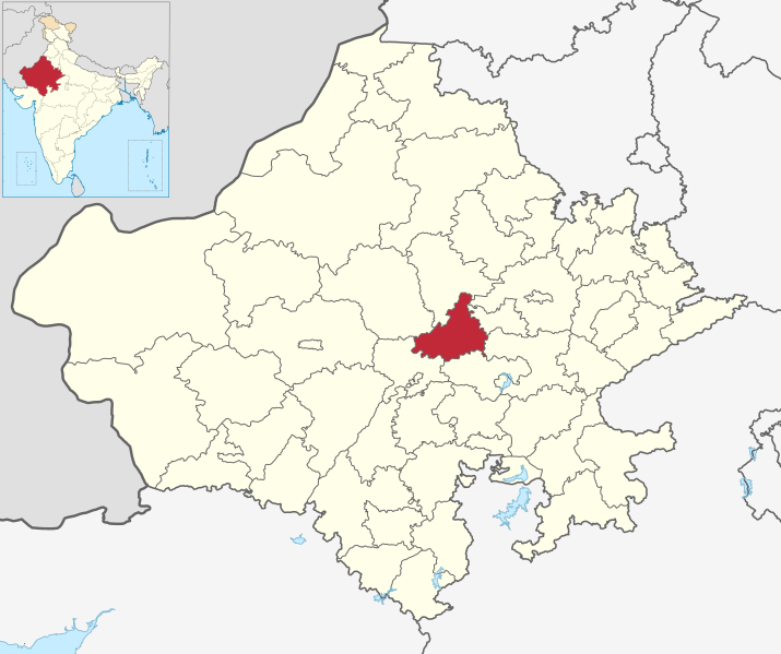
| Description | Map of Ajmer district of Rajasthan |
| Date | 1 June 2021 |
| Source | Derivative of File:India Rajasthan location map.svg |
| Author | Own work based on User:Milenioscuro |
| Permission (Reusing this file) |
This file is licensed under the Creative Commons Attribution-Share Alike 3.0 Unported license.
|
File history
Click on a date/time to view the file as it appeared at that time.
| Date/Time | Thumbnail | Dimensions | User | Comment | |
|---|---|---|---|---|---|
| current | 18:06, 28 September 2023 | | 1,093 × 916 (1.02 MB) | C1MM (talk | contribs) | updated bounds |
| 02:19, 27 February 2023 |  | 1,051 × 880 (729 KB) | C1MM (talk | contribs) | updated bounds | |
| 16:30, 1 June 2021 |  | 1,059 × 887 (932 KB) | C1MM (talk | contribs) | {{Information|Description=Map of Ajmer district of Rajasthan|Source=Derivative of File:India Rajasthan location map.svg|Date=1 June 2021|Author=Own work based on User:Milenioscuro|Permission={{Cc-by-sa-3.0}}}} Category:SVG locator maps of districts of Rajasthan |
You cannot overwrite this file.
File usage on Commons
The following 4 pages use this file:
File usage on other wikis
The following other wikis use this file:
- Usage on ar.wikipedia.org
- Usage on arz.wikipedia.org
- Usage on bn.wikipedia.org
- Usage on ca.wikipedia.org
- Usage on da.wikipedia.org
- Usage on de.wikipedia.org
- Usage on en.wikipedia.org
- List of districts of Rajasthan
- Ajmer district
- User:Ts12rAc/sandbox
- Bubani, Ajmer
- Chachiyawas, Ajmer
- Akhri Village, Ajmer
- Template:AjmerDistrict-geo-stub
- Ajmer tehsil
- Badlya, Ajmer
- Boraj-Kazipura, Ajmer
- Amba Maseena, Ajmer
- Aradka, Ajmer
- Babayacha, Ajmer
- Badiya Ka Bala, Ajmer
- Baghpura, Ajmer
- Balwanta, Ajmer
- Banseli, Ajmer
- Bargaon, Ajmer
- Beer, Ajmer
- Bhanwta, Ajmer
- Bhawani Khera, Ajmer
- Bhoodol, Ajmer
- Chandiyawas, Ajmer
- Chawandiya, Ajmer
- Danta, Ajmer
- Bhinai
- Conquest of Ajmer
- Usage on es.wikipedia.org
- Usage on eu.wikipedia.org
- Usage on fa.wikipedia.org
- Usage on fr.wikipedia.org
- Usage on ha.wikipedia.org
- Usage on incubator.wikimedia.org
- Usage on it.wikipedia.org
- Usage on ja.wikipedia.org
- Usage on mai.wikipedia.org
- Usage on ml.wikipedia.org
- Usage on mr.wikipedia.org
- Usage on nl.wikipedia.org
- Usage on no.wikipedia.org
- Usage on pnb.wikipedia.org
- Usage on ru.wikipedia.org
- Usage on sa.wikipedia.org
View more global usage of this file.
.svg)
.svg&oldid=805947215)