File:Aichi Electric Railroad Toyohashi Line map.svg
Jump to navigation
Jump to search

Size of this PNG preview of this SVG file: 754 × 600 pixels. Other resolutions: 302 × 240 pixels | 604 × 480 pixels | 966 × 768 pixels | 1,280 × 1,018 pixels | 2,560 × 2,036 pixels | 1,373 × 1,092 pixels.
Original file (SVG file, nominally 1,373 × 1,092 pixels, file size: 573 KB)
Captions
Captions
Add a one-line explanation of what this file represents
Summary
[edit]
| Description |
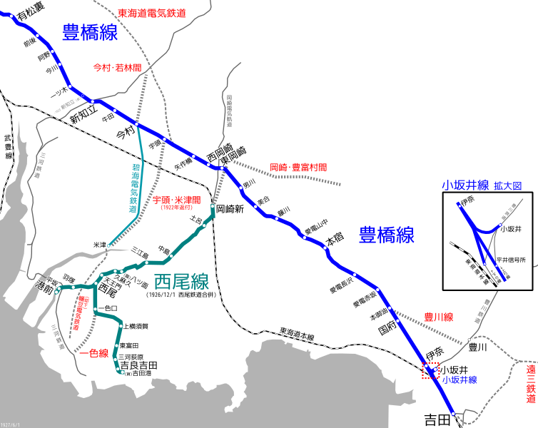
English: linemap of Aichi Electric Railroad Toyohashi Line. Reference material:
|
| Date | |
| Source | Own work |
| Author | ButuCC |
Licensing
[edit]
I, the copyright holder of this work, hereby publish it under the following license:
This file is licensed under the Creative Commons Attribution-Share Alike 3.0 Unported license.
- You are free:
- to share – to copy, distribute and transmit the work
- to remix – to adapt the work
- Under the following conditions:
- attribution – You must give appropriate credit, provide a link to the license, and indicate if changes were made. You may do so in any reasonable manner, but not in any way that suggests the licensor endorses you or your use.
- share alike – If you remix, transform, or build upon the material, you must distribute your contributions under the same or compatible license as the original.
File history
Click on a date/time to view the file as it appeared at that time.
| Date/Time | Thumbnail | Dimensions | User | Comment | |
|---|---|---|---|---|---|
| current | 19:18, 25 July 2020 | | 1,373 × 1,092 (573 KB) | ButuCC (talk | contribs) | Update |
| 12:07, 7 July 2016 |  | 2,096 × 1,652 (772 KB) | ButuCC (talk | contribs) | 渥美電気鉄道→渥美電鉄 ほか | |
| 03:52, 6 March 2014 |  | 2,312 × 1,652 (744 KB) | ButuCC (talk | contribs) | 小坂井支線 → 小坂井線 | |
| 13:25, 12 February 2014 |  | 2,312 × 1,652 (743 KB) | ButuCC (talk | contribs) | User created page with UploadWizard |
You cannot overwrite this file.
File usage on Commons
The following 9 pages use this file:
- User:ButuCC/Image/Map
- User:Chumwa/OgreBot/Potential transport maps/2016 July 1-10
- User:Chumwa/OgreBot/Public transport information/2016 July 1-10
- User:Chumwa/OgreBot/Public transport information/2020 July 21-31
- User:Chumwa/OgreBot/Transport Maps/2016 July 1-10
- User:Chumwa/OgreBot/Transport Maps/2020 July 21-31
- User:Chumwa/OgreBot/Travel and communication maps/2016 July 1-10
- User:콩가루/일본철도/2016 July
- User:콩가루/일본철도/2020 July
File usage on other wikis
The following other wikis use this file:
- Usage on ja.wikipedia.org