File:Agra-Brücke, Markkleeberg, 1710150952, ako.jpg

Original file (5,397 × 3,036 pixels, file size: 7.64 MB, MIME type: image/jpeg)
Captions
Captions
Summary
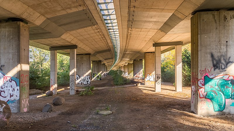
[edit]| Description |
Deutsch: Die Brücke der B2 durchquert das agra-Gelände in Markkleeberg. HDR aus fünf Belichtungen (kein Stativ): f/8, 1/800; 1/400; 1/200; 1/100 und 1/50 @ ISO 800. English: The bridge of the federal road "B2" crosses the "agra" areal in Markkleeberg, Saxony, Germany. HDR from five exposures (hand-held): f/8, 1/800; 1/400; 1/200; 1/100 und 1/50 @ ISO 800. |
||
| Date | |||
| Source | Own work | ||
| Author | Ansgar Koreng | ||
| Permission (Reusing this file) |
|
||
| Attribution (required by the license) | Ansgar Koreng / | ||
| Camera location | | View this and other nearby images on: OpenStreetMap |
|---|
Licensing
[edit]- You are free:
- to share – to copy, distribute and transmit the work
- to remix – to adapt the work
- Under the following conditions:
- attribution – You must give appropriate credit, provide a link to the license, and indicate if changes were made. You may do so in any reasonable manner, but not in any way that suggests the licensor endorses you or your use.
- share alike – If you remix, transform, or build upon the material, you must distribute your contributions under the same or compatible license as the original.
|
The photographical reproduction of this work is covered under the article § 59 of the German copyright law, which states that "It shall be permissible to reproduce, by painting, drawing, photography or cinematography, works which are permanently located on public ways, streets or places and to distribute and publicly communicate such copies. For works of architecture, this provision shall be applicable only to the external appearance."
As with all other “limits of copyright by legally permitted uses”, no changes to the actual work are permitted under § 62 of the German copyright law (UrhG). See Commons:Copyright rules by territory/Germany#Freedom of panorama for more information.
|
Modifications
[edit]|
|
Please do not upload a modified image here without consultation with the Author. The author would like to make corrections only at his own source. This ensures that the changes are preserved. |

File history
Click on a date/time to view the file as it appeared at that time.
| Date/Time | Thumbnail | Dimensions | User | Comment | |
|---|---|---|---|---|---|
| current | 05:03, 22 October 2017 | | 5,397 × 3,036 (7.64 MB) | Code (talk | contribs) | =={{int:filedesc}}== {{Information |description={{de|1=Die Brücke der B2 durchquert das agra-Gelände in Markkleeberg. HDR aus fünf Belichtungen (kein Stativ): f/8, 1/800; 1/400; 1/200; 1/100 und 1/50 @ ISO 800.}}{{en|1=The bridge of the federal road... |
You cannot overwrite this file.
File usage on Commons
The following page uses this file:
File usage on other wikis
The following other wikis use this file:
- Usage on www.wikidata.org