File:African, Caribbean and Pacific Group of States member nations map.svg
Jump to navigation
Jump to search

Size of this PNG preview of this SVG file: 800 × 353 pixels. Other resolutions: 320 × 141 pixels | 640 × 283 pixels | 1,024 × 452 pixels | 1,280 × 565 pixels | 2,560 × 1,130 pixels | 940 × 415 pixels.
Original file (SVG file, nominally 940 × 415 pixels, file size: 1.6 MB)
Captions
Captions
Add a one-line explanation of what this file represents
| Description |
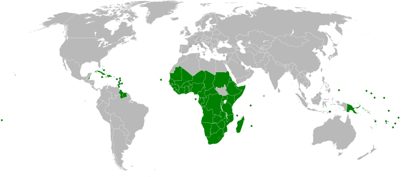
Deutsch: Karte von Ländern der AKP.
English: Map of the African, Caribbean and Pacific Group of States (ACP) member states.
Español: Mapa de los Estados miembros del ACP. |
||
| Date | |||
| Source |
Own work. Derived from |
||
| Author | Cflm001 (talk) | ||
| Permission (Reusing this file) |
|
||
| Other versions |
|
||
| SVG development |

File history
Click on a date/time to view the file as it appeared at that time.
| Date/Time | Thumbnail | Dimensions | User | Comment | |
|---|---|---|---|---|---|
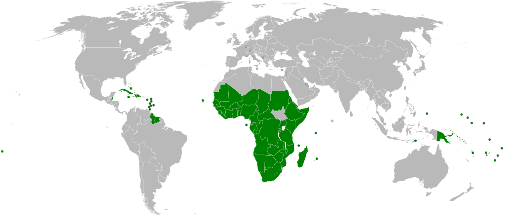
| current | 19:21, 26 August 2020 | | 940 × 415 (1.6 MB) | Pechristener (talk | contribs) | Cook Islands and Niue added |
| 20:31, 9 July 2011 |  | 940 × 415 (1.6 MB) | Smurfy (talk | contribs) | Reverted to version as of 20:28, 9 July 2011 | |
| 20:30, 9 July 2011 |  | 940 × 415 (1.6 MB) | Smurfy (talk | contribs) | Reverted to version as of 20:30, 9 July 2011 | |
| 20:30, 9 July 2011 |  | 940 × 415 (1.6 MB) | Smurfy (talk | contribs) | none | |
| 20:30, 9 July 2011 |  | 940 × 415 (1.6 MB) | Smurfy (talk | contribs) | none | |
| 20:29, 9 July 2011 |  | 940 × 415 (1.6 MB) | Smurfy (talk | contribs) | none | |
| 20:28, 9 July 2011 |  | 940 × 415 (1.6 MB) | Smurfy (talk | contribs) | Added South Sudan. | |
| 11:34, 21 August 2009 |  | 940 × 415 (1.59 MB) | Cflm001 (talk | contribs) | {{Information |Description={{en|1=Map of the African, Caribbean and Pacific Group of States (ACP) member states.}} {{es|1=Mapa de los Estados miembros del ACP.}} {{de|1=Karte von Ländern der AKP.}} |
You cannot overwrite this file.
File usage on Commons
The following 2 pages use this file:
File usage on other wikis
The following other wikis use this file:
- Usage on ar.wikipedia.org
- Usage on ast.wikipedia.org
- Usage on az.wikipedia.org
- Usage on ca.wikipedia.org
- Usage on cs.wikipedia.org
- Usage on da.wikipedia.org
- Usage on de.wikipedia.org
- Usage on en.wikipedia.org
- Usage on eo.wikipedia.org
- Gabono
- Ĝibutio
- Kenjo
- Kameruno
- Kaboverdo
- Komoroj
- Liberio
- Lesoto
- Maŭritanio
- Mozambiko
- Madagaskaro
- Malavio
- Malio
- Niĝerio
- Namibio
- Niĝero
- Ruando
- Sud-Afriko
- Sudano
- Santomeo kaj Principeo
- Sejŝeloj
- Sieraleono
- Somalio
- Tanzanio
- Ugando
- Zambio
- Zimbabvo
- Respubliko Kongo
- Maŭricio
- Demokratia Respubliko Kongo
- Senegalo
- Konvencio de Lomeo
- AKP-ŝtatoj
- Konvencio de Kotonuo
- Usage on es.wikipedia.org
- Usage on et.wikipedia.org
View more global usage of this file.