File:Aerosols over China (MODIS 2022-01-21).jpg
Jump to navigation
Jump to search

Size of this preview: 758 × 600 pixels. Other resolutions: 304 × 240 pixels | 607 × 480 pixels | 971 × 768 pixels | 1,280 × 1,012 pixels | 2,560 × 2,025 pixels | 7,282 × 5,760 pixels.
Original file (7,282 × 5,760 pixels, file size: 4.29 MB, MIME type: image/jpeg)
Captions
Captions
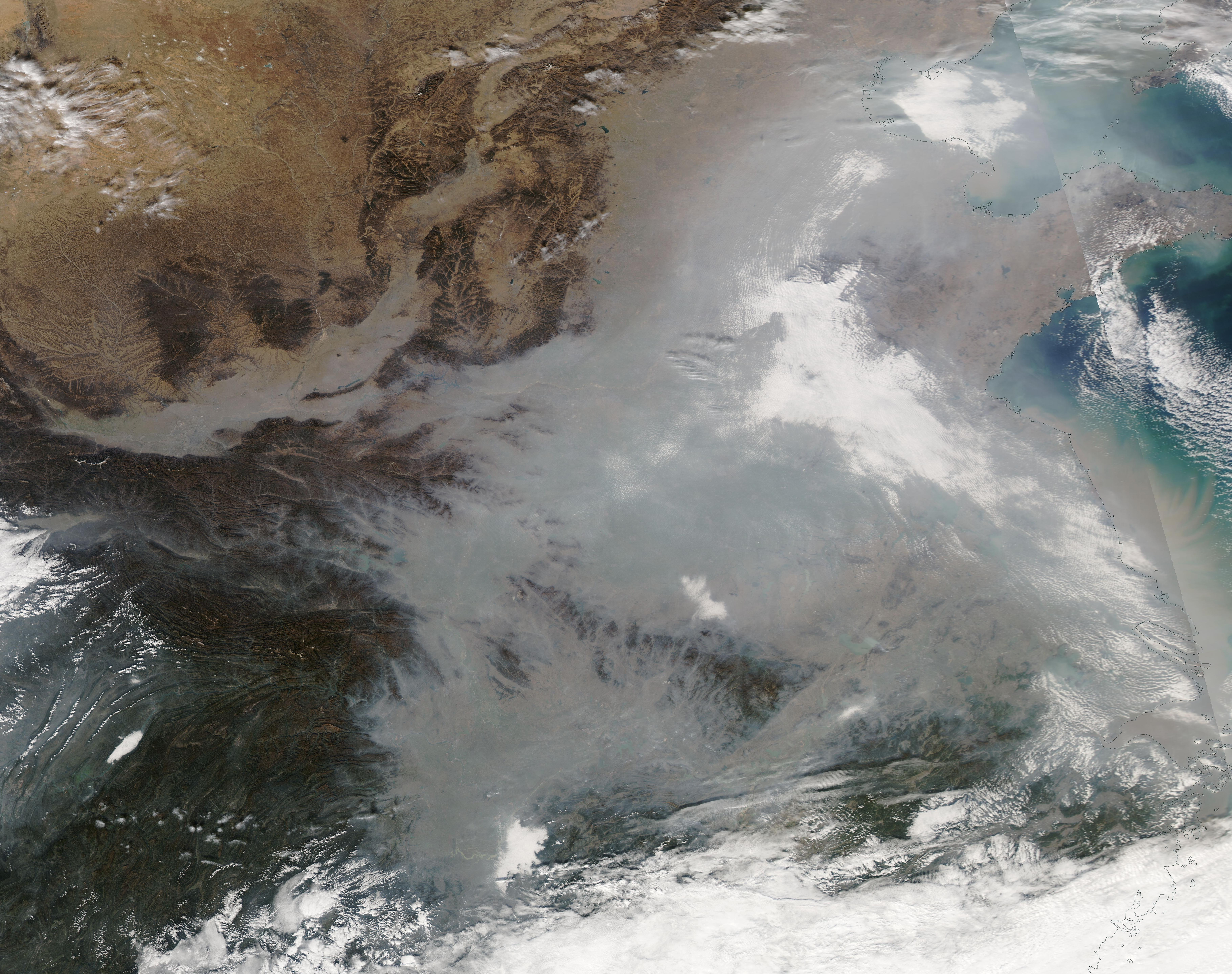
The Moderate Resolution Imaging Spectroradiometer (MODIS) on board NASA’s Aqua satellite acquired a true-color image of the widespread, thick haze on January 18.
Summary
[edit].jpg&action=edit§ion=1)
| Description |
English: Heavy haze covered northeastern China through much of January 2022. The Moderate Resolution Imaging Spectroradiometer (MODIS) on board NASA’s Aqua satellite acquired a true-color image of the widespread, thick haze on January 18. The gray haze stretched roughly 1,500 km (930 mi) from north to south and spanned more than 1,200,000 square kilometers (463,322 square miles). For most of the expanse, the haze was so thick that it was impossible to see the land beneath.
Outbreaks of haze can occur any time in this region but large events, such as this one, are more common in the winter, when dropping temperatures trigger a need for warmth and increase the likelihood of temperature inversions. Air normally cools with altitude, with warm air near the ground and cool air up high. During a temperature inversion, warm air settles above a layer of cool air near the surface. The warm air acts like a lid, stopping air from rising through the warm layer. This traps pollutants near the surface, especially in basins and valleys. Common sources of pollution in the winter include coal and wood burning for heat, industrial activity, and vehicle emissions. Smoke from fires and dust storms can also contribute to poor air quality. |
||
| Date | Taken on 18 January 2022 | ||
| Source |
Aerosols over China (direct link)
|
||
| Author | MODIS Land Rapid Response Team, NASA GSFC |
| This media is a product of the Aqua mission Credit and attribution belongs to the mission team, if not already specified in the "author" row |
Licensing
[edit].jpg&action=edit§ion=2)
| This file is in the public domain in the United States because it was solely created by NASA. NASA copyright policy states that "NASA material is not protected by copyright unless noted". (See Template:PD-USGov, NASA copyright policy page or JPL Image Use Policy.) | ||
 |
Warnings:
|
File history
Click on a date/time to view the file as it appeared at that time.
| Date/Time | Thumbnail | Dimensions | User | Comment | |
|---|---|---|---|---|---|
| current | 22:20, 9 January 2024 | | 7,282 × 5,760 (4.29 MB) | OptimusPrimeBot (talk | contribs) | #Spacemedia - Upload of http://modis.gsfc.nasa.gov/gallery/images/image01212022_250m.jpg via Commons:Spacemedia |
You cannot overwrite this file.
File usage on Commons
There are no pages that use this file.
.jpg&oldid=840071282)