File:Aerial view of Trier-Pfalzel, Germany, on 8 May 1945 (193772767).jpg
Jump to navigation
Jump to search

Size of this preview: 496 × 600 pixels. Other resolutions: 198 × 240 pixels | 397 × 480 pixels | 635 × 768 pixels | 847 × 1,024 pixels | 1,693 × 2,048 pixels | 3,015 × 3,646 pixels.
Original file (3,015 × 3,646 pixels, file size: 4.51 MB, MIME type: image/jpeg)
Captions
Captions
Add a one-line explanation of what this file represents
Summary
[edit].jpg&action=edit§ion=1)
| Description |
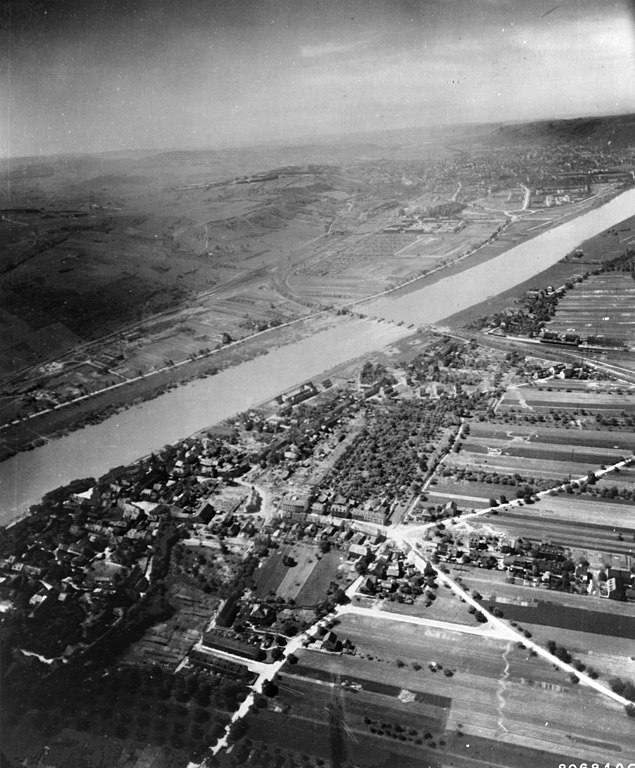
English: Aerial view of Pfalzel, Germany, on 8 May 1945. The view is to the south towards Trier with the destroyed railroad bridge across the Moselle river in the center. |
|||
| Date | Taken on 8 May 1945 | |||
| Source |
|
|||
| Author | U.S. Army Air Force photo 342-FH-3A22553-80681AC (ex-NARA 193772767) |
| Camera location | | View this and other nearby images on: OpenStreetMap |
|---|
.jpg¶ms=049.781760_N_0006.694410_E_globe:Earth_type:camera__&language=en)
Licensing
[edit].jpg&action=edit§ion=2)
This image or file is a work of a U.S. Air Force Airman or employee, taken or made as part of that person's official duties. As a work of the U.S. federal government, the image or file is in the public domain in the United States.
|
 |
File history
Click on a date/time to view the file as it appeared at that time.
| Date/Time | Thumbnail | Dimensions | User | Comment | |
|---|---|---|---|---|---|
| current | 20:09, 30 January 2021 | | 3,015 × 3,646 (4.51 MB) | Cobatfor (talk | contribs) | == {{int:filedesc}} == {{Information |Description={{en|1=Aerial view of Pfalzel, Germany, on 8 May 1945. The view is to the south towards Trier with the destroyed railroad bridge across the Moselle river in the center.}} |Source={{NARA-image|id=193772767}} |Date=1945-05-08 |Author=U.S. Army Air Force photo 342-FH-3A22553-80681AC |Permission= |other_versions= }} =={{int:license-header}}== {{PD-USGov-Military-Air Force}} Category:Trier-Pfalzel Category:1945 in Trier |
You cannot overwrite this file.
File usage on Commons
There are no pages that use this file.
.jpg&oldid=828244086)