File:Aerial view of Hadleigh light industrial area - geograph.org.uk - 1594318.jpg
Jump to navigation
Jump to search
No higher resolution available.
Aerial_view_of_Hadleigh_light_industrial_area_-_geograph.org.uk_-_1594318.jpg (640 × 507 pixels, file size: 174 KB, MIME type: image/jpeg)
Captions
Captions
Add a one-line explanation of what this file represents
Summary
[edit]
| Description |
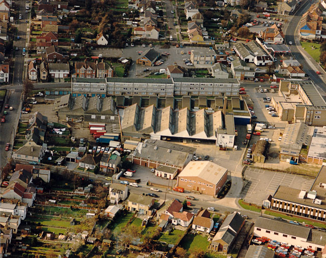
English: Aerial view of Hadleigh light industrial area This shows the light industrial area between the London Road (A13) at the upper right, and Beech Road running along the left side. At the top right, on either side of the London Road are the Castle Pub (left) and the Ancora restaurant (right). Both are worth a visit. |
| Date | |
| Source | From geograph.org.uk |
| Author | Edward Clack |
| Attribution (required by the license) | Edward Clack / Aerial view of Hadleigh light industrial area / |
| Camera location | | View this and other nearby images on: OpenStreetMap |
|---|
_heading:292.00&language=en)
| Object location | | View this and other nearby images on: OpenStreetMap |
|---|
_heading:292.00&language=en)
Licensing
[edit]

|
This image was taken from the Geograph project collection. See this photograph's page on the Geograph website for the photographer's contact details. The copyright on this image is owned by Edward Clack and is licensed for reuse under the Creative Commons Attribution-ShareAlike 2.0 license.
|
This file is licensed under the Creative Commons Attribution-Share Alike 2.0 Generic license.
Attribution: Edward Clack
- You are free:
- to share – to copy, distribute and transmit the work
- to remix – to adapt the work
- Under the following conditions:
- attribution – You must give appropriate credit, provide a link to the license, and indicate if changes were made. You may do so in any reasonable manner, but not in any way that suggests the licensor endorses you or your use.
- share alike – If you remix, transform, or build upon the material, you must distribute your contributions under the same or compatible license as the original.
File history
Click on a date/time to view the file as it appeared at that time.
| Date/Time | Thumbnail | Dimensions | User | Comment | |
|---|---|---|---|---|---|
| current | 02:24, 4 March 2011 | | 640 × 507 (174 KB) | GeographBot (talk | contribs) | == {{int:filedesc}} == {{Information |description={{en|1=Aerial view of Hadleigh light industrial area This shows the light industrial area between the London Road (A13) at the upper right, and Beech Road running along the left side. At the top right, on |
You cannot overwrite this file.
File usage on Commons
There are no pages that use this file.