File:Aerial view of Denmark, Wisconsin and vicinity in Brown and Manitowoc counties, Wisconsin 2020.png
Jump to navigation
Jump to search

Size of this preview: 453 × 600 pixels. Other resolutions: 181 × 240 pixels | 362 × 480 pixels | 580 × 768 pixels | 773 × 1,024 pixels | 1,546 × 2,048 pixels | 9,488 × 12,564 pixels.
Original file (9,488 × 12,564 pixels, file size: 219.02 MB, MIME type: image/png)
Captions
Captions
Add a one-line explanation of what this file represents
| Warning | The original file is very high-resolution. It might not load properly or could cause your browser to freeze when opened at full size. |
|---|
| Description |
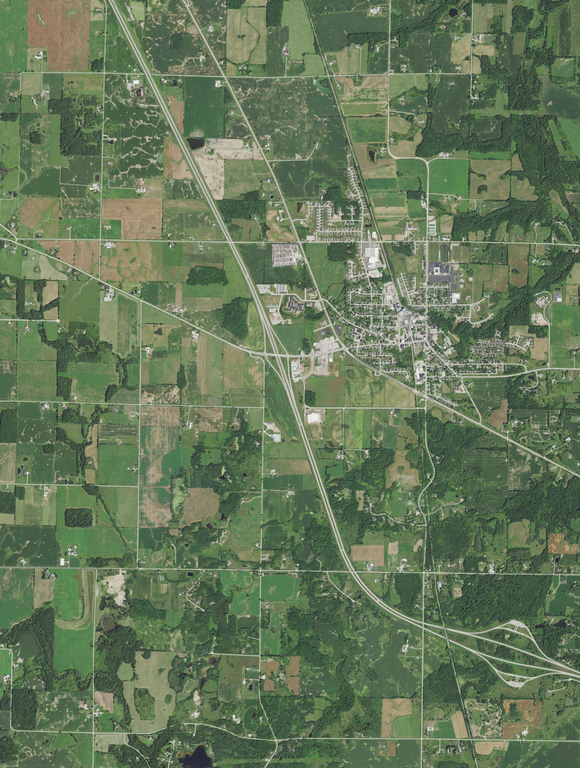
English: Aerial view of the village of Denmark and the surrounding town of New Denmark, both in Brown County, and also part of the northern area of the town of Cooperstown in Manitowoc County, taken on July 28, 2020. Interstate 43 runs through the center of the photo and bends right in the lower portion and Wisconsin Highway 96 is on the left side of the photo. The Neshota River flows southeast in the top right corner.
Coordinates:
|
|||
| Date | ||||
| Source | converted to .png by Epiphyllumlover from the original .tif available as item m_4408742_nw_16_060_20200728 on EarthExplorer | |||
| Author | Aerial Photography Field Office (APFO) for NAIP, USGS; in contract with the Surdex Corporation | |||
| Permission (Reusing this file) |
|
File history
Click on a date/time to view the file as it appeared at that time.
| Date/Time | Thumbnail | Dimensions | User | Comment | |
|---|---|---|---|---|---|
| current | 16:56, 5 May 2022 | | 9,488 × 12,564 (219.02 MB) | Epiphyllumlover (talk | contribs) | c:User:Rillke/bigChunkedUpload.js: {{Information | Description = {{en|Aerial view of the village of Denmark and the surrounding town of New Denmark, both in Brown County, and also part of the northern area of the town of Cooperstown in Manitowoc County, taken on July 28, 2020. Interstate 43 runs through the center o... |
You cannot overwrite this file.
File usage on Commons
There are no pages that use this file.