File:Aerial view of Crenshaw Boulevard, Los Angeles County, California.jpg
Original file (4,000 × 3,000 pixels, file size: 4.17 MB, MIME type: image/jpeg)
Captions
Captions
Summary
[edit]
| Description |
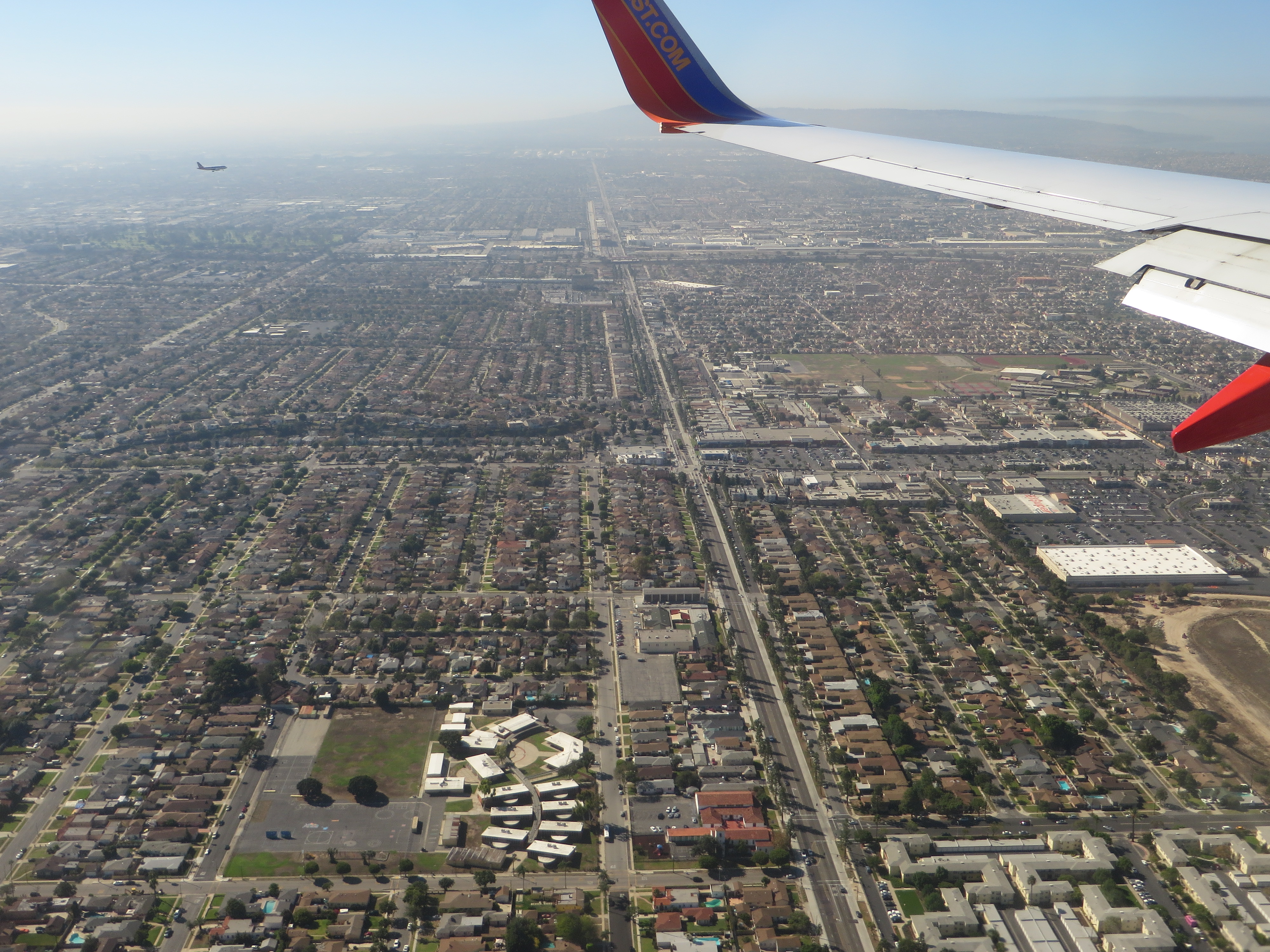
Crenshaw Boulevard is a major thoroughfare street in Los Angeles, California that runs through, and outside, the Crenshaw district. The street starts at Wilshire Boulevard in Hancock Park and runs through several demographically diverse areas to end in Rolling Hills. Tracks for the No. 5 Los Angeles Railway "yellow" streetcars in the 1920s through 1950s ran in the median between Leimert Boulevard on the north to near Florence Ave on the south. Since the abandonment of the streetcars, the former railway median has been narrowed, the driving lanes improved and the street reconfigured. Many local residents were disappointed to see 71 mature trees chopped down to make way for the Space Shuttle Endeavour to be moved from LAX to the California Science Center. Additional trees were to be removed for the under construction Crenshaw/LAX Line, but various officials have promised an aesthetically cohesive boulevard with more trees being planted than were removed. The name "Crenshaw" has become associated with African-American culture because it traverses as a large black community. Crenshaw Boulevard has been mentioned in hip hop songs by artists such as Eminem, Eazy-E, Nas, 2Pac, Montell Jordan, DJ Quik, Raekwon from the Wu-Tang Clan, Skee-Lo, Dr. Dre, The Game, Nipsey Hussle, Dom Kennedy, MC Allergy, and The Pharcyde. The street was named in 1904 after banker and real estate developer George Lafayette Crenshaw. The street also has a history of Sunday night "gatherings", where a large number of cars would meet up. However, due to a police crackdown, this tradition has now declined. en.wikipedia.org/wiki/Crenshaw_Boulevard en.wikipedia.org/wiki/Wikipedia:Text_of_Creative_Commons_... |
| Date | |
| Source | Crenshaw Boulevard, Inglewood, California |
| Author | Ken Lund from Reno, Nevada, USA |
| Camera location | | View this and other nearby images on: OpenStreetMap |
|---|
Licensing
[edit]
- You are free:
- to share – to copy, distribute and transmit the work
- to remix – to adapt the work
- Under the following conditions:
- attribution – You must give appropriate credit, provide a link to the license, and indicate if changes were made. You may do so in any reasonable manner, but not in any way that suggests the licensor endorses you or your use.
- share alike – If you remix, transform, or build upon the material, you must distribute your contributions under the same or compatible license as the original.
| This image was originally posted to Flickr by Ken Lund at https://flickr.com/photos/75683070@N00/21399133140. It was reviewed on 27 December 2015 by FlickreviewR and was confirmed to be licensed under the terms of the cc-by-sa-2.0. |
File history
Click on a date/time to view the file as it appeared at that time.
| Date/Time | Thumbnail | Dimensions | User | Comment | |
|---|---|---|---|---|---|
| current | 22:59, 27 December 2015 | | 4,000 × 3,000 (4.17 MB) | Kingofthedead (talk | contribs) | Transferred from Flickr via Flickr2Commons |
You cannot overwrite this file.
File usage on Commons
The following page uses this file:
- File:Aerial view of Inglewood, California.jpg (file redirect)
File usage on other wikis
The following other wikis use this file:
- Usage on he.wikipedia.org
- Usage on ja.wikipedia.org