File:Aerial photographs of 2019 Abukuma River flood by GSI 469.jpg
Jump to navigation
Jump to search

Size of this preview: 800 × 533 pixels. Other resolutions: 320 × 213 pixels | 640 × 427 pixels | 1,024 × 683 pixels | 1,368 × 912 pixels.
Original file (1,368 × 912 pixels, file size: 1,017 KB, MIME type: image/jpeg)
Captions
Captions
Add a one-line explanation of what this file represents
Summary
[edit]
| Description |
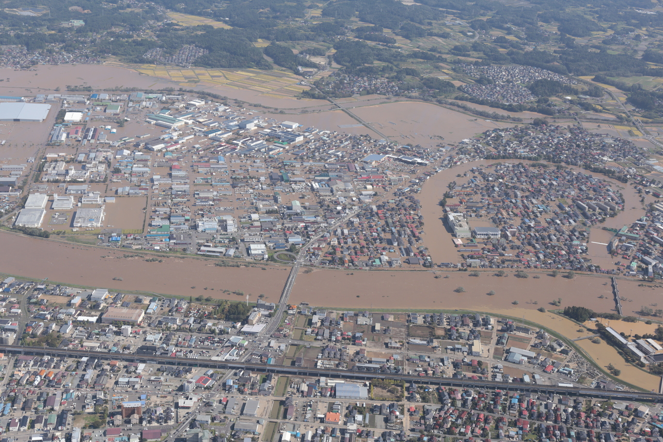
日本語: 令和元年台風第19号によって氾濫した郡山市を流れる阿武隈川。右岸の地域が泥水に浸かっている。画像下部を左右に通る高架は東北新幹線で、画像中央の橋梁は国道49号が通る金山橋である。 |
| Date | |
| Source | https://saigai.gsi.go.jp/1/R1_10typhoon19/1013abukumagawa/naname/qv/ABU469.JPG |
| Author | 国土地理院 |
| Camera location | | View this and other nearby images on: OpenStreetMap |
|---|
Licensing
[edit]

|
This work is licensed under the Government of Japan Standard Terms of Use (Ver.2.0). The Terms of Use are compatible with the Creative Commons Attribution License 4.0 International. For the terms of use of this work, see this license page.
|
This file is licensed under the Creative Commons Attribution 4.0 International license.
Attribution: 国土地理院 (GSI)
- You are free:
- to share – to copy, distribute and transmit the work
- to remix – to adapt the work
- Under the following conditions:
- attribution – You must give appropriate credit, provide a link to the license, and indicate if changes were made. You may do so in any reasonable manner, but not in any way that suggests the licensor endorses you or your use.
File history
Click on a date/time to view the file as it appeared at that time.
| Date/Time | Thumbnail | Dimensions | User | Comment | |
|---|---|---|---|---|---|
| current | 05:53, 14 October 2019 | | 1,368 × 912 (1,017 KB) | 片割れ靴下 (talk | contribs) | User created page with UploadWizard |
You cannot overwrite this file.
File usage on Commons
The following page uses this file:
- File:ABU469.jpg (file redirect)
File usage on other wikis
The following other wikis use this file:
- Usage on fi.wikipedia.org
- Usage on ja.wikipedia.org
- Usage on ru.wikipedia.org
- Usage on zh.wikipedia.org