File:Aerial photograph of 2019 Typhoon Hagibis flood in Nagano prefecture - GSI 5676.jpg
Jump to navigation
Jump to search

Size of this preview: 800 × 533 pixels. Other resolutions: 320 × 213 pixels | 640 × 427 pixels | 1,024 × 683 pixels | 1,440 × 960 pixels.
Original file (1,440 × 960 pixels, file size: 327 KB, MIME type: image/jpeg)
Captions
Captions
Add a one-line explanation of what this file represents
Summary
[edit]
| Description |
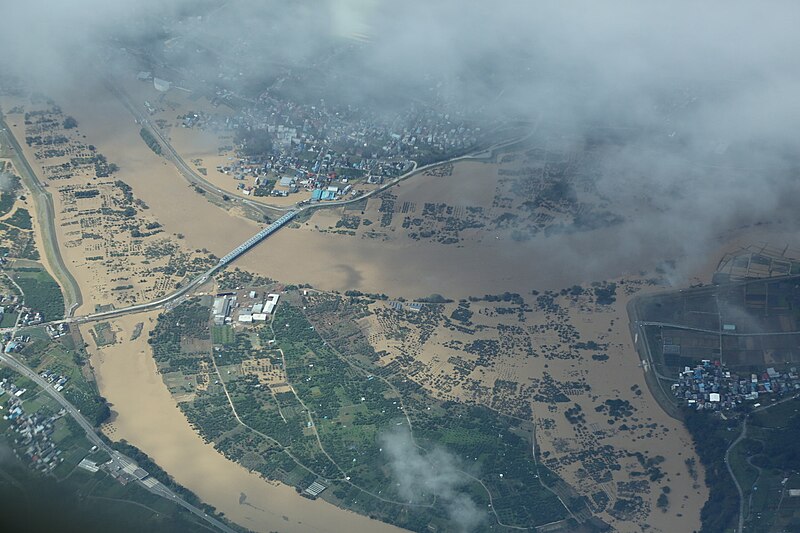
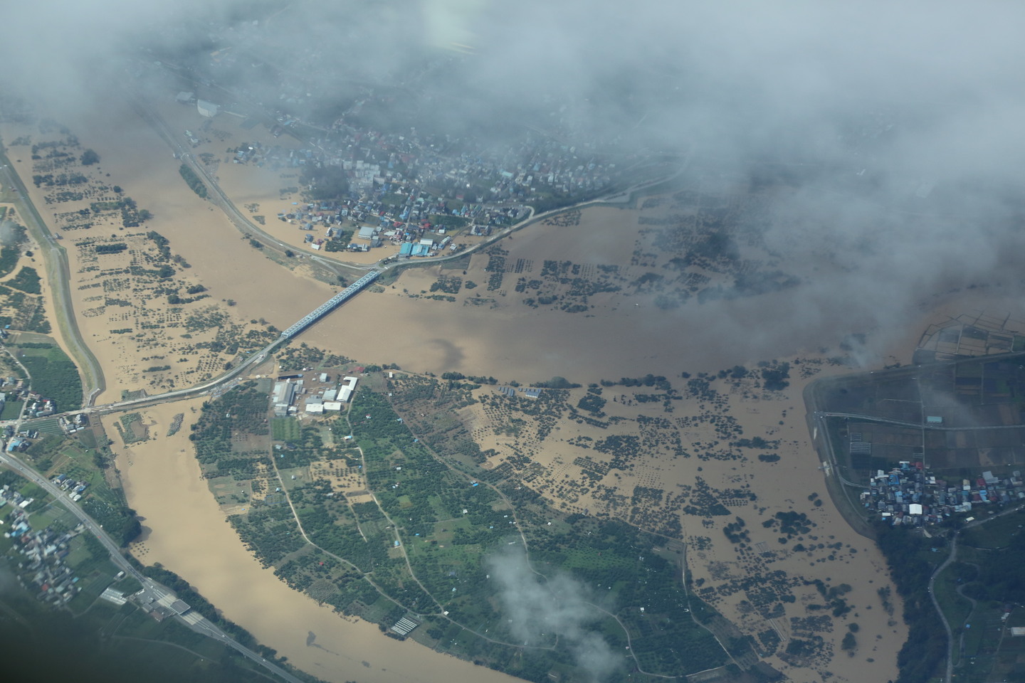
日本語: 令和元年(2019年)台風19号に関する情報・空中写真(斜め写真)・長野地区 |
| Date | |
| Source | https://saigai.gsi.go.jp/1/R1_10typhoon19/1013nagano/naname/qv/GSI_5676.JPG |
| Author | 国土地理院 |
| Camera location | | View this and other nearby images on: OpenStreetMap |
|---|
Licensing
[edit]

|
This work is licensed under the Government of Japan Standard Terms of Use (Ver.2.0). The Terms of Use are compatible with the Creative Commons Attribution License 4.0 International. For the terms of use of this work, see this license page.
|
This file is licensed under the Creative Commons Attribution 4.0 International license.
Attribution: 国土地理院 (GSI)
- You are free:
- to share – to copy, distribute and transmit the work
- to remix – to adapt the work
- Under the following conditions:
- attribution – You must give appropriate credit, provide a link to the license, and indicate if changes were made. You may do so in any reasonable manner, but not in any way that suggests the licensor endorses you or your use.
File history
Click on a date/time to view the file as it appeared at that time.
| Date/Time | Thumbnail | Dimensions | User | Comment | |
|---|---|---|---|---|---|
| current | 01:21, 15 October 2019 | | 1,440 × 960 (327 KB) | 片割れ靴下 (talk | contribs) |
You cannot overwrite this file.
File usage on Commons
The following 2 pages use this file:
- User:片割れ靴下/gallery
- File:GSI 5676.JPG (file redirect)
File usage on other wikis
The following other wikis use this file:
- Usage on ar.wikipedia.org
- Usage on de.wikipedia.org
- Usage on en.wikipedia.org
- User talk:Nightstallion
- User talk:AySz88
- User talk:Fableheroesguild
- User talk:IrfanFaiz
- User talk:Typhoonchaser
- User talk:Ajm81
- User talk:WmE
- User talk:Juan andrés
- User talk:Jamie C
- User talk:Sarsaparilla39
- User talk:Ev-Man
- User talk:WindRunner
- User talk:Pobbie Rarr
- User talk:WotGoPlunk
- User talk:Dr Denim
- User talk:WeatherVane
- User:Bob rulz/Hurricane Herald
- User talk:AstroHurricane001
- User talk:Maverick423
- User talk:Plasticup
- User talk:Appleworm
- User talk:TheNobleSith
- User talk:VX
- User talk:HurricaneSpin
- User talk:Wonderworld1995268
- User talk:Dylan620
- User talk:Iune
- User talk:Darren23
- User:Rosalina2427/Archive4
- User talk:ChocolateTrain
- User talk:CooperScience
- User talk:Nova Crystallis/Archive 5
- User talk:KN2731/Archive 3
- Wikipedia:WikiProject Tropical cyclones/Newsletter/Archive 39
- User talk:Hurricane Noah/Archive 3
- Typhoon Hagibis
- User:Typhoon You-too/Powerful and Notable Storms1
- User talk:X!/Archives/03/2020
- User talk:Cyclonebiskit/Archive19
- User talk:The Grid/Archive 9
- User talk:Titoxd/Archive33
- User talk:12george1/Archive 28
- User talk:Silvestertaylor/Archive 1
- User talk:Yellow Evan/Archive 28
- Usage on pt.wikipedia.org
- Usage on simple.wikipedia.org
- Usage on tr.wikipedia.org