File:Aegelsee Karte 1926.png

Original file (1,729 × 931 pixels, file size: 3.03 MB, MIME type: image/png)
Captions
Captions
Summary
[edit]
| Description |
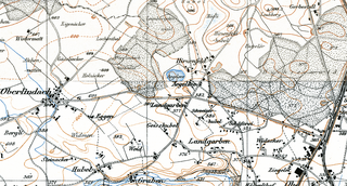
Deutsch: Karte von 1926 mit dem Aegelsee |
| Date | |
| Source |
|
| Author | Unknown author |
Licensing
[edit]
The data made publicly available by swisstopo may be used, distributed and made accessible. Furthermore, they may be enriched and processed and also used commercially. A reference to the source is mandatory. In the case of digital or analogue representations and publications, as well as in the case of dissemination, one of the following source references must be attached in any case:
Terms of use for free geodata and geoservices (OGD) from swisstopo
|
.svg) |
File history
Click on a date/time to view the file as it appeared at that time.
| Date/Time | Thumbnail | Dimensions | User | Comment | |
|---|---|---|---|---|---|
| current | 09:27, 24 October 2021 | | 1,729 × 931 (3.03 MB) | AmBu (talk | contribs) | Uploaded a work by swisstopo from swisstopo with UploadWizard |
You cannot overwrite this file.
File usage on Commons
The following page uses this file:
- File:Aegelsee Karte 1928.png (file redirect)
File usage on other wikis
The following other wikis use this file:
- Usage on de.wikipedia.org