File:Admiralty Routeing Chart 5125(10) South Atlantic Ocean October, Published 1964.jpg
Jump to navigation
Jump to search

Size of this preview: 635 × 600 pixels. Other resolutions: 254 × 240 pixels | 508 × 480 pixels | 813 × 768 pixels | 1,084 × 1,024 pixels | 2,168 × 2,048 pixels | 9,573 × 9,045 pixels.
Original file (9,573 × 9,045 pixels, file size: 6.79 MB, MIME type: image/jpeg)
Captions
Captions
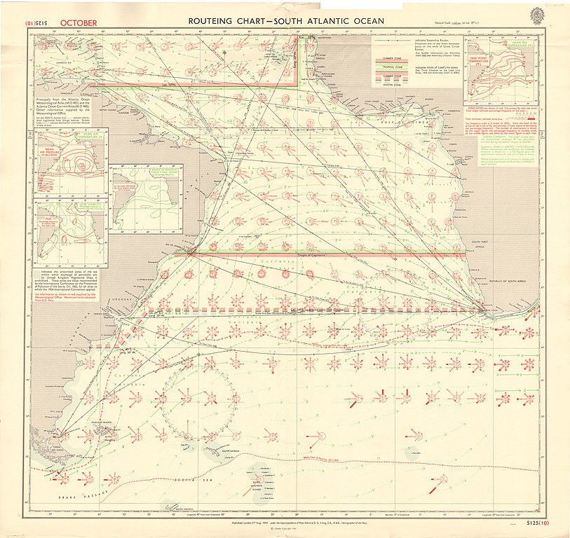
Routeing Chart for the South Atlantic in October
Summary
[edit]_South_Atlantic_Ocean_October,_Published_1964.jpg&action=edit§ion=1)
| Warning | The original file is very high-resolution. It might not load properly or could cause your browser to freeze when opened at full size. |
|---|
_South_Atlantic_Ocean_October,_Published_1964.jpg&flash=no)
| Description |
English: Routeing Chart for the South Atlantic in October, showing ocean currents, winds, and major shipping routes. Admiralty chart No 5125(10). Not Current - Not to be used for navigation! |
| Date | |
| Source | Scan of original Admiralty chart |
| Author | E.G. Irving |
Licensing
[edit]_South_Atlantic_Ocean_October,_Published_1964.jpg&action=edit§ion=2)
This work created by the United Kingdom Government is in the public domain.
This is because it is one of the following:
HMSO has declared that the expiry of Crown Copyrights applies worldwide (ref: HMSO Email Reply)
|
 |
File history
Click on a date/time to view the file as it appeared at that time.
| Date/Time | Thumbnail | Dimensions | User | Comment | |
|---|---|---|---|---|---|
| current | 14:32, 21 May 2019 | | 9,573 × 9,045 (6.79 MB) | Kognos (talk | contribs) | User created page with UploadWizard |
You cannot overwrite this file.
File usage on Commons
There are no pages that use this file.
File usage on other wikis
The following other wikis use this file:
- Usage on en.wikipedia.org
- Usage on fr.wikipedia.org
_South_Atlantic_Ocean_October,_Published_1964.jpg&oldid=864339670)