File:Actions Stations - Boathouse no 6 - Portsmouth Historic Dockyard - The Mast Pond & Miniport (9333401879).jpg

Original file (4,288 × 3,216 pixels, file size: 3.22 MB, MIME type: image/jpeg)
Captions
Captions
Summary
[edit].jpg&action=edit§ion=1)
| Description |
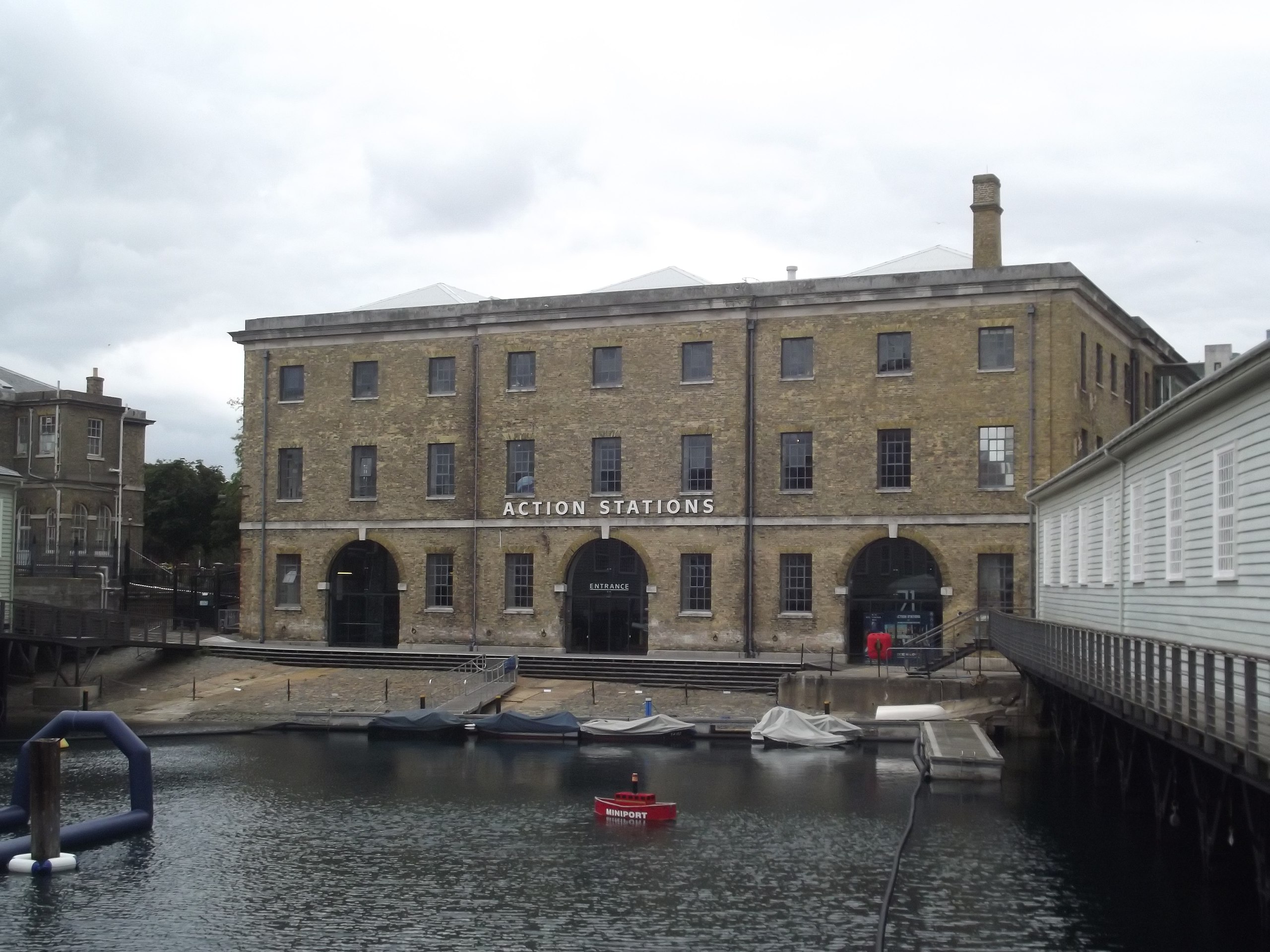
A look at Action Stations in Boathouse no 6 at Portsmouth Historic Dockyard. A unique experience of the modern hi-tech Royal Navy through interactive displays and simulators, large-format film and the exciting InterAction marine technology gallery. It also has a Laser Quest apparently. We didn't go into this one. In front is The Mast Pond & Miniport. It was dug out in 1665 by soldiers and Dutch prisoners-of-war. The Mast Pond is linked by a tunnel underneath to Boathouse 4.
<a href="http://www.britishlistedbuildings.co.uk/en-476648-number-6-boathouse-building-number-1-23-" rel="noreferrer nofollow">Number 6 Boathouse (Building Number 1/23) and Slipway to Front, Portsmouth</a> SU 6300 SW COLLEGE ROAD (Northwest side) HM Naval Base 774-1/30/201 No.6 Boathouse (Building No 1/23) and slipway to front GV II*
   Includes: No.6 Boathouse (Building No. 1/23) and slipway to front, MAIN ROAD HM NAVAL BASE
   Mast house, then boathouse with slipway at front. 1845; bomb-damaged 1941. Designed by Captain RS Beatson RE, contractor Mr Rigby. Yellow brick in ashlar bond with ashlar dressings, with internal cast-iron frame. Replacement mid-late C20 corrugated iron roof with roof lights. EXTERIOR: 3 storeys, on west side the ground level being lower to give access to adjacent mast pond. 5-sided, the rectangular plan having diagonal wall built across south-east corner. The bomb damage was to the east end, where the building remains a shell with first-floor windows blocked and 2nd floor missing. Ashlar plinth, to west elevation; band over ground floor; eaves band and cornice. Windows have flat brick arches, projecting ashlar sills, and CZO replacement metal windows; they are shorter on ground and 2nd floors. Loading doors have eared ashlar architraves with tripartite keystones. West elevation: 9 bays, 3 central bays breaking forward. At centre of each 3-bay section a large round- arched entrance with imposts, keystones, studded double board doors, fanlights, and lamp on left of central door. Iron mooring rings at low level. A brick chimney rises behind parapet at right-hand corner, tapering and corniced. Slipway along front, sloping down to Mast Pond (qv), is of stone setts with iron mooring rings and a track of granite slabs with iron rollers leading up to each entrance of the boathouse (that leading to the right-hand entrance now built over). North elevation: 15 bays, with 2-bay end breaks and 3-bay central break which has a central loading door on each floor, now blocked. East elevation: 6 bays, with loading doors on each floor of bays Z and 5. South-east elevation: 5 bays with central loading doors. South-west elevation: 11 bays with central3-bay break which has central loading doors, that on 1st floor with crane. Double board door to ground floor of bay 3.
   INTERIOR: cast-iron columns; cast-iron segmental-arched beams across shorter spans, and cast-iron trussed beams across wider spans. On 3rd floor, braced rivet ted steel roof trusses. Wooden floors. On ground floor, 3 slipways with a double row of columns between (14 columns to a row); above the central slipway the ceiling is open, to allow mast- fitting. At west end is a trap door, strengthened by Z extra columns.
   HISTORY: designed by Beatson to take an exceptionally heavy load, and of interest with his other work at Portsmouth, the Fire Station and Chain Testing Shop (qqv). This must have been one of the last uses of trussed beams before the 1847 Dee Bridge disaster enquiry discredited their use. A contrasting design to the traditional timber 1844 Lower Boat House at Chatham, and the innovative 1859 Boat store at Sheerness designed by GT Greene. Boats could be lifted internally through to the upper floors. Lloyd (1974) observes that "This is one of the earliest buildings where load-bearing iron-framed construction is used on such a massive scale, and with such sophistication".
   (Sources: The Buildings of England: Lloyd D: Hampshire and the Isle of Wight: Harmondsworth: 1985: 410 ; Portsmouth Naval Base Property Trust: Naval Heritage at Portsmouth, Visitor's Guide: Portsmouth: 1988; Lloyd DW: Buildings of Portsmouth and its Environs: Portsmouth: 1974: 72).
   SU 6300 SW MAIN ROAD
   (East side)
   HM Naval Base
   774-1/30/201 No 6 Boathouse (Building No 1/23)
   and slipway to front
GV II*
See under: No.6 Boathouse (Building No. 1/23) and slipway to front, COLLEGE ROAD HM NAVAL BASE
Listing NGR: SU6299200361
|
| Date | |
| Source | Actions Stations - Boathouse no 6 - Portsmouth Historic Dockyard - The Mast Pond & Miniport |
| Author | Elliott Brown from Birmingham, United Kingdom |
| Camera location | | View this and other nearby images on: OpenStreetMap |
|---|
.jpg¶ms=050.799872_N_-001.107323_E_globe:Earth_type:camera_source:Flickr_&language=en)
Licensing
[edit].jpg&action=edit§ion=2)
- You are free:
- to share – to copy, distribute and transmit the work
- to remix – to adapt the work
- Under the following conditions:
- attribution – You must give appropriate credit, provide a link to the license, and indicate if changes were made. You may do so in any reasonable manner, but not in any way that suggests the licensor endorses you or your use.
- share alike – If you remix, transform, or build upon the material, you must distribute your contributions under the same or compatible license as the original.
| This image was originally posted to Flickr by ell brown at https://flickr.com/photos/39415781@N06/9333401879. It was reviewed on 10 March 2021 by FlickreviewR 2 and was confirmed to be licensed under the terms of the cc-by-sa-2.0. |
File history
Click on a date/time to view the file as it appeared at that time.
| Date/Time | Thumbnail | Dimensions | User | Comment | |
|---|---|---|---|---|---|
| current | 17:14, 10 March 2021 | | 4,288 × 3,216 (3.22 MB) | Matlin (talk | contribs) | Transferred from Flickr via #flickr2commons |
You cannot overwrite this file.
File usage on Commons
There are no pages that use this file.
.jpg&oldid=781665797)