File:Acer macrophyllum range map.png
Jump to navigation
Jump to search

Size of this preview: 364 × 600 pixels. Other resolutions: 145 × 240 pixels | 291 × 480 pixels | 1,003 × 1,653 pixels.
Original file (1,003 × 1,653 pixels, file size: 201 KB, MIME type: image/png)
Captions
Captions
Add a one-line explanation of what this file represents
Summary
[edit]
| Description |
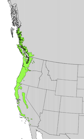
English: Range distribution map of Acer macrophyllum — on the West Coast of North America. |
|||
| Date | ||||
| Source | Digital representation of "Atlas of United States Trees" by Elbert L. Little, Jr. [1] | |||
| Author | U.S. Geological Survey | |||
| Permission (Reusing this file) |
|
File history
Click on a date/time to view the file as it appeared at that time.
| Date/Time | Thumbnail | Dimensions | User | Comment | |
|---|---|---|---|---|---|
| current | 18:22, 12 October 2012 | | 1,003 × 1,653 (201 KB) | Pinethicket (talk | contribs) | {{Information |Description ={{en|1=Range map of ''Acer macrophyllum'' }} |Source =Digital representation of "Atlas of United States Trees" by Elbert L. Little, Jr. [http://esp.cr.usgs.gov/data/atlas/little/] |Author =U.S. Geological ... |
You cannot overwrite this file.
File usage on Commons
The following page uses this file:
File usage on other wikis
The following other wikis use this file:
- Usage on ar.wikipedia.org
- Usage on arz.wikipedia.org
- Usage on eu.wikipedia.org
- Usage on fa.wikipedia.org
- Usage on hu.wikipedia.org
- Usage on pt.wikipedia.org
- Usage on www.wikidata.org