File:Aberystwyth castle - geograph.org.uk - 1746753.jpg
Jump to navigation
Jump to search
Size of this preview: 800 × 600 pixels. Other resolutions: 320 × 240 pixels | 640 × 480 pixels | 1,024 × 768 pixels.
Original file (1,024 × 768 pixels, file size: 303 KB, MIME type: image/jpeg)
Captions
Captions
Add a one-line explanation of what this file represents
Summary
[edit]
| Description |
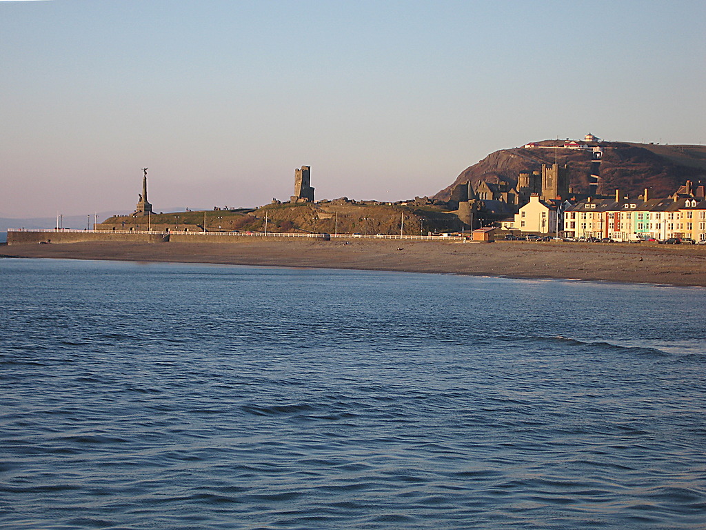
English: Aberystwyth castle Seen from the harbour jetty, right next to the lighthouse. The castle lies on a small promontory separating North and South Beach, with the war memorial at the tip (left, west). On the right, the colourful houses of South Marine Terrace can be seen. St Michael's church and the Old College of Aberystwyth University are behind them towards the centre. Constitution hill ('Consti') with its funicular railway in SN5882 loiters at the back. |
| Date | |
| Source | From geograph.org.uk |
| Author | Rudi Winter |
| Attribution (required by the license) | Rudi Winter / Aberystwyth castle / |
| Camera location | | View this and other nearby images on: OpenStreetMap |
|---|
_heading:22.00&language=en)
| Object location | | View this and other nearby images on: OpenStreetMap |
|---|
_heading:22.00&language=en)
Licensing
[edit]

|
This image was taken from the Geograph project collection. See this photograph's page on the Geograph website for the photographer's contact details. The copyright on this image is owned by Rudi Winter and is licensed for reuse under the Creative Commons Attribution-ShareAlike 2.0 license.
|
This file is licensed under the Creative Commons Attribution-Share Alike 2.0 Generic license.
Attribution: Rudi Winter
- You are free:
- to share – to copy, distribute and transmit the work
- to remix – to adapt the work
- Under the following conditions:
- attribution – You must give appropriate credit, provide a link to the license, and indicate if changes were made. You may do so in any reasonable manner, but not in any way that suggests the licensor endorses you or your use.
- share alike – If you remix, transform, or build upon the material, you must distribute your contributions under the same or compatible license as the original.
File history
Click on a date/time to view the file as it appeared at that time.
| Date/Time | Thumbnail | Dimensions | User | Comment | |
|---|---|---|---|---|---|
| current | 18:05, 5 March 2011 | | 1,024 × 768 (303 KB) | GeographBot (talk | contribs) | == {{int:filedesc}} == {{Information |description={{en|1=Aberystwyth castle Seen from the harbour jetty, right next to the lighthouse. The castle lies on a small promontory separating North and South Beach, with the war memorial at the tip (left, west). |
You cannot overwrite this file.
File usage on Commons
There are no pages that use this file.
File usage on other wikis
The following other wikis use this file:
- Usage on de.wikipedia.org
- Usage on eu.wikipedia.org